Last Updated on 16th February 2021 4:40 PM by AfriWX

All you need to know about Tropical Storm (ex Cyclone) Eloise and the major flooding she brought to South Africa.
Cyclone Eloise Declared a National Disaster
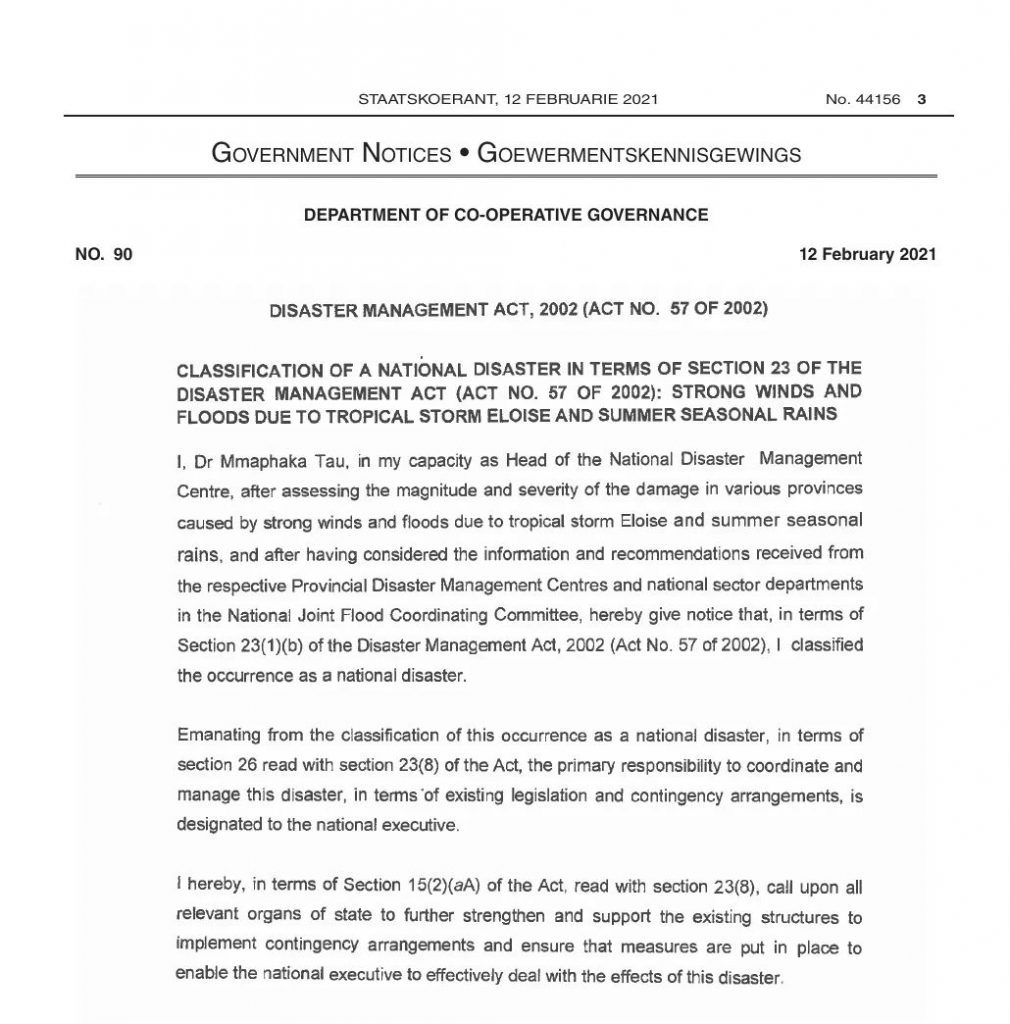
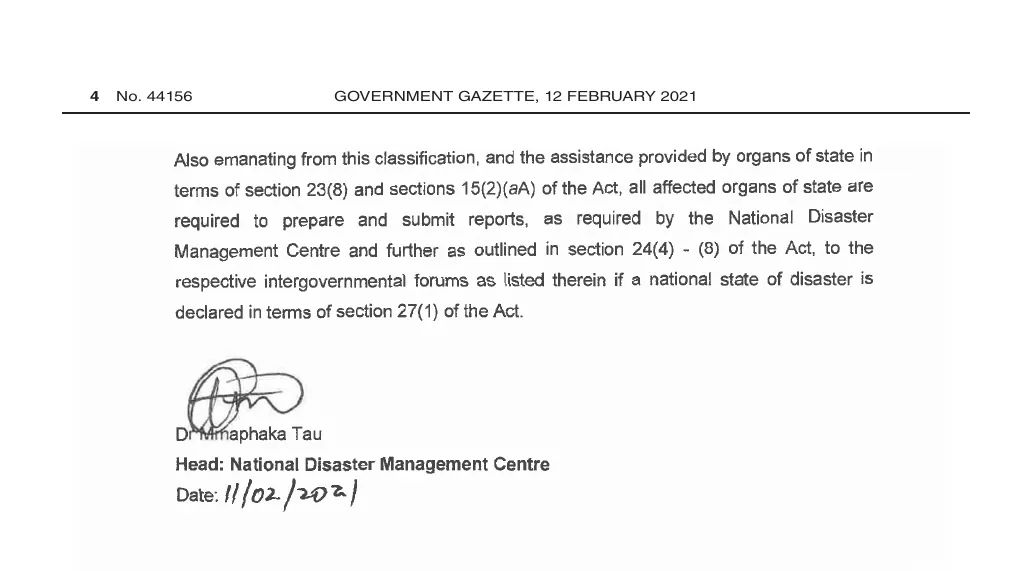
“After assessing the magnitude and severity of the damage in various provinces caused by strong winds and floods due to tropical storm Eloise and summer seasonal rains (…), I classified the occurrence as a national disaster,” said Dr Mmaphaka Tau, Head of the National Disaster Management, in a statement accompanying the government gazette on Friday.
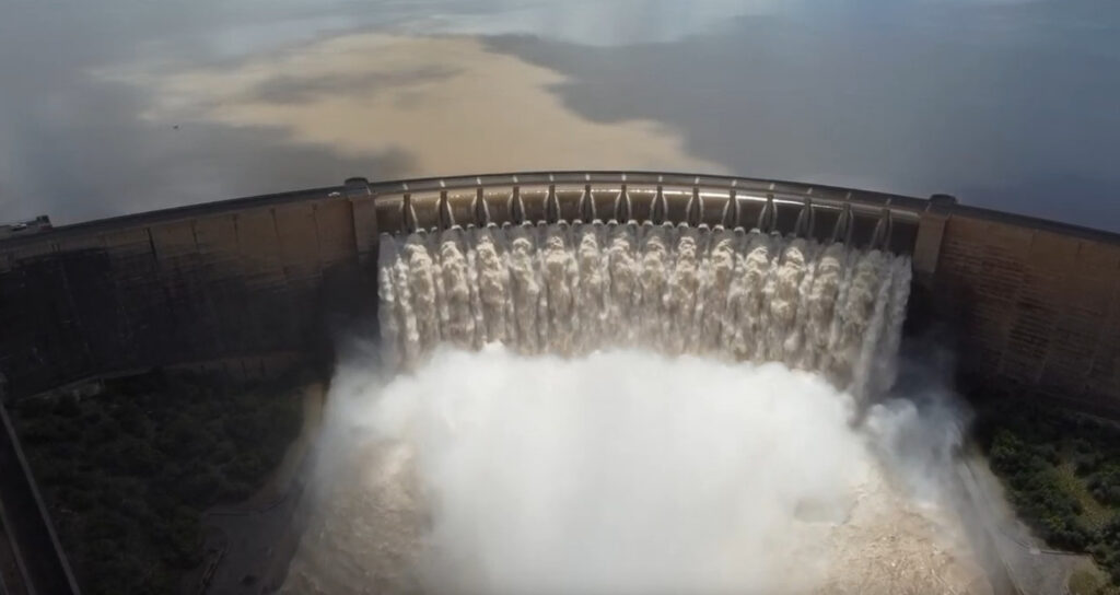
Gariep Dam South Africa Full Flood 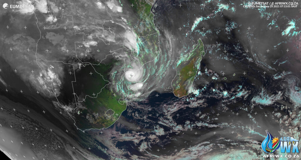

Augrabies Falls in Flood
Gariep Dam Overflowing in Full Flood
St Lucia Estuary – 2 Feb 2021 – The Demoina Effect
Flooding in Kruger National Park
Flooding in South Africa from Cyclone Eloise
Heavy rain and storm flooded Ermelo South Africa 31.1.2021
Beautiful animation of Tropical Cyclone Eloise and La Niña kicking into high gear
THE CAUSE OF RECENT HEAVY RAINS IN NORTH-EAST RSA
From Mike Berridge (Weather Today Southern Africa)
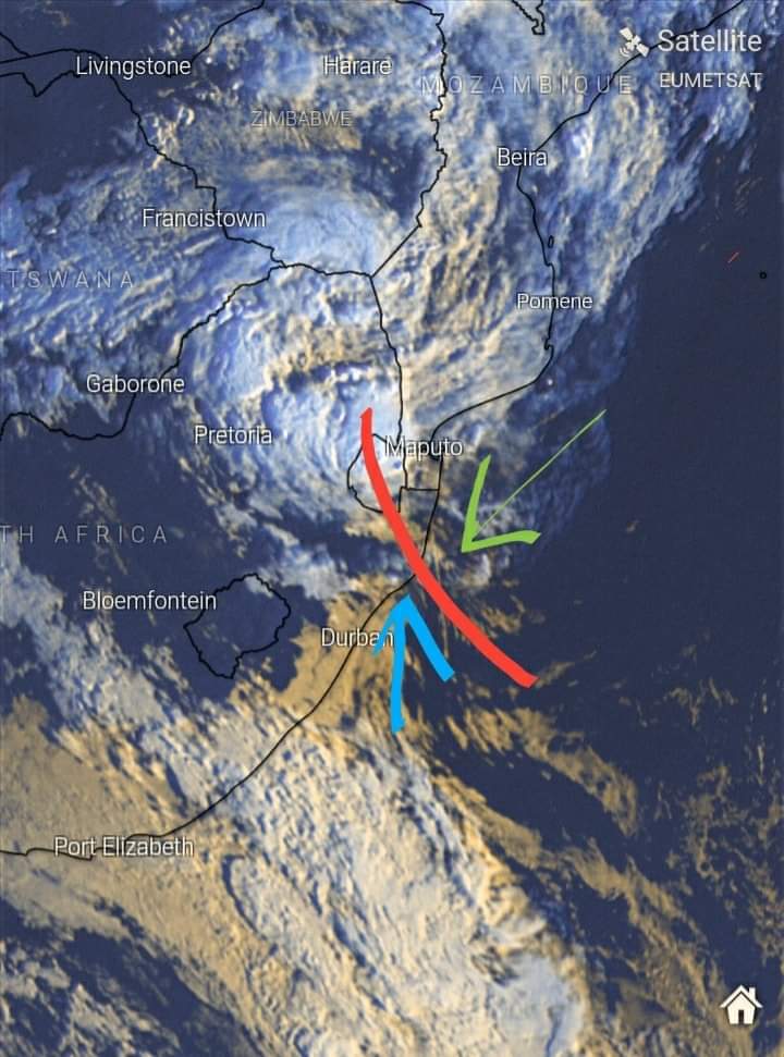
I’ve created this diagram in the hope of clearing up some misunderstandings over the recent heavy rain and winds in the north-east of RSA.
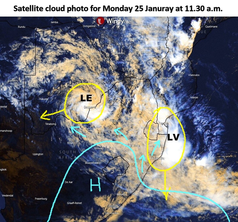
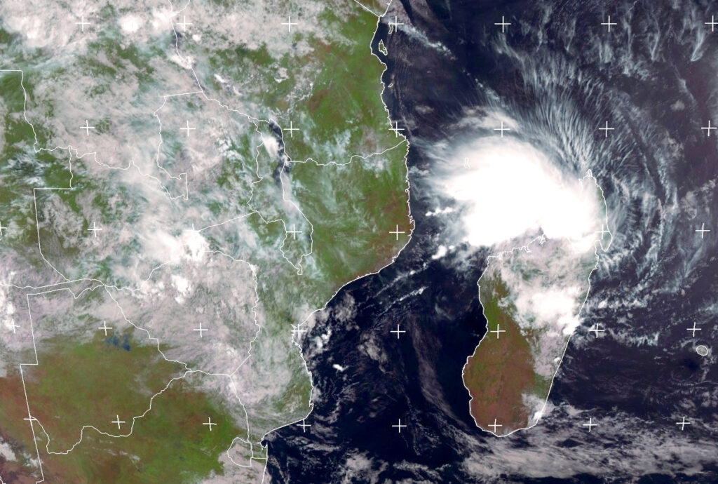
With the exception of Limpopo, Loise was not the direct cause. The photo is an actual cloud photo of the situation at 11.30 a.m. this morning 25th January. White areas show the heaviest clouds with the most rain.
“LE” represents the tropical depression ex-Loise.
“LV” represents a separate depression of similar strength which formed yesterday as a result of the convergence of Equatorial air from the north, and a mid-latitude front that came from the south and clashed with it driven by a high pressure anti-cyclone in the south.
They are completely separate systems and are moving apart as shown by the thin yellow arrows.
The brisk east winds over Gauteng and environs is attributed to the pressure gradient that exists between these two depressions and the ridging High in the south.
So the winds are predominantly high-pressure related as shown by blue arrows. (apologies for having messed up a nice cloud photo).
What will happen to “LV” and “LE”
“LV” will sink southward out to sea and disappear in a couple of days. Convergence will be extinguished by tomorrow (Tue), so rain will dramatically subside or clear in the north-east. “LE” will remain fairly stationary in south Botswana and continue to deliver patches of moderate to heavy rain.
On Wednesday it will form into an enlarged tropical Low stretching northward to the Caprivi strip.
This will initiate a new convergence or confluence zone that will deliver scattered showers or thunder storms for Botswana, particularly in the west and south-western sectors.
Join our AfriWX Telegram Weather Group
Don’t forget to join the free AfriWX group on Telegram Messenger, please download Telegram for Android or iPhone if you want to always be up to date with the latest weather maps.
Click to join our Telegram Group
Satellite Animation of Eloise over 96 hours (4 Days)
Update on Tropical Depression Eloise
Monday 25 January 10h00 SAST
Courtesy Angelo Ricardo Hoorn – SWAICSA
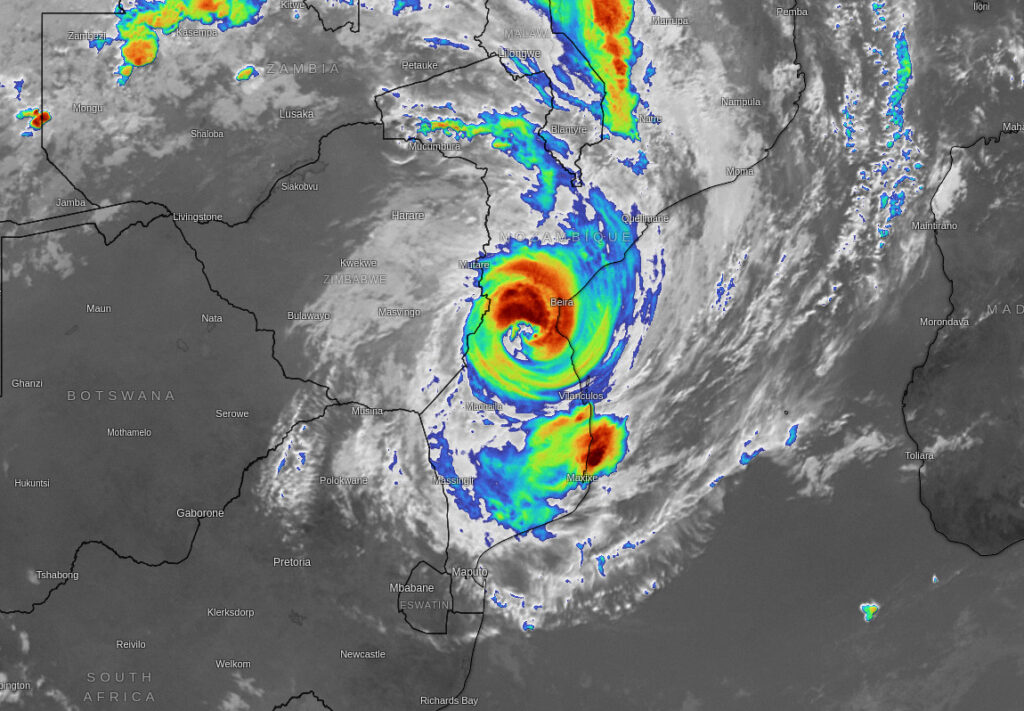
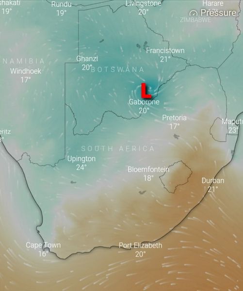
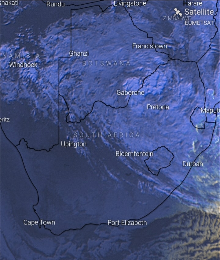
Tropical Depression Eloise has exited SA and is now positioned over SE-Botswana.
Heavy Rain, conducive to Flooding, Flash Flooding and Landslides, is expected to fall over SE-Botswana, parts of LP, the eastern parts of MP, Eswatini, the northern parts of KZN and eastern parts of NW today.
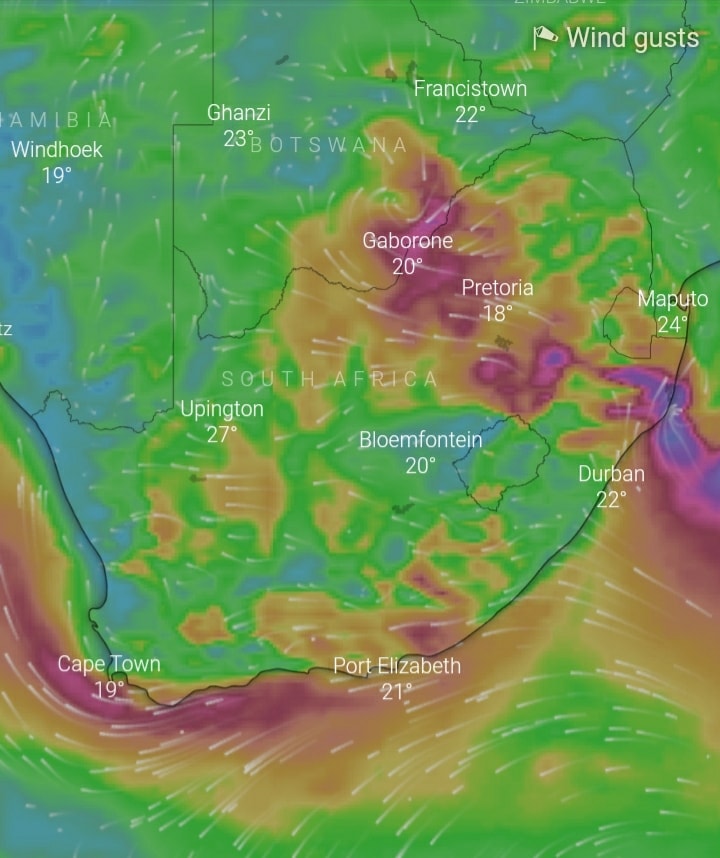
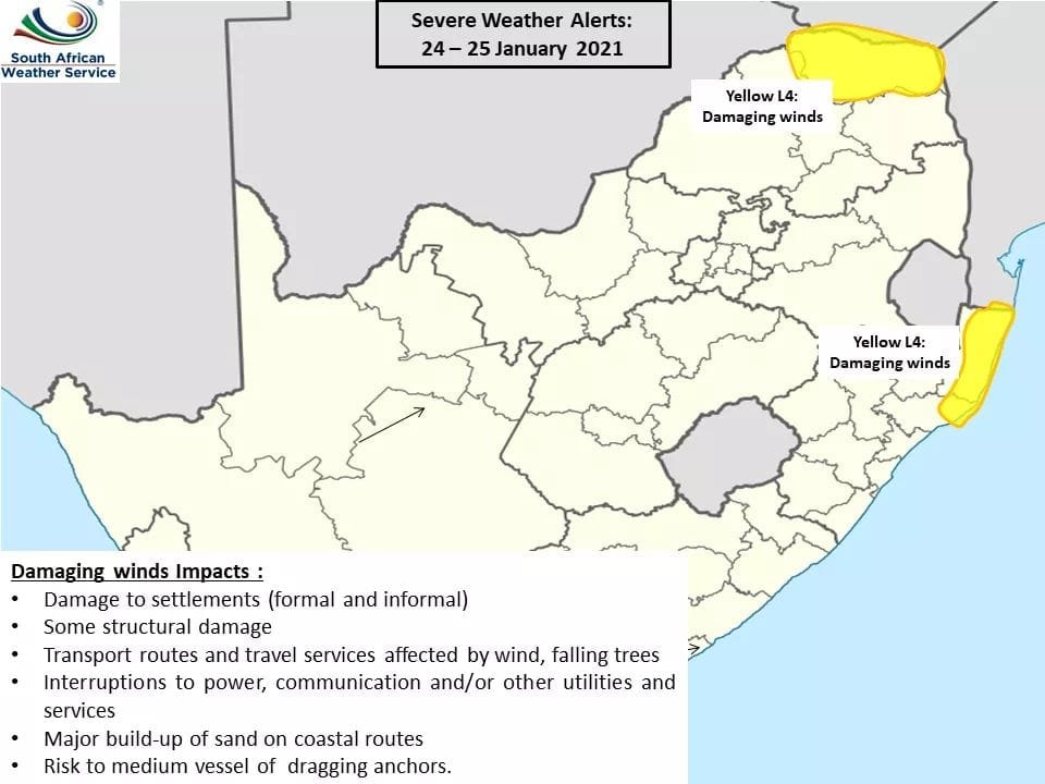
Strong windgusts are also expected in parts of the SE-Botswana and parts of SA today (Image 4).
Very strong windgusts are expected in parts of northern KZN this morning.
Stay safe!

10 Day Satellite Animation of Tropical Storm Eloise
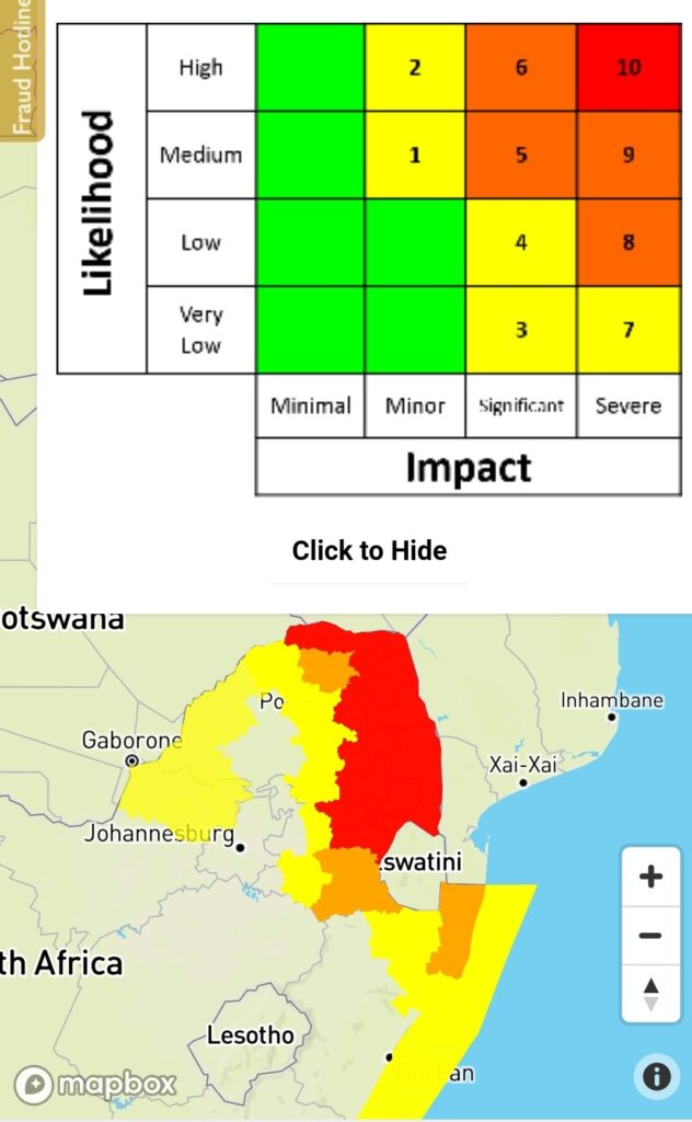
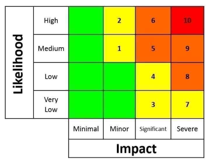
Red Level 10 Warning Issued by South African Weather Service
A Red level 10 Warning issued for Eastern parts of Limpopo and Mpumalanga for today into tomorrow due to persistent heavy rain and more heavy rain expected tonight into tomorrow. This will cause serious strain on emergency services. Take extreme caution in these areas.
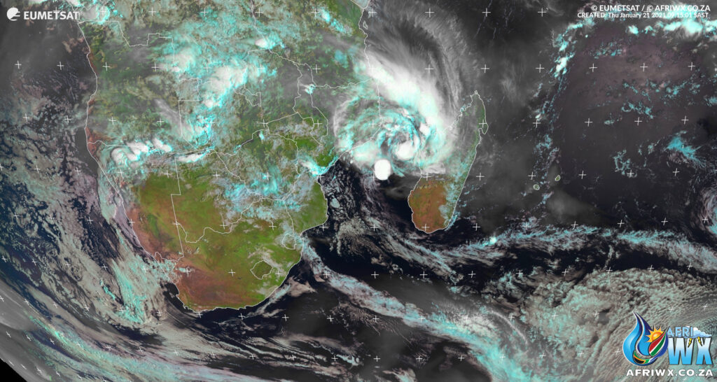
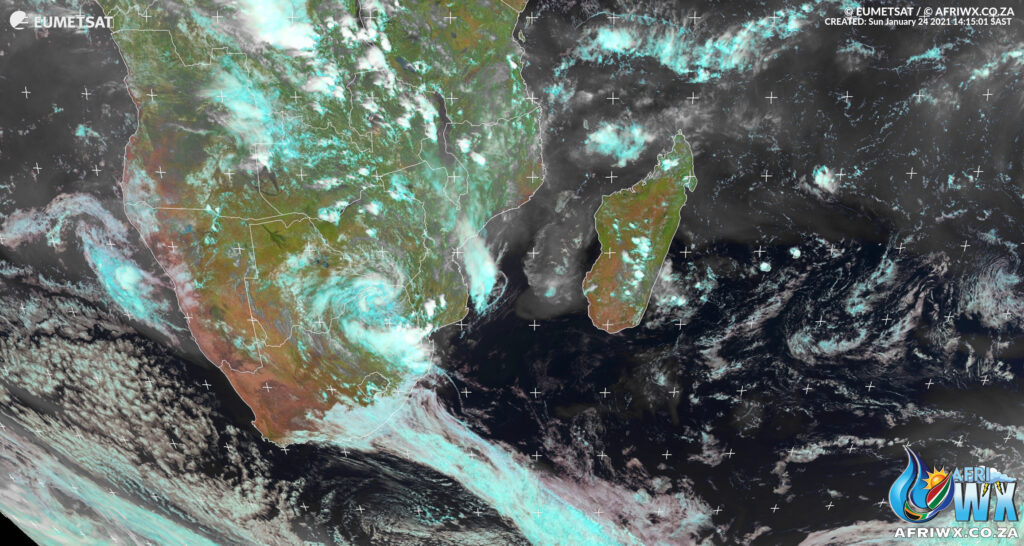
Latest Satellite Image of South Africa Sunday 24 January 2021 – 14h15 SAST
72 Hour Animation of Tropical Storm Eloise
Flooding Expected in Mpumalanga, Eswatini, Northern Kwazulu-Natal and Limpopo.
Weather warnings have been issued by the South African Weather Service (SAWS) for flooding in Mpumalanga, Limpopo and Northern Kwazulu-Natal. (see below)
Watch the Skies and Use your Eyes
We always say Watch the skies and use your Eyes !!!!
Pay attention to the weather and what’s going on around you.
Pay attention to ALL weather warnings issued by the Weather Service but DO NOT wait for any additional warnings if you see yourself or your family in imminent danger.
If you see heavy rain approaching or it is already raining heavily you can expect that rivers are rising fast and will burst their banks.
Northern parts of our country have already had very heavy rainfall and that water has to go somewhere. In addition to current rainfall falling today into tomorrow there is a big threat of flash floods from upstream rivers that have already burst their banks and upstream Dams releasing massive amounts of water to protect their integrity.
AVOID ALL LOW LYING AREAS !!!!!
If you live near a river or an area prone to flooding due to poor drainage get your family to higher ground if you notice water’s rising. Do not leave it to the last minute to try and evacuate. Do not stand around taking photos and videos if your life is in imminent danger.
REPORT YOUR WEATHER
If you are not in any immediate risk of Danger and are able to take any photos and videos. Kindly do share them on our Facebook Group StormWatch SA
Please do NOT try and take photos if you are even slightly in any imminent danger. Rivers can come down in flash floods in seconds.
Your weather photos and reports are vital to the public and surrounding communities to help people stay informed.
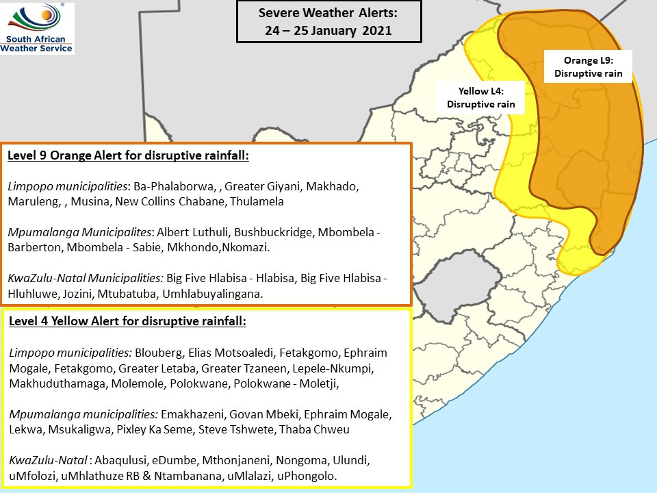
WEATHER WARNINGS FROM SAWS FOR SUNDAY 24 JAN 2021 > MONDAY 25 JAN 2021
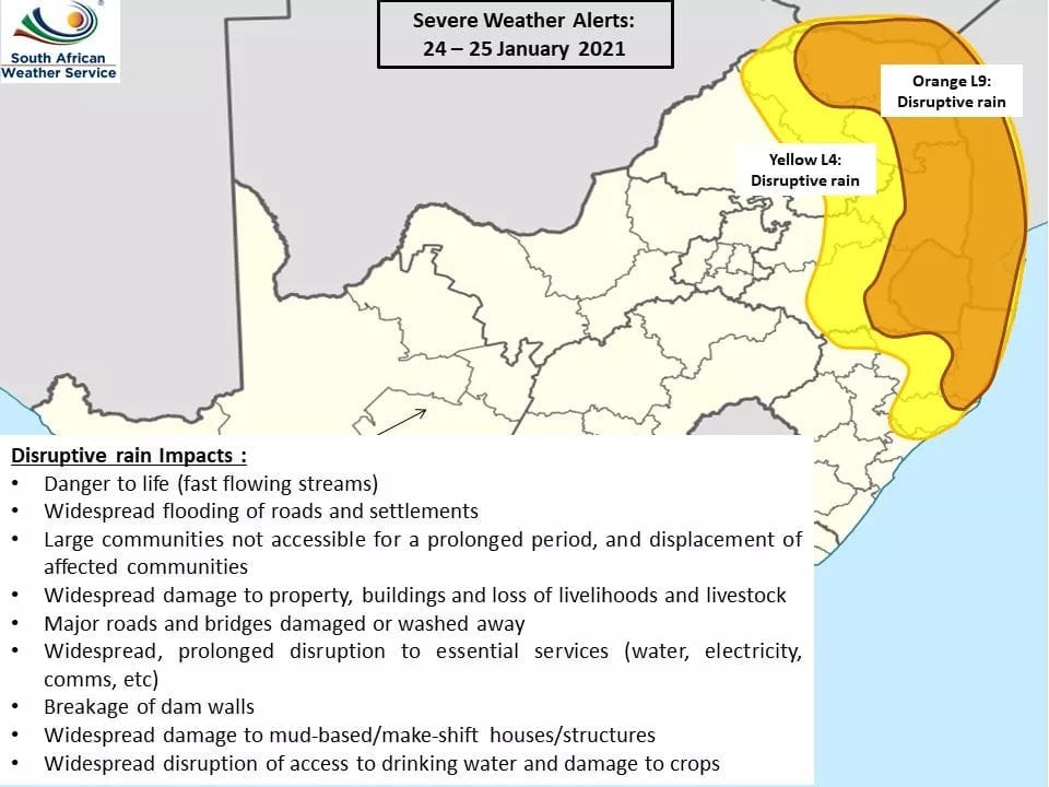
Yellow level 4 warning for Disruptive Rain leading to localized flooding of roads, low lying bridges and poor driving conditions is expected over the central parts of Limpopo and Mpumalanga as well as the northern parts of KwaZulu-Natal until Monday.
Orange level 9 warning for Disruptive Rain leading to widespread flooding and damages to roads, bridges, informal and formal settlements, danger to lives due to fast flowing streams, very poor driving conditions, communities not accessible or cut off, widespread disruption to transport routes and travel services along the escarpment and eastern parts of Limpopo, the eastern Highveld, escarpment and Lowveld of Mpumalanga and the north-eastern parts of KwaZulu-Natal until Monday.
Rainfall affecting Mpumalanga, Eswatini and Northern Kwazulu-Natal
From Angelo Ricardo Hoorn of SWAICSA – Please be advised that any rain falling over MP at this very moment is as a result of Tropical Depression “Eloise”.
The rain is expected to become much heavier over eastern parts of MP, Eswatini and northern parts of KZN later today when two weather systems explained yesterday (a Coldfront and the ITCZ) ‘collide’.
Keep safe, mind your weather! Stay Vigilant !!!
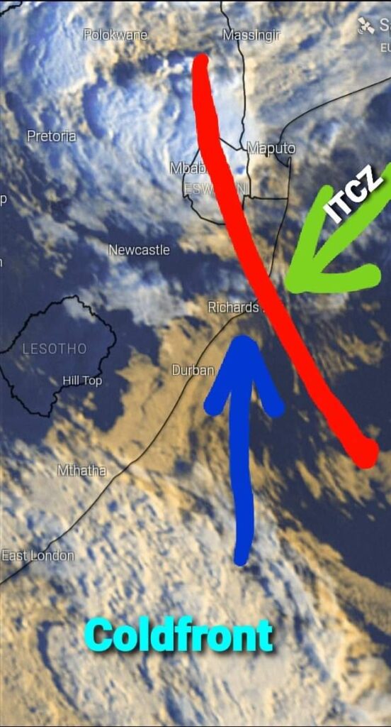
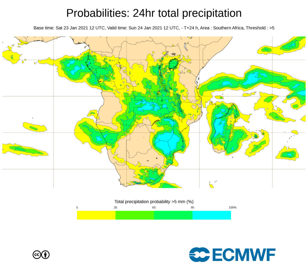
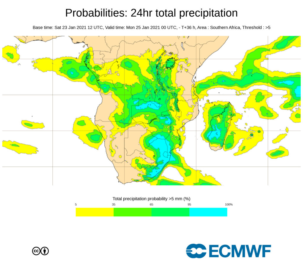
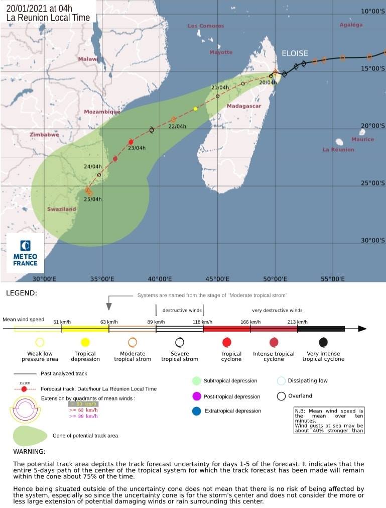
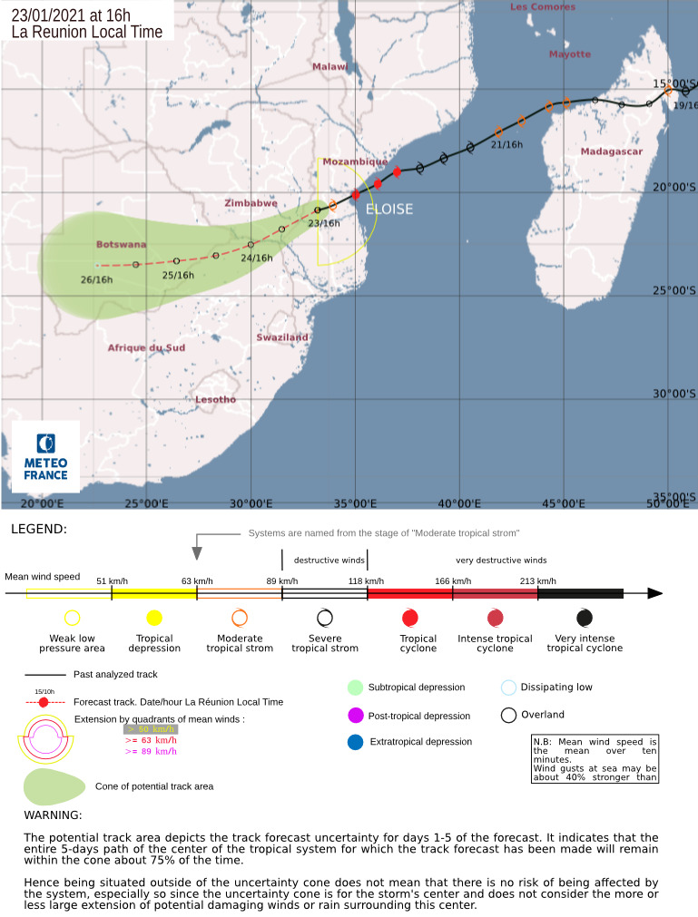
Latest Trajectory of Tropical Overland Depression Eloise
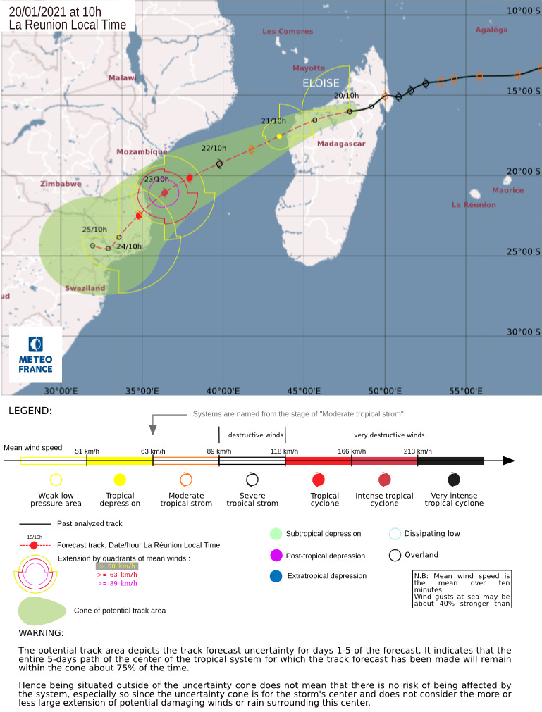
Latest Trajectory of Tropical Overland Depression #Eloise from Meteo France. Eloise is now an Overland depression with still much rain to deliver. Another amazing weather event will bring heavy rains to the interior of South Africa – a new blog post will follow in this regard.
Valid as of 02h00 SAST – SUNDAY 24 JAN 2021

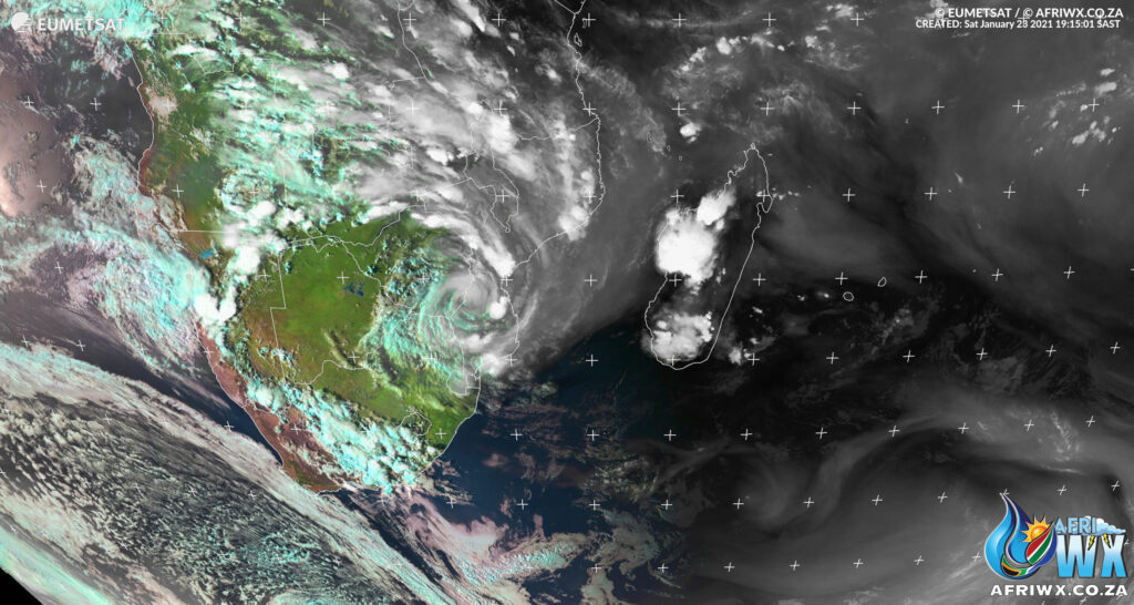
Tropical Depression Eloise
19h15 SAST – Saturday 23 Jan 2021
Latest HD satellite photo.
Look at how amazing #Eloise looks with her tentacles reaching into the interior of Africa.
Eloise, now a slow moving Overland tropical depression, still has much rain to deliver.
As the sun starts to set now we have some amazing thunderstorm development across the Northern and Eastern Cape and lower South-West of the Free State.
Much rain coming in the days ahead, see our earlier posts and as always we will keep you updated.
This composite satellite photo made with Love by #AfriWX
Warnings from South African Weather Service
Alerts for Tonight (Saturday) and tomorrow (Sunday) for South Africa. Disruptive rainfall (of 100 to 200mm) expected in places in a 24 hour period with over 200mm possible in places along the escarpment areas of Mpumalanga into Swaziland and northern KZN into Monday.


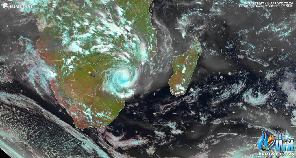
Latest Satellite of Tropical Storm Eloise – Sat 23 Jan 2020 15h15 SAST
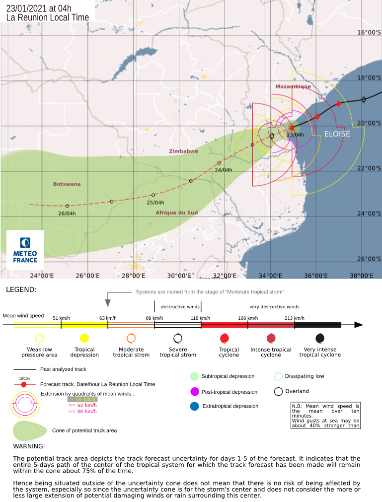
Latest Storm Trajectory of Tropical Depression Eloise

48 Hour High Definition Satellite Animation of Tropical Cyclone Eloise
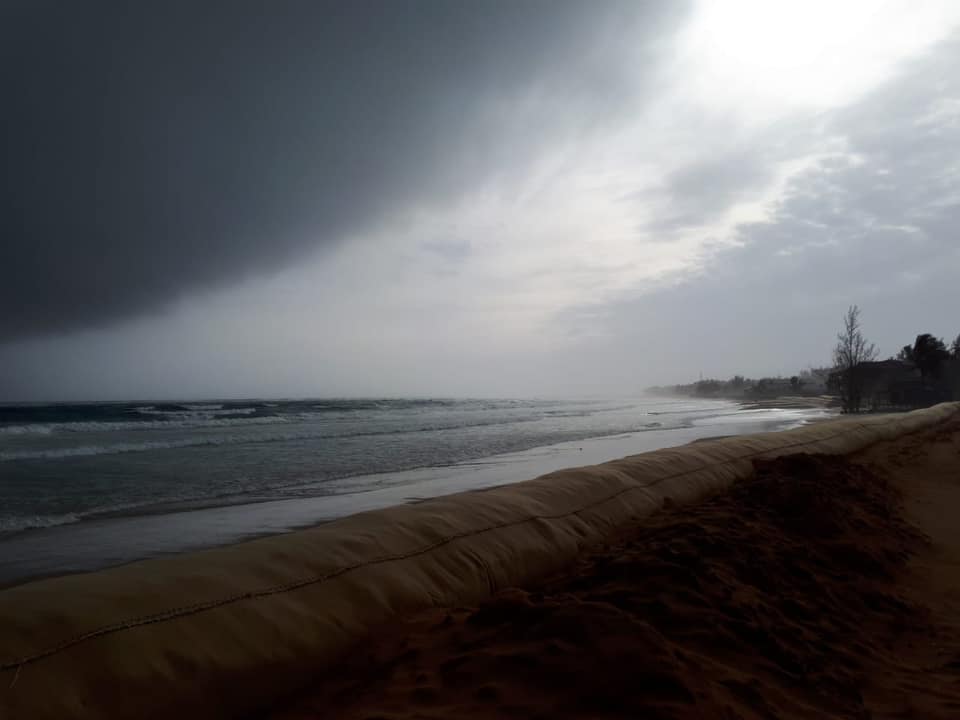
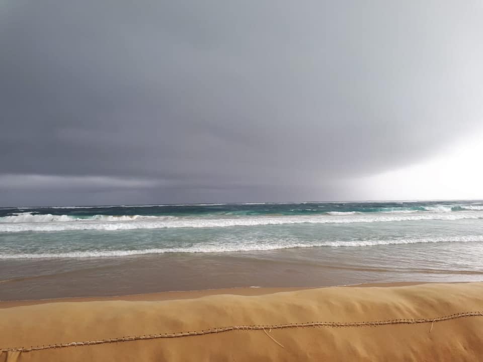
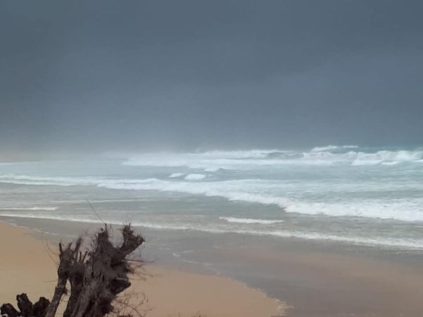
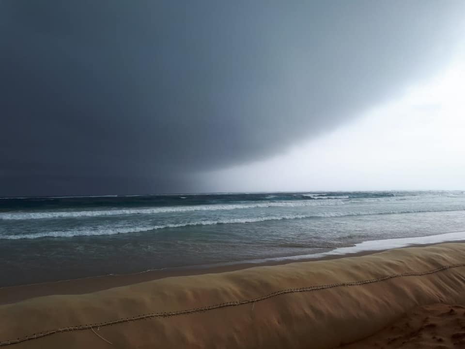
Barra Beach, Inhambane, Mozambique
Cyclone Eloise approaching our house on Barra Beach, Inhambane
Photos Copyright: Elke Bantz (via StormWatchSA)
Eloise Downgraded to Moderate Tropical Storm
Tropical Storm Eloise has been downgraded to a Moderate Tropical Storm status with winds of 45 knots (83km/h).
Central pressure is 978hPa and is still moving in a West-South-Westerly direction.
Outer bands are starting to affect the Lowveld areas of Limpopo later today.
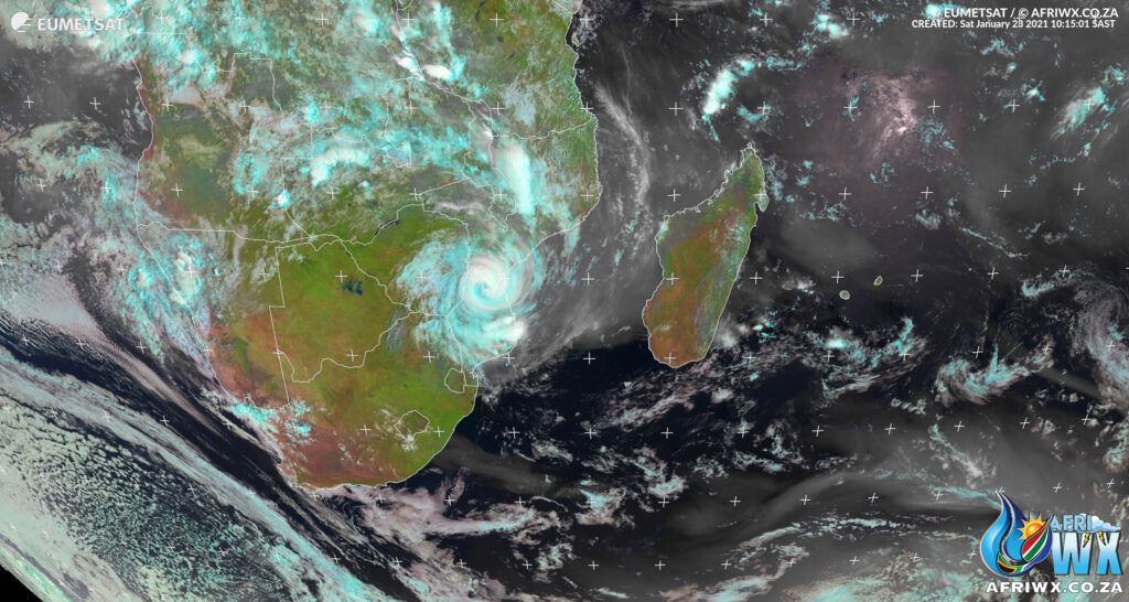
Latest Satellite Images of Tropical Cyclone Eloise


9-Day Satellite Animation of Tropical Cyclone Eloise
Tropical Cyclone Eloise Makes Landfall in Beira
![]() High Definition early morning photo of Cyclone #Eloise
High Definition early morning photo of Cyclone #Eloise
![]() Tropical Cyclone Eloise made landfall earlier this morning (Sat 23 Jan 2021) in the Beira area of Mozambique.
Tropical Cyclone Eloise made landfall earlier this morning (Sat 23 Jan 2021) in the Beira area of Mozambique.
Eloise is expected to weaken into an overland depression and move into parts of Limpopo tomorrow.
![]() Rain will already start today in Limpopo and Mpumalanga.
Rain will already start today in Limpopo and Mpumalanga.

Sunrise over Tropical Storm Cyclone Eloise
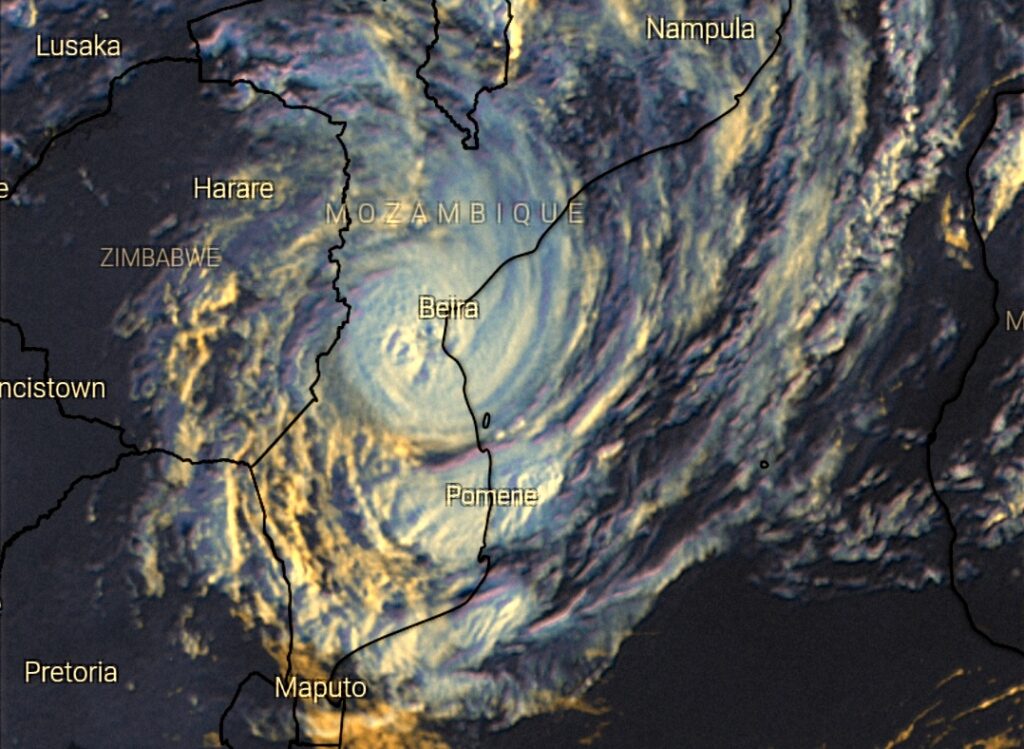
Cyclone Eloise Update Saturday 23 Jan 05h30
Latest Storm Trajectory from Meteo France valid as of Saturday 23 Jan 2021 02h00 SAST
Weather Warnings for South Africa for Tropical Storm Cyclone Eloise
⚠️Yellow level 1 for severe thunderstorms with heavy downpours, gusty winds and excessive lightning resulting in localized damages to settlements formal/informal, vehicles and a short-term disruptionto power over the eastern interior spreading to the coastline.
🔴 ADVISORIES
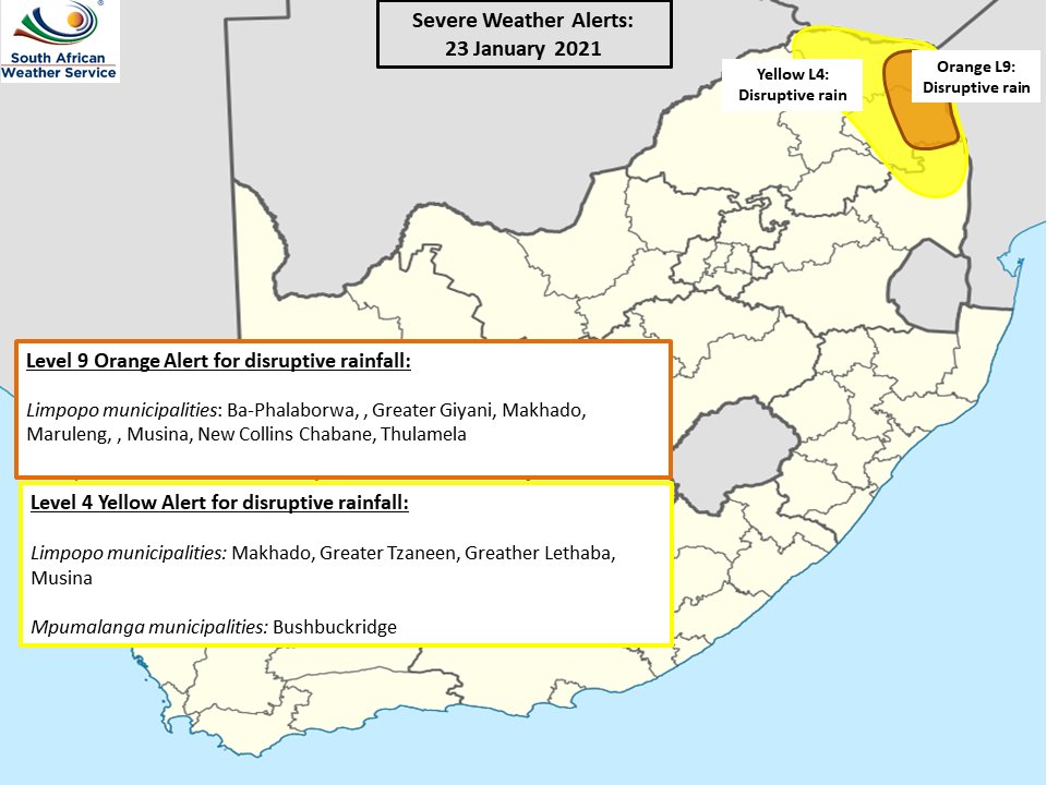
⚠️Orange Level(9) warning for disruptive rain with heavy downpours resulting in localized flooding over the Lowveld of Mpumalanga and Limpopo including the northern parts of the Limpopo Province as well as north-eastern parts of KwaZulu-Natal from Sunday on 24th January to Monday 25th January 2021
⚠️Yellow Level(4) warning for disruptive rain with heavy downpours resulting in localized flooding expected from Sunday 24th January to 25th January 2021 along the eascarpment and extreme eastern Highveld of both Limpopo and Mpumalanga including the King Cetshwayo and Zululand Districts of KwaZulu-Natal Province.
⚠️Yellow level(4) warning for damaging winds with wind speeds ranging between 50 to 60km/h resulting in injuries and danger to life from flying debris, damage to settlements, structural damage, transport routes and travel services affected by wind and falling trees expected over the Vhembe District of Limpopo and Mkhanyakude District of KwaZulu-Natal on Monday (25/01/2021).
Issued: 🗓️FRIDAY 22 JANUARY 2021 ⏰16h00 Issued by South African Weather Service
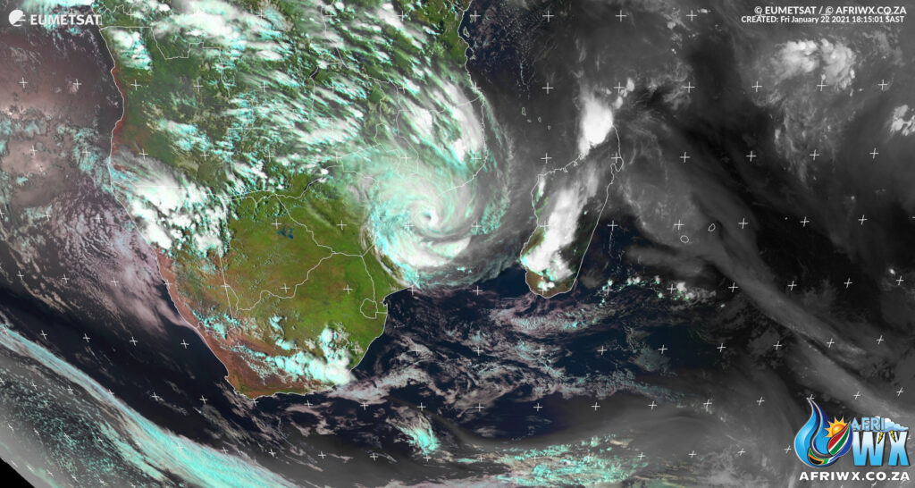
High Definition Satellite Photo of Cyclone Eloise
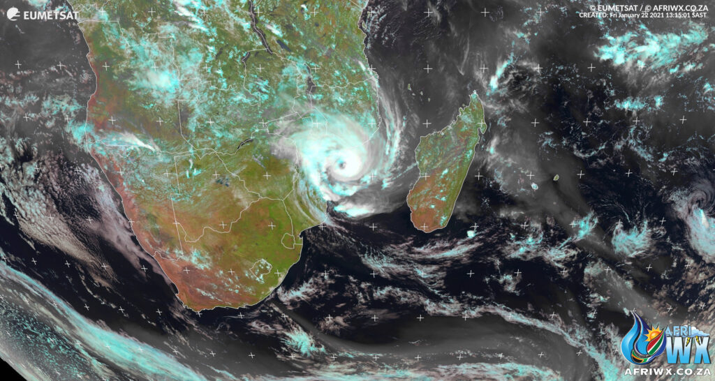
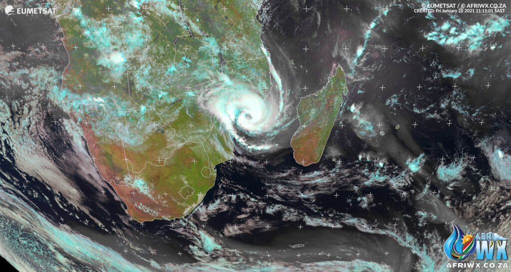
Latest satellite photo of Tropical Storm Cyclone Eloise making landfall with Beira in Mozambique. Friday 22 Jan 2021 – 18h15 SAST
Latest Satellite Animations of Cyclone Eloise
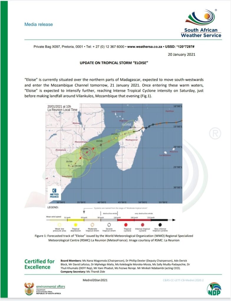
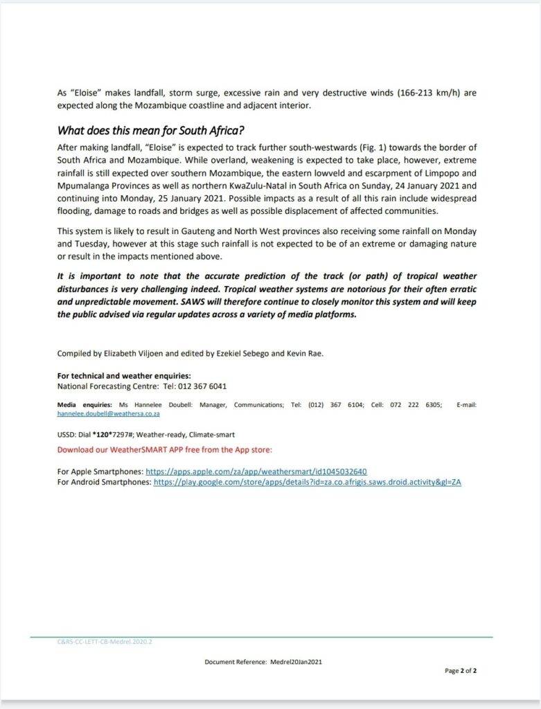
Media Release from South African Weather Service on Cyclone Eloise
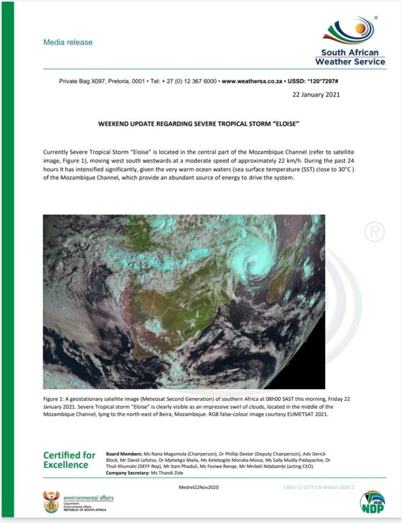
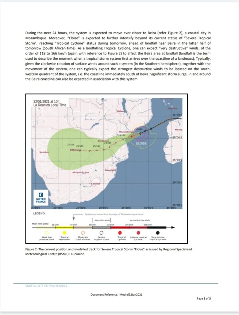
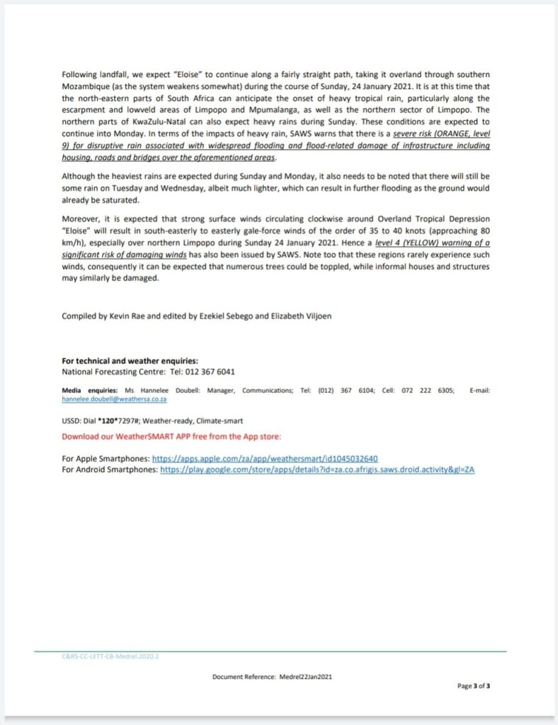
Latest Trajectory of Cyclone Eloise
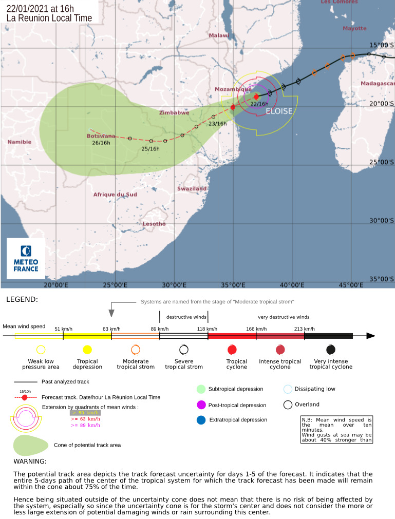
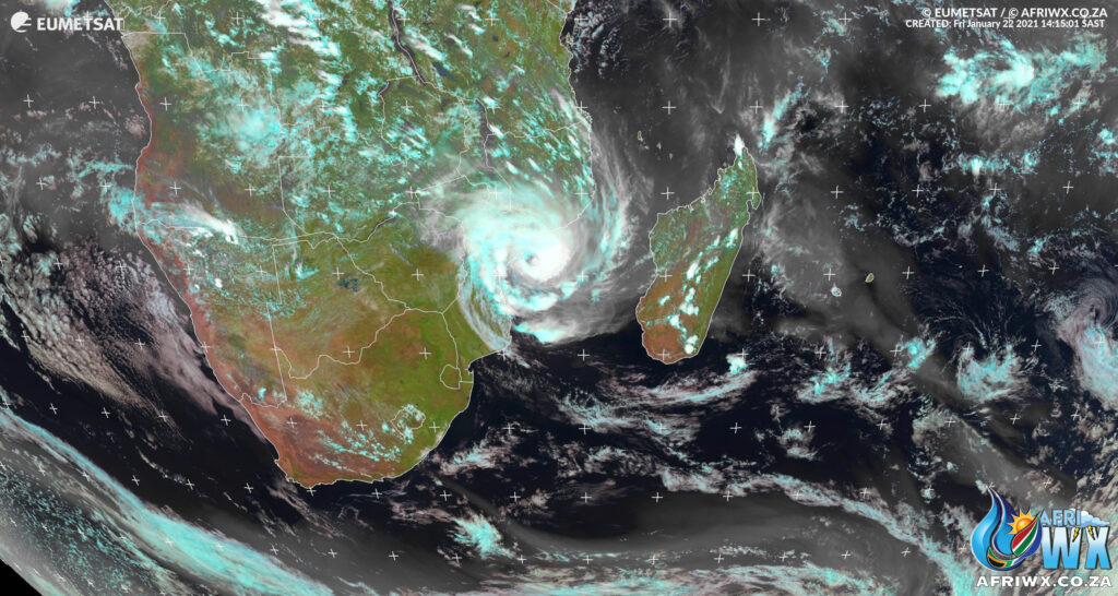
Cyclone Eloise – Friday 22 Jan 14h15 SAST

Tropical Cyclone Eloise Latest Trajectory and Satellite Image
Friday 22 January 2021 – 13h30 SAST

South African Weather Service Warnings for South Africa from Tropical Cyclone Eloise
Orange (L9) warning: Disruptive Rain: 24/01/2021 00h00 TO:25/01/2021 00h00 – is expected over the eastern parts of Mpumalanga, as well as northern and eastern parts of Limpopo from Sunday into Monday.
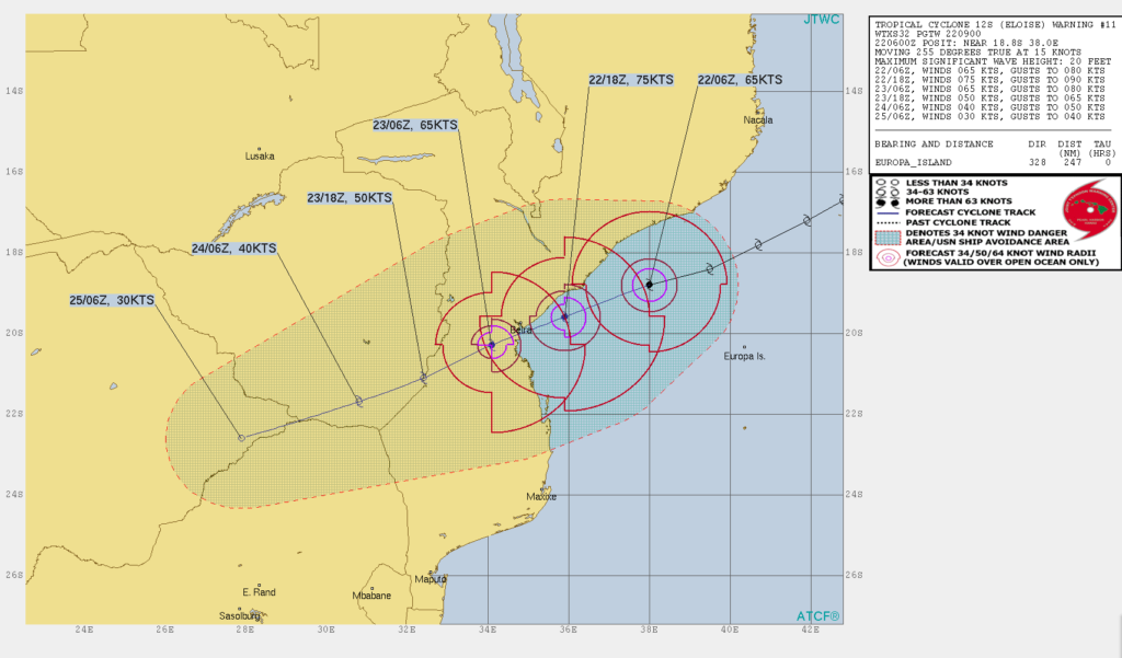
ELOISE is expected to reach Tropical Cyclone status and make landfall near Beira in Mozambique. It is then expected to become an overland depression and result in significant rain over eastern parts of SA. Have a look at the alert areas below.
UPDATE: SEVERE TROPICAL STORM ELOISE.
11:25, 22|01|2021.
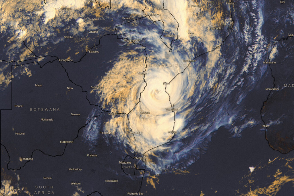
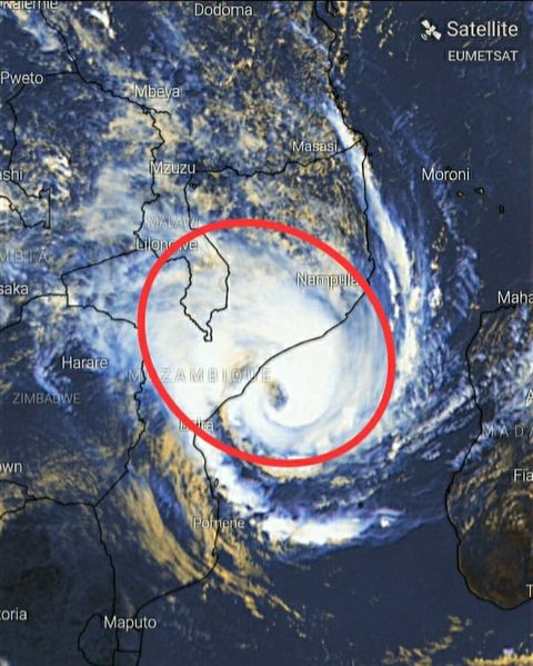
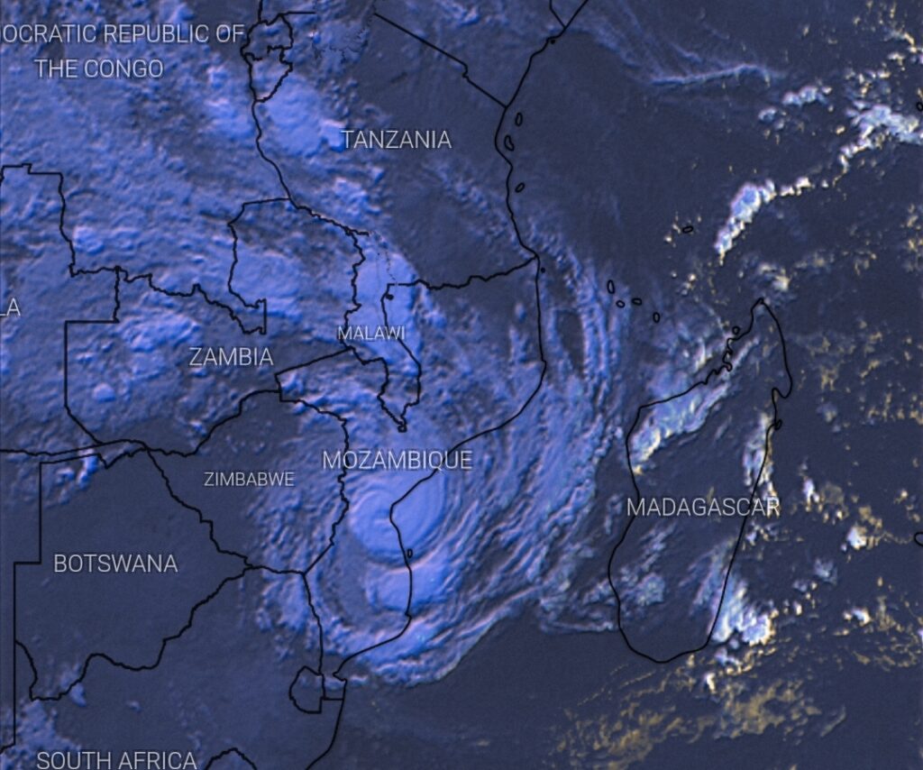
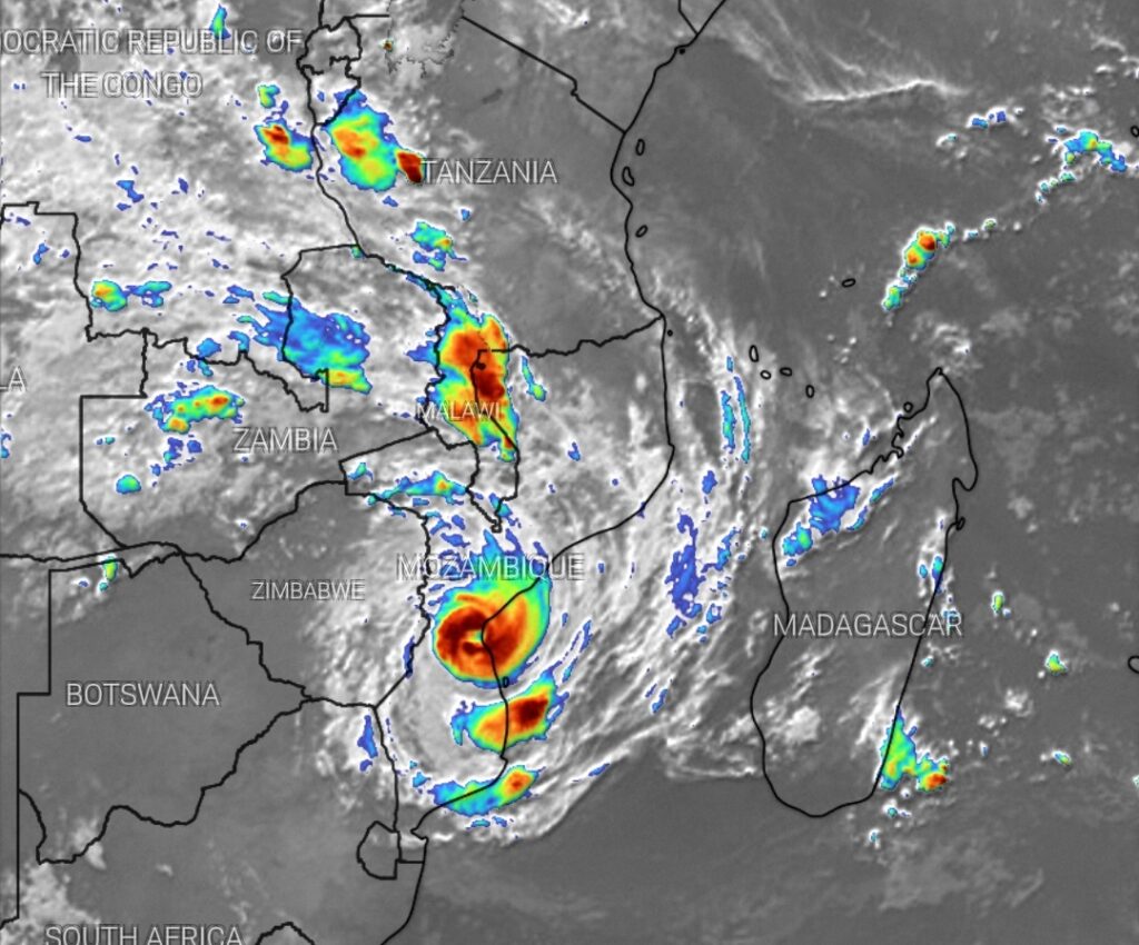
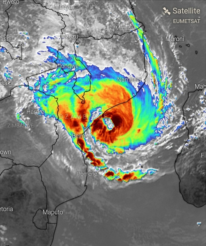
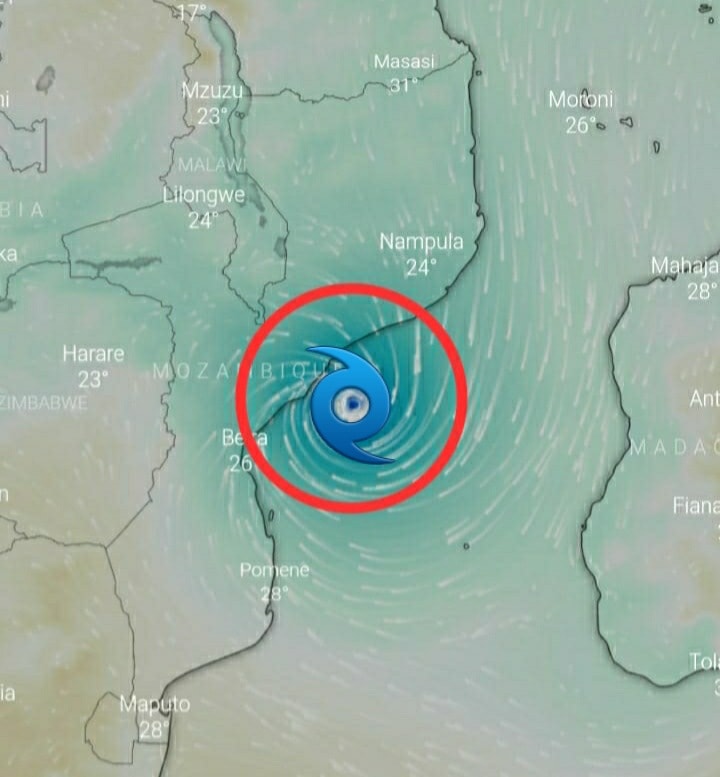
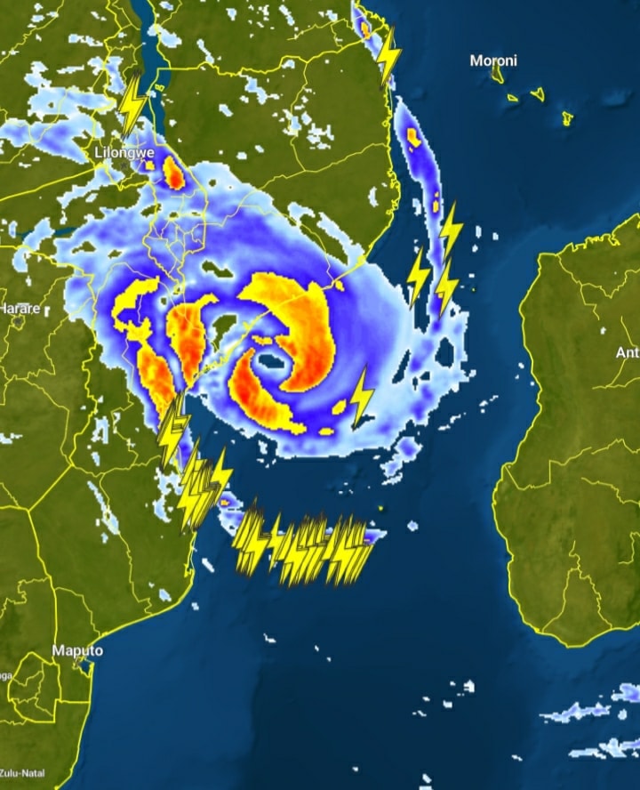
Image 1 shows the region already impacted by Severe Tropical Storm Eloise. The EYE (images 5 & 6) has developed and the Storm is still intensifying. It is likely to reach TROPICAL CYCLONE -status just before making landfall to Beira (either late tonight or in the early hours of tomorrow morning). – Source: SWAICSA

Heavy Rainfall Expected
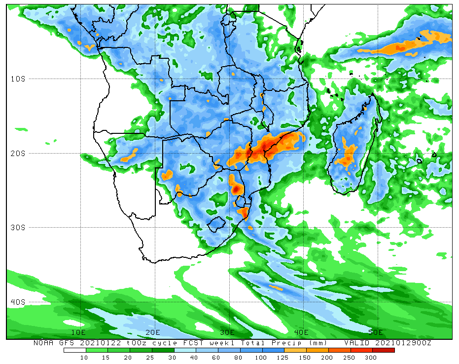
The latest accumulated rainfall showing heavy rainfall possible over north-eastern South Africa on Sunday into Monday. The South African Weather Service has issued a L4 Yellow WARNING for Disruptive rain leading to localised flooding over Mpumalanga and Limpopo.
The Eye of Tropical Cyclone Eloise
Latest Beautiful High Definition Composite Satellite Image of Severe Tropical Storm / Cyclone Eloise. Can you see the eye of Eloise developing?
FLOOD ALERT: THE LIMPOPO RIVER BASIN.
Courtesy – Angelo Ricardo Hoorn – SWAICSA : The Latest Storm Trajectory of Severe Tropical Storm / Cyclone Eloise suggests that the system will move over the Limpopo River Basin- an area nutorious for flooding and flash flooding- from Saturday, 23|01|2021.
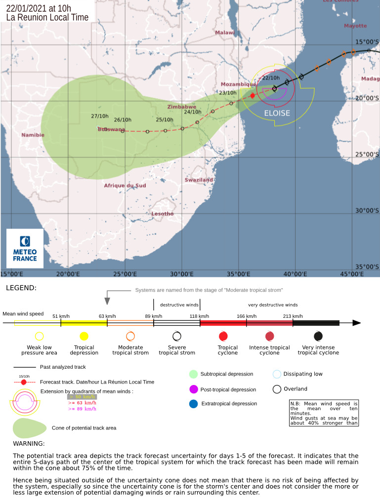
By then, this system will most likely be a Tropical Depression, accompanied by torrential (very heavy) rain.
The Limpopo River Basin is located in Southern Africa and covers an area of 416,296 km2, spreading over four countries: Botswana, Mozambique, South Africa and Zimbabwe.
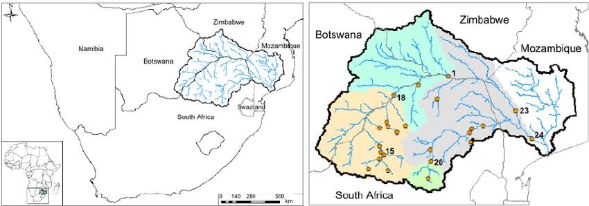
Flooding is a major problem in the Limpopo River basin, particularly in the lower Limpopo River, across the coastal floodplain in Mozambique. This low lying region is particularly susceptible as during periods of high flow, it receives a large portion of the waters from upper basin.
The Limpopo River basin has been subject to several significant flooding events over the recent years. All of these events are associated with heavy rainfall resulting from tropical cyclones.
Flooding in the Limpopo River basin is generally caused by a series of primary factors:
1. Heavy, episodic, localised rainfall, often associated with tropical cyclone activity and saturated soils from preceding events;
2. Poor land use management practises, including land-clearing and poor agricultural land management in the upper river basin;
3. Associated soil erosion and increased run-off; and
4. Lack of integrated management of upstream dams and wetlands.Loss or damage to wetlands can have a significant impact on flooding as wetlands can act as a buffer in times of high flow.
Wetlands in the upper river can absorb and retain water, buffering the effects of heavy rainfall and increased stream-flow. While wetlands do contribute to flow control, their capacity is finite and once saturated, they have little impact in terms of reducing the impacts of flooding.
The Likelihood of the Limpopo River Basin Flooding again during the next 7 days is EXTREME HIGH and the impact SEVERE. It is recommended that people living in the Limpopo River Basin (especially the low-lying areas of: Limpopo, southern Zimbabwe, southern Mosambique, and the western parts of Botswana) take precautionary measures immediately, moving to higher ground will be a good start.
Rather safe, than sorry.
8 Day Satellite Animation of Tropical Storm Eloise
High Definition Animation of Tropical Cyclone Eloise
Trajectory of Tropical Cyclone Eloise
Latest Storm Trajectory for Severe Tropical Storm / Cyclone Eloise
Friday 22 January 2021 – 08h00 SAST – Meteo France
Watch beautiful Satellite Animations of Tropical Storm / Cyclone Eloise at https://weathertube.co.za
Latest Analysis on Tropical Cyclone Eloise from Angelo Ricardo Hoorn of SWAICSA
TROPICAL STORM ELOISE – SWAICSA.
08:30, 22|01|2021.


Although the Storm is only expected to make landfall (officially) in Beira within the next 12 hours, it has already started to affect the coastal regions of Mosambique (between Angoche and Beira) with heavy rain, rough seas and strong winds as it is moving parrallel to the coast, towards Beira.
A Tropical Cyclone or -Storm is classified as making LANDFALL when the center of the storm moves across the coast; in strong tropical cyclones this is when the eye moves over land.
EFFECTS OF TROPICAL CYCLONES.
The effects of tropical cyclones include heavy rain, strong wind, large storm surges near landfall, and tornadoes. The destruction from a tropical cyclone depends mainly on its intensity, its size, and its location.
Tropical cyclones remove forest canopy as well as change the landscape near coastal areas, by moving and reshaping sand dunes and causing extensive erosion along the coast.
Even well inland, heavy rainfall can lead to landslides in mountainous areas.After the cyclone has passed, devastation often continues. Fallen trees can block roads and delay rescues, with medical supplies, or slow the repairs to electrical lines, telephone towers or water pipes, which could put other lives at risk for days or months.
Stagnant water can cause the spread of disease, and transportation or communication infrastructure may have been destroyed, hampering clean-up and rescue efforts.
Nearly 2 million people have died globally due to tropical cyclones. Despite their devastating effects, tropical cyclones are also beneficial, by potentially bringing rain to dry areas and moving heat from the tropics poleward. Hazards are often characterized as primary, secondary or tertiary:
1. A primary hazard involves destructive winds, debris and storm surge.
2. Secondary hazards include flooding and fires.
3. Tertiary hazards include spikes in prices of food and other necessities, as well as long term hazards like water-borne diseases.
STRONG WINDS
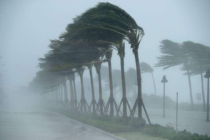
Strong winds can damage or destroy vehicles, buildings, bridges, trees, personal property and other outside objects, turning loose debris into deadly flying projectiles. Tropical cyclones often knock out power to tens or hundreds of thousands of people, preventing vital communication and hampering rescue efforts.Tropical cyclones often destroy key bridges, overpasses, and roads, complicating efforts to transport food, clean water, and medicine to the areas that need it. Furthermore, the damage caused by tropical cyclones to buildings and dwellings can result in economic damage to a region, and to a diaspora of the population of the region – spread of any people from their original homeland.
STORM SURGE
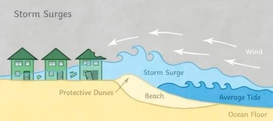
A storm surge is a coastal flood or tsunami-like phenomenon of rising water commonly associated with low-pressure weather systems, such as cyclones. The storm surge, or the increase in sea level due to the cyclone, is typically the worst effect from landfalling tropical cyclones.
The relatively quick surge in sea level can move miles/kilometers inland, flooding homes and cutting off escape routes. The storm surges and winds of Tropical Storms and -Cyclones may be destructive to human-made structures, but they also stir up the waters of coastal estuaries, which are typically important fish-breeding locales.
HEAVY RAINFALL
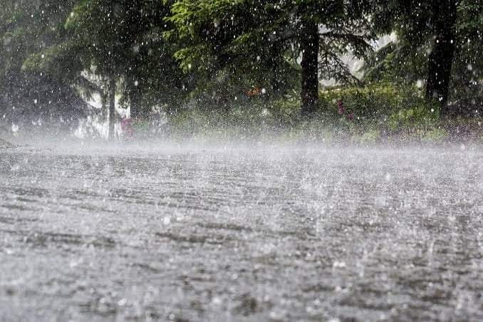
The thunderstorm activity in a tropical cyclone produces intense rainfall, potentially resulting in flooding, mudslides, and landslides. Inland areas are particularly vulnerable to freshwater flooding, due to residents not preparing adequately or little or no warning. Heavy inland rainfall eventually flows into coastal estuaries, damaging marine life in coastal estuaries.
The wet environment in the aftermath of a tropical cyclone, combined with the destruction of sanitation facilities and a warm tropical climate, can induce epidemics of disease which claim lives long after the storm passes. Infections of cuts and bruises can be greatly amplified by wading in sewage-polluted water.
Large areas of standing water caused by flooding also contribute to mosquito-borne illnesses. Furthermore, crowded evacuees in shelters increase the risk of disease propagation.
Although cyclones take an enormous toll in lives and personal property, they may be important factors in the precipitation regimes of places they affect and bring much-needed precipitation to otherwise dry regions.
On the other hand, the occurrence of tropical cyclones can cause tremendous variability in rainfall over the areas they affect: indeed cyclones are the primary cause of the most extreme rainfall variability in the world, as observed in places such as Onslow and Port Hedland in subtropical Australia where the annual rainfall can range from practically nothing with no cyclones to over 1,000 millimetres (39 in) if cyclones are abundant.
TORNADOES
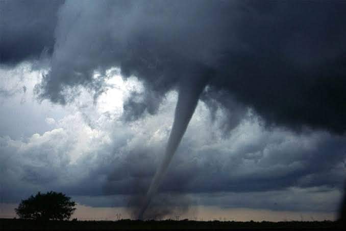
The broad rotation of a land-falling tropical cyclone often spawns tornadoes, particularly in their LEFT FRONT QUADRANT. While these tornadoes are normally not as strong as their non-tropical counterparts, heavy damage or loss of life can still occur. Tornadoes can also be spawned as a result of eyewall mesovortices, which persist until landfall.
NB: Eyewall mesovortices are small scale rotational features found in the eyewalls of intense tropical cyclones. They are similar, in principle, to small “suction vortices” often observed in multiple-vortex tornadoes. In these vortices, wind speed can be up to 10% higher than in the rest of the eyewall.
IMAGES USED FOR ILLUSTRATION AND INFORMATION PURPOSES ONLY.
Update on Severe Tropical Storm TC12S Eloise
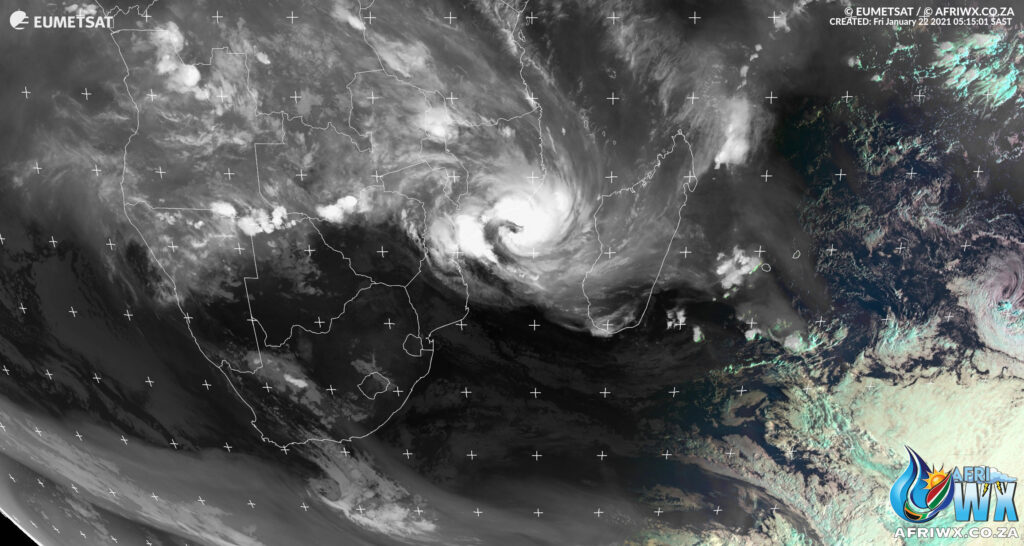
Friday 22 January 2020
06h00 SAST
More updates to follow.
ELOISE Current Status
Current Wind Speed 55 knots / MPH
Max Predicted Wind Speed 75 knots / 86 MPH at Saturday, 23 Jan 2021 8:00 AM
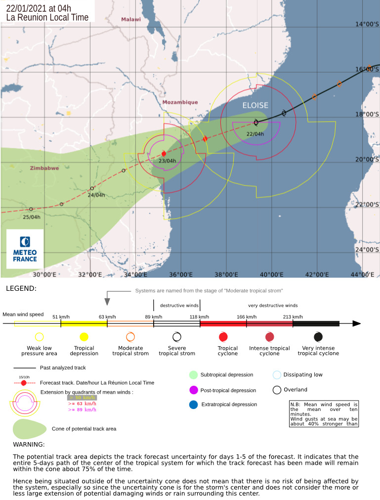
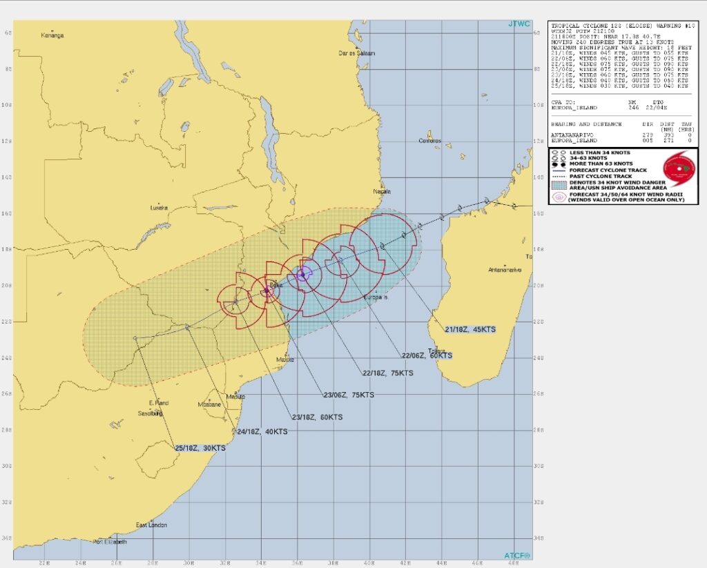
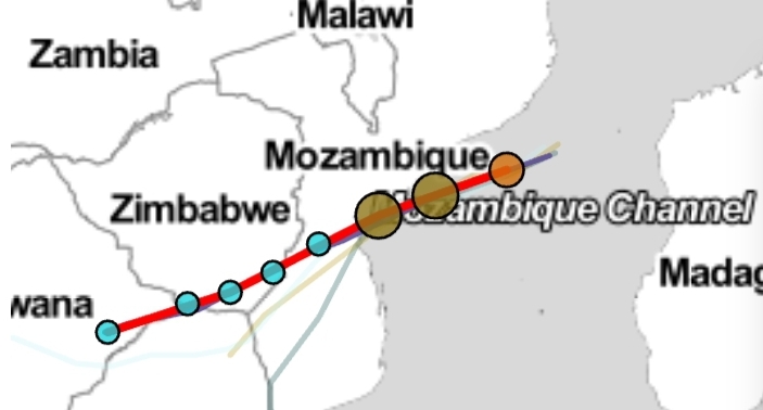
Maps and Text:
Joint Typhoon Warning Centre Cyclocane Eumetsat Meteo France AfriWX
JTWC Remarks:
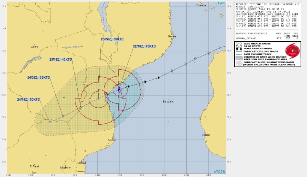
TC 12S IS FORECAST TO TRACK SOUTHWEST THROUGH DURATION OF THE FORECAST PERIOD, ALONG THE NORTHWEST PERIPHERY OF A DEEP-LAYER SUBTROPICAL RIDGE (STR) CENTERED TO THE SOUTHEAST.
THE SYSTEM IS EXPECTED TO MAKE LANDFALL NEAR JUST PRIOR TO TAU 36 NEAR OR JUST SOUTH OF BEIRA, MOZAMBIQUE. ENVIRONMENTAL CONDITIONS ALONG THE TRACK ARE HIGHLY CONDUCIVE TO FURTHER INTENSIFICATION WITH LOW (5-10 KT) VWS, ROBUST EQUATORWARD OUTFLOW AND VERY WARM (31 DEG C) SSTS.
THE SYSTEM SHOULD BE ABLE TO INTENSIFY RAPIDLY, REACHING A PEAK OF 75 KNOTS JUST PRIOR TO LANDFALL.
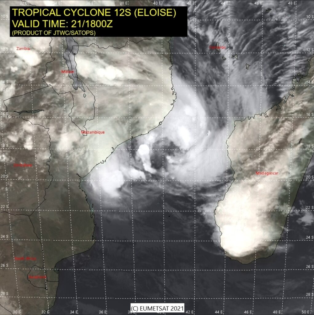
AFTER LANDFALL, THE SYSTEM WILL RAPIDLY WEAKEN AND ULTIMATELY DISSIPATE BY TAU 96.
Analysis on Tropical Storm Eloise from Mike Berridge of Weather Today Southern Africa
Mike Berridge – Weather Today Southern Africa
MY UPDATE ON TROPICAL STORM ELOISE:- Because my earlier post was dismissed by Face Book without a warning, I am pasting the most significant part of it from my Patreon site. (you’ll need to click the diagrams here if you want full views)
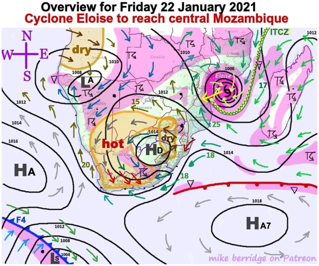
The exact trajectory for the storm Eloise has been a cause for consternation amongst us all for several days now, but I am confident that a course has finally been settled upon, and there is less than 24 hours left to go.
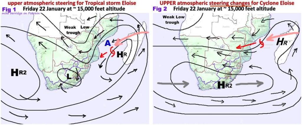
Two figures illustrate the changes that have occurred in the upper atmosphere since Monday. The Atlantic High “HR2” has moved (or spread) eastward to ABSORB the Madagascan High “HR” so that the counter-clockwise wind circulation of the latter has been extinguished.
This eradicates the expected south-west drift of the storm and replaces it with a trajectory which is almost “due west” (with a slight southerly component) to follow the northern perimeter of the altered shape of “HR2”.
This small change of angle has a significant effect on where the storm will make landfall and where it will go from there.
It is now set to cross the port of Beira and head for south-east Zimbabwe.Please be aware that as soon as the storm has crossed the coastline, the winds will decline drastically within a matter of hours, and the system will weaken to a “tropical depression” or “tropical disturbance”.
However, the depression will continue to draw in very humid air which includes inter-tropical convergence (see ITCZ), so rain will continue to be copious.
There is a possibility that the storm might attain “cyclone” strength just before making landfall.
The expected central pressure is very low at about 965 – 978 hPa (millibars) which will certainly make for a very turbulent night (Fri – Sat) for the coastal region of Sofala just north of Beira in central Mozambique.
Sustained winds could then be around 70 knots with gusts exceeding 100 knots (>200 km/hr). But there is a chance for an 11th hour weakening of the storm, although an “eye” can already be seen beginning to form in the satellite photo.
It will cross Beira early tomorrow (Saturday) in a weakening condition due to the friction of the land contours.
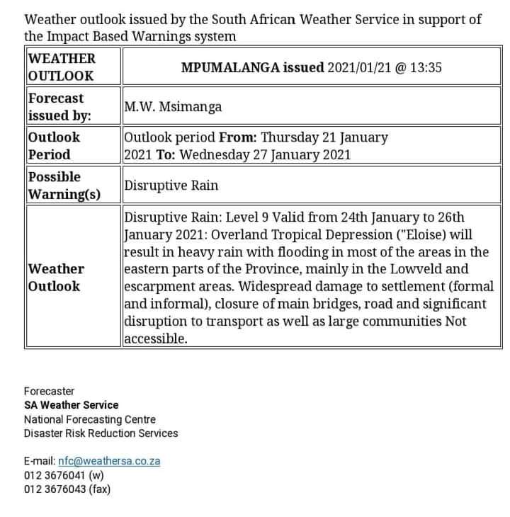
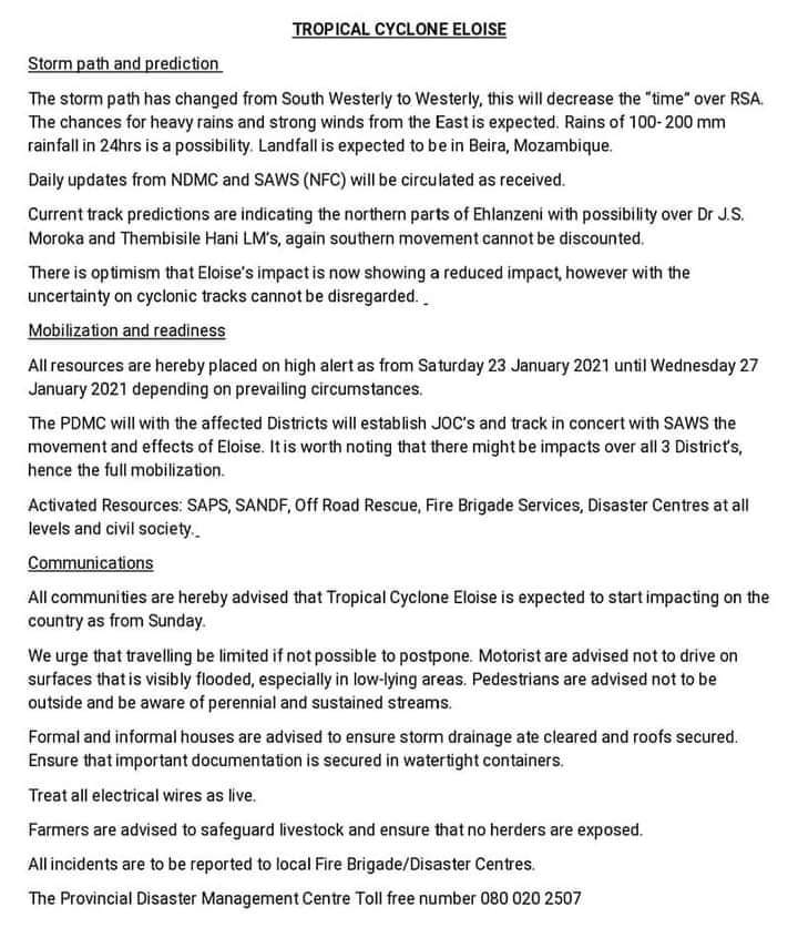
TROPICAL CYCLONE ELOISE. WARNING BY THE SAWS FOR MPUMALANGA.

ALERT TO OUR FOLLOWERS IN MOZAMBIQUE
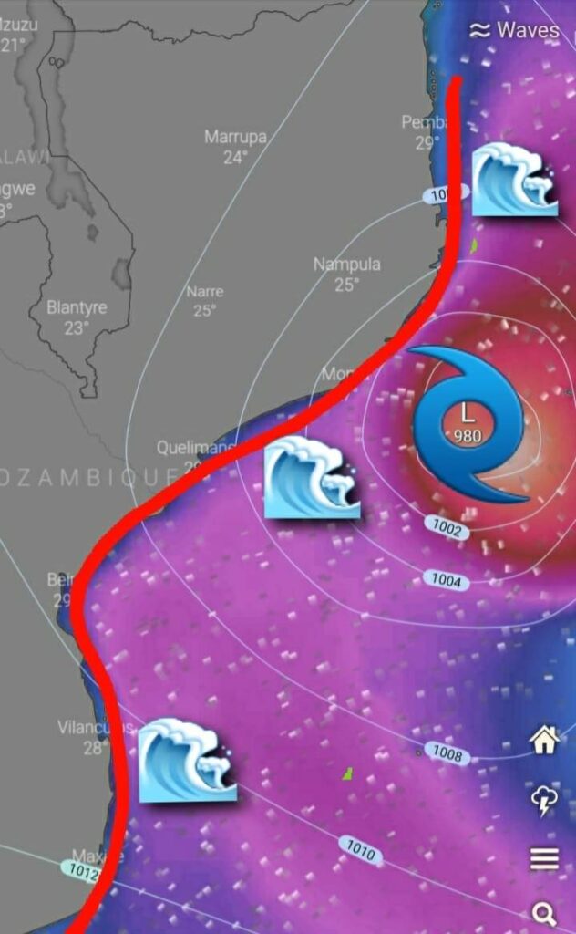
From SWAICSA – Rough sea conditions are expected to develop as from later this evening along the southern coastline of Mozambique due to the strong winds winds associated with Tropical Storm Eloise that is currently over the Mosambique Channel.
A Storm Surge is expected to develop over the same area tomorrow as Eloise moves closer to the coast of Mosambique.
A Storm Surge is a coastal flood or tsunami-like phenomenon of rising water commonly associated with low-pressure weather systems, such as cyclones.
A storm surge can do major damage to anything (or anyone) in its path. The extreme rise in water levels and strong winds can cause severe flooding, property damage, and beach and coastal highway erosion.Please let us know where in Mozambique you live.

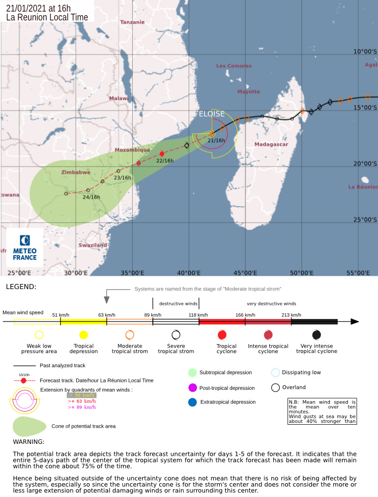
Latest Update on Tropical Storm #Eloise
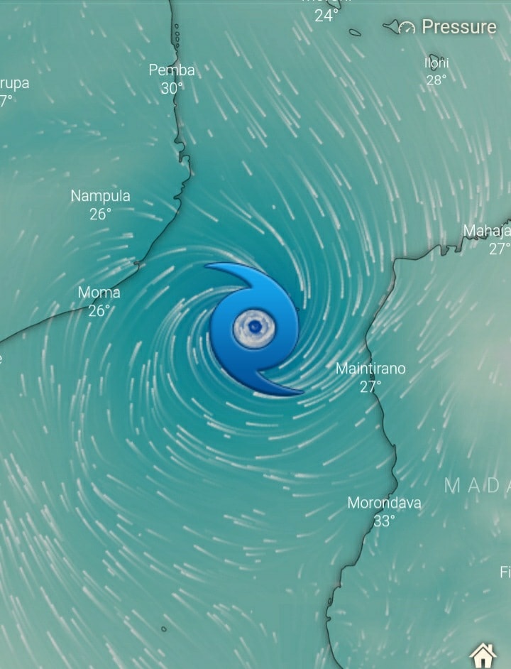
Latest trajectory from Meteo France now indicates even slightly more North than the trajectory posted this morning putting Beira directly in her sights.
As always the track can change again but this is current as of 14h00 SAST Thursday 21 January 2021
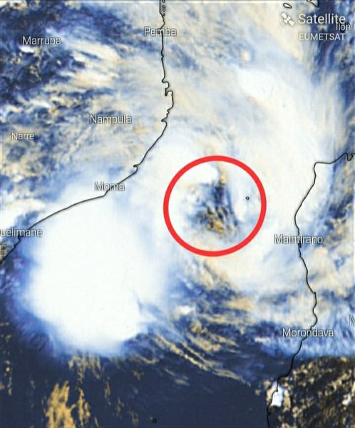
The EYE of Severe Tropical Storm Eloise is re-developing, as was expected. The Storm is intensifying rapidly. The SAWS, the Weather Authority of SA, has not issued any OFFICIAL WARNINGS to SA yet.- Courtesy SWAICSA


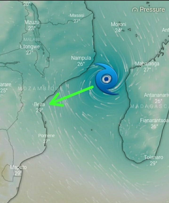

UPDATE! MODERATE TROPICAL STORM TC12S ELOISE.
08:30, 21|01|2021. – From SWAICSA
Moderate Tropical Storm (MTS) (TC12S) ELOISE has reached the warm water of the Mosambique Channel and there are already signs that the Intensification Process has begun!
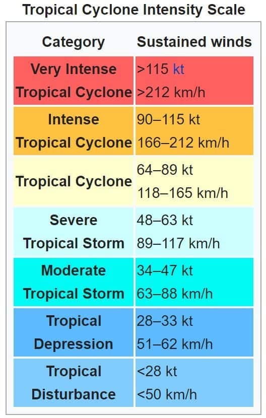
The MTS is expected to be upgraded again to a Severe Tropical Storm (STS) during today and a fully fledged TROPICAL CYCLONE with winds in excess of 118km/h this evening or very early tomorrow morning after which its expected to be upgraded to an INTENSE TROPICAL CYCLONE with windspeeds in excess of 166km/h tomorrow.
The EYE of Eloise is also expected to re-develop during today.
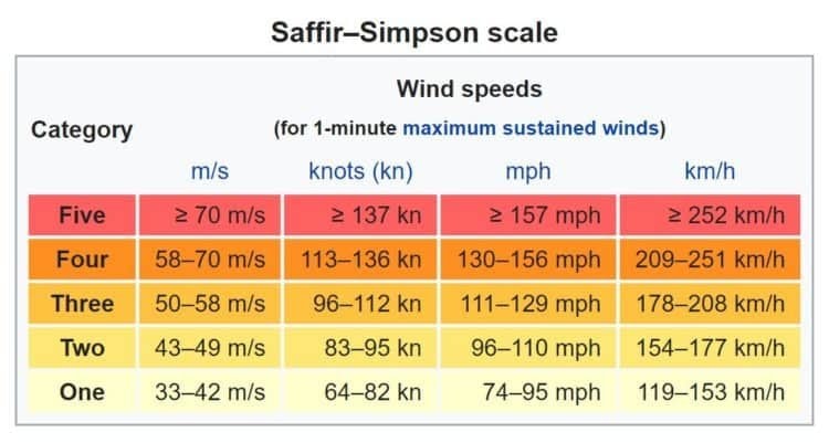
The Scale used for Tropical Cyclones in our region (South West Indian Ocean- SWIO) is the Tropical Cyclone Intensity Scale, not the Saffir-Simpson Scale that the Americans uses. The latter is included for comparison.The word “ERRATIC” should have become part our vocabulary by now! Anything can still happen, stay safe.
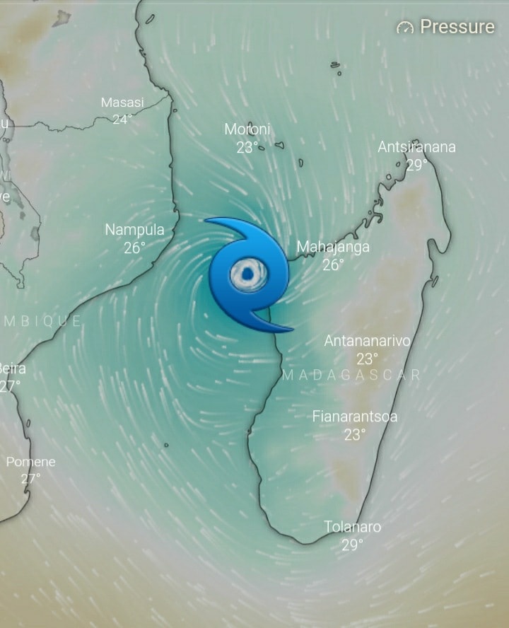
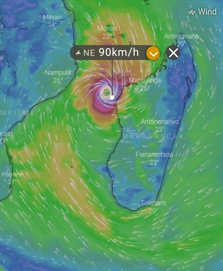
🌀Latest Update on Moderate Tropical Storm #Eloise
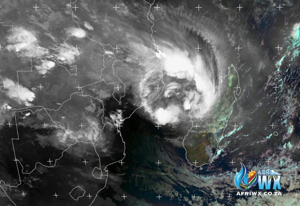
Thursday 21 Jan 2021
06h30
Moderate tropical storm Eloise
ELOISE Current Status
Current Wind Speed 35 knots / MPH
Max Predicted Wind Speed 95 knots / MPH at Saturday, 23 Jan 2021 8:00 AM
Eloise is now sitting in the Mozambique channel where she is expected to reintensify before making landfall on Saturday with Mozambique.
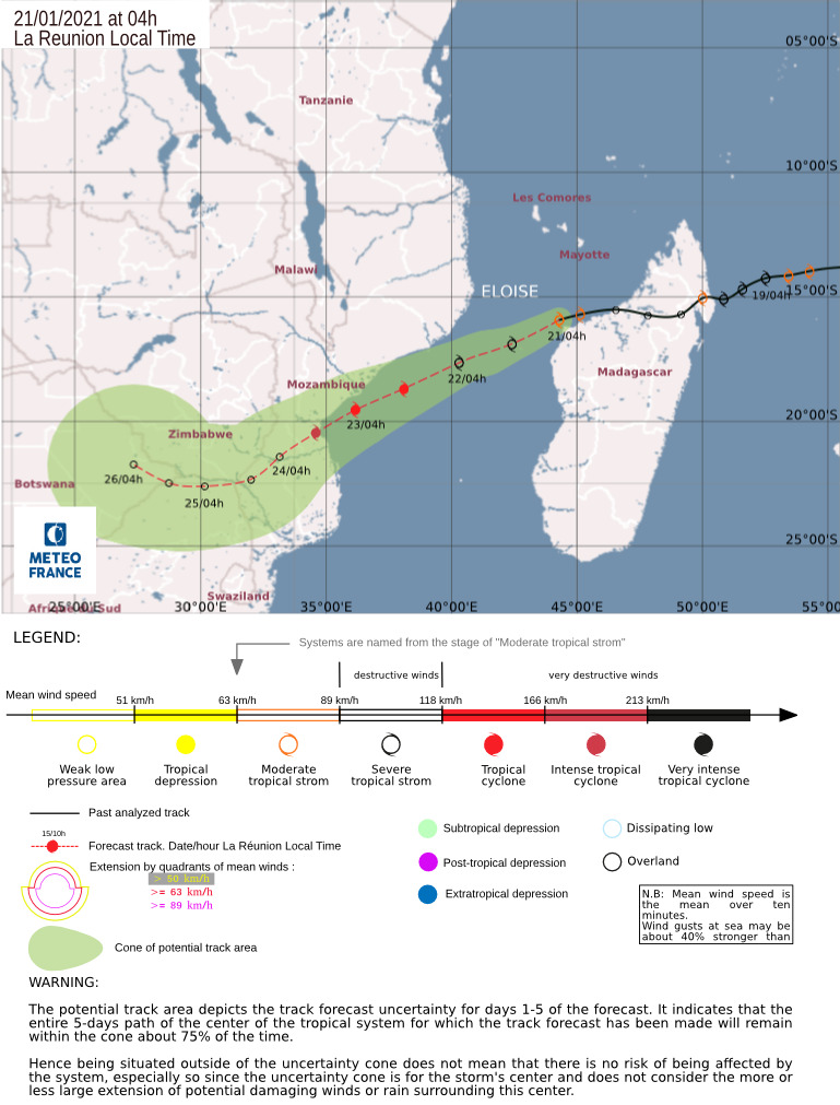
Latest trajectory from Meteo France and the Joint Typhoon Warning Centre now place the landfall in Mozambique at Beira which is much more North than earlier predictions.
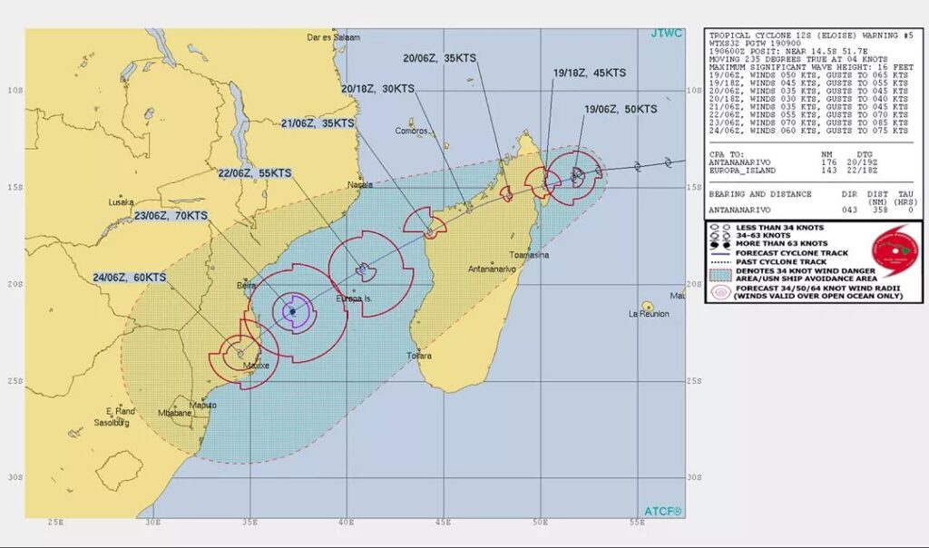
Once again this is subject to change as these tropical systems can be very erratic.
Next update around 11am this morning.
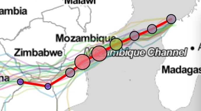
Maps and Text:
Joint Typhoon Warning Centre
Meteo France
Cyclone
Eumetsat
AfriWX
Windy
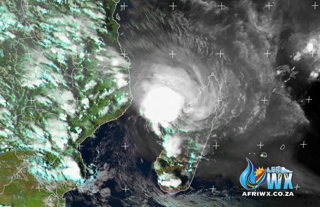
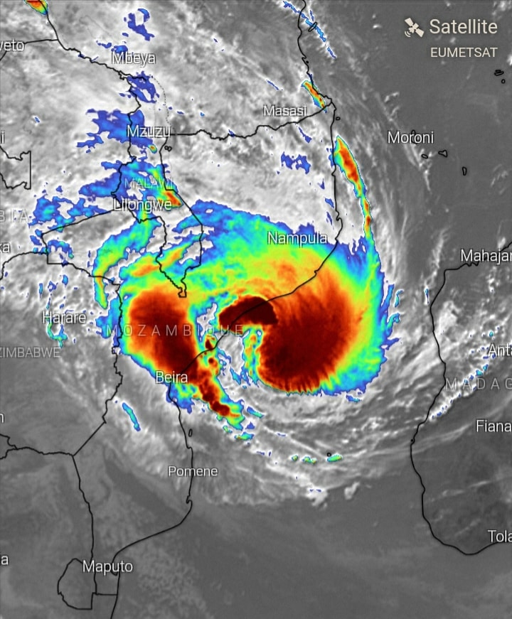
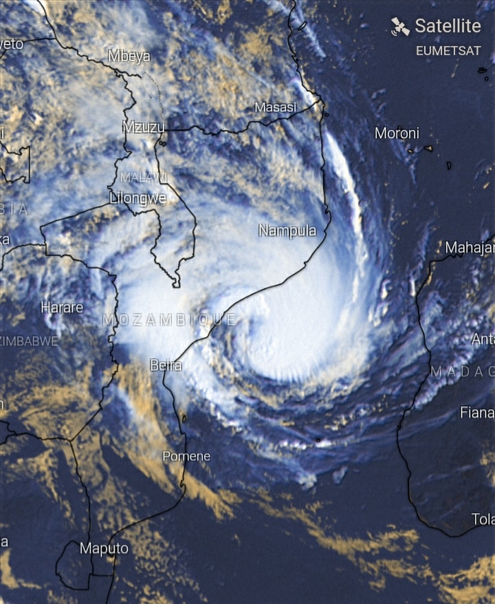
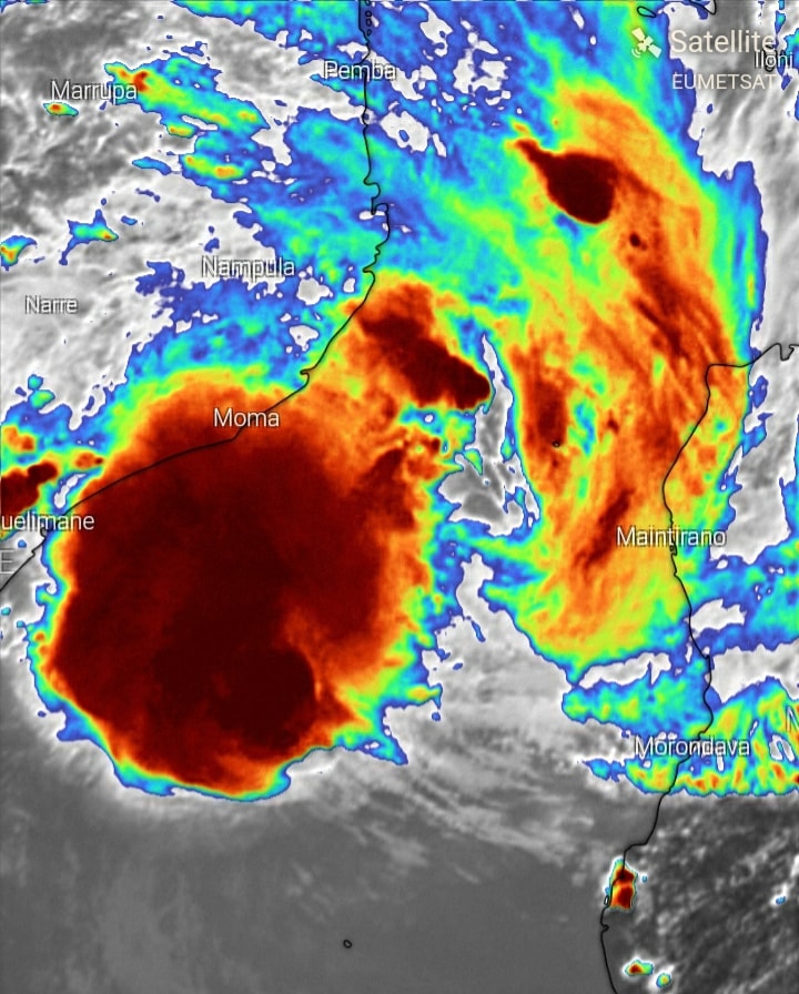
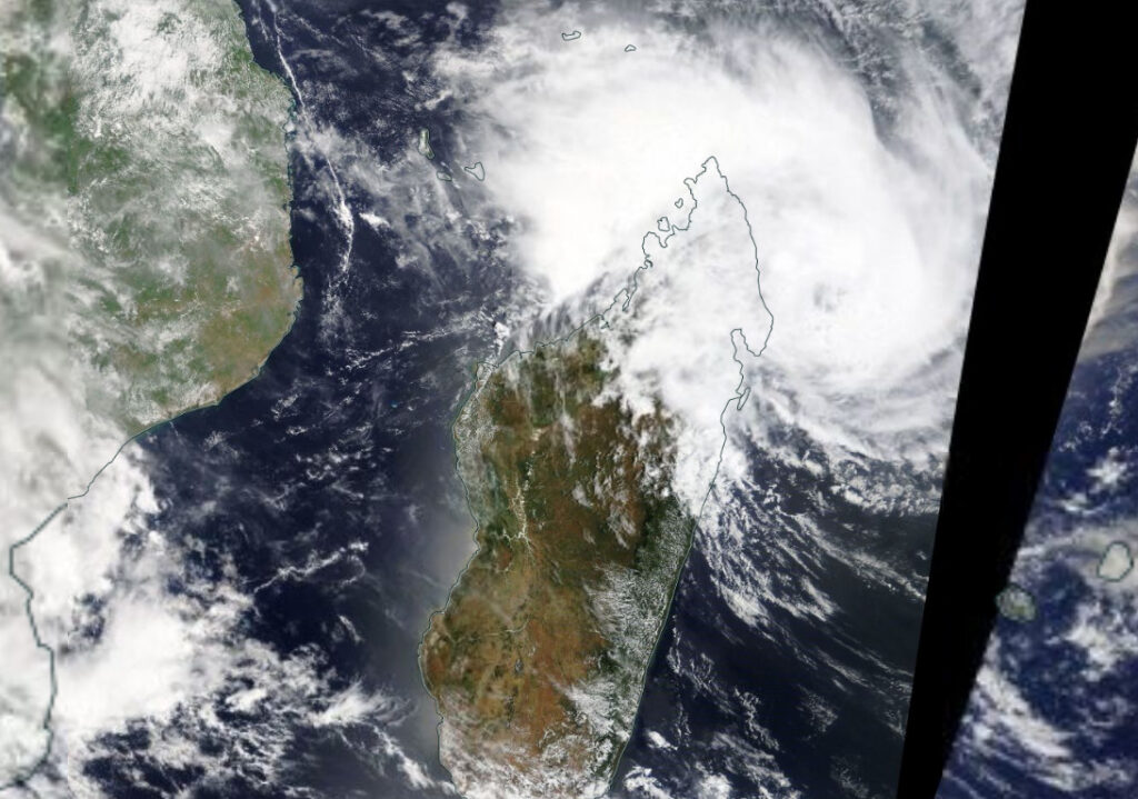
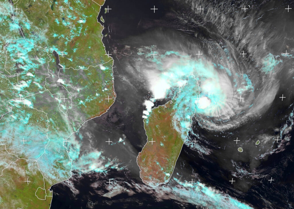
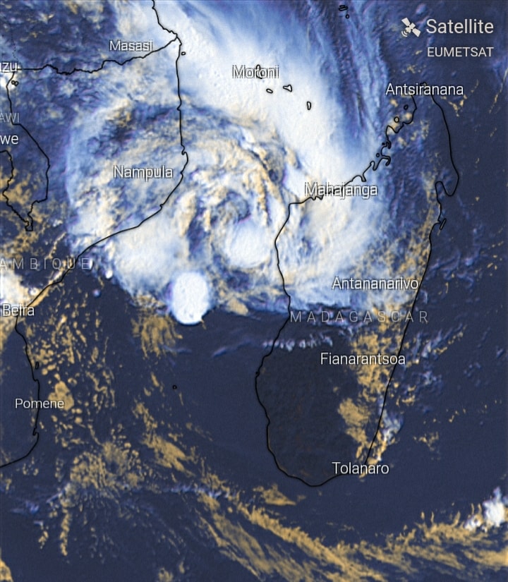
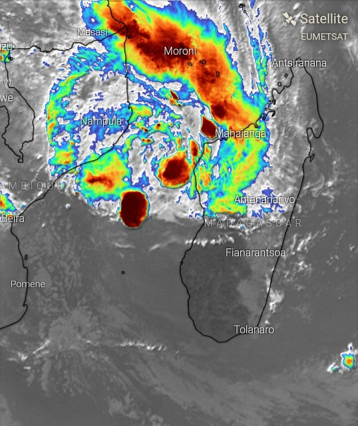
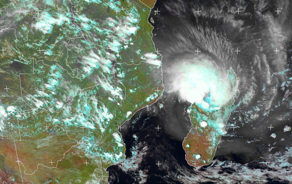
Latest composite High Definition Satellite image of Tropical Storm #Eloise which is close to leaving Madagscar into the Mozambique channel this evening. We will keep you posted.
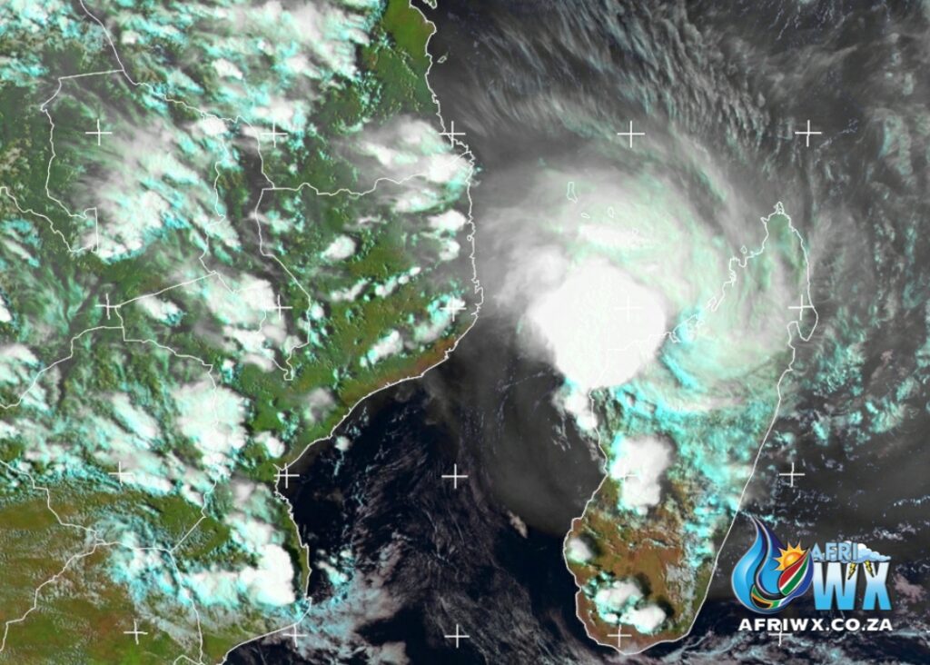
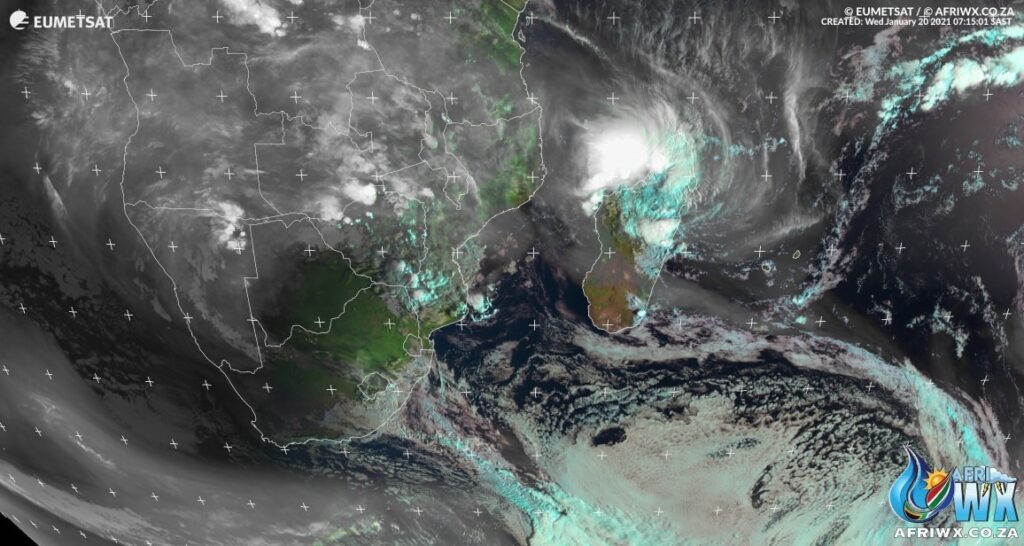
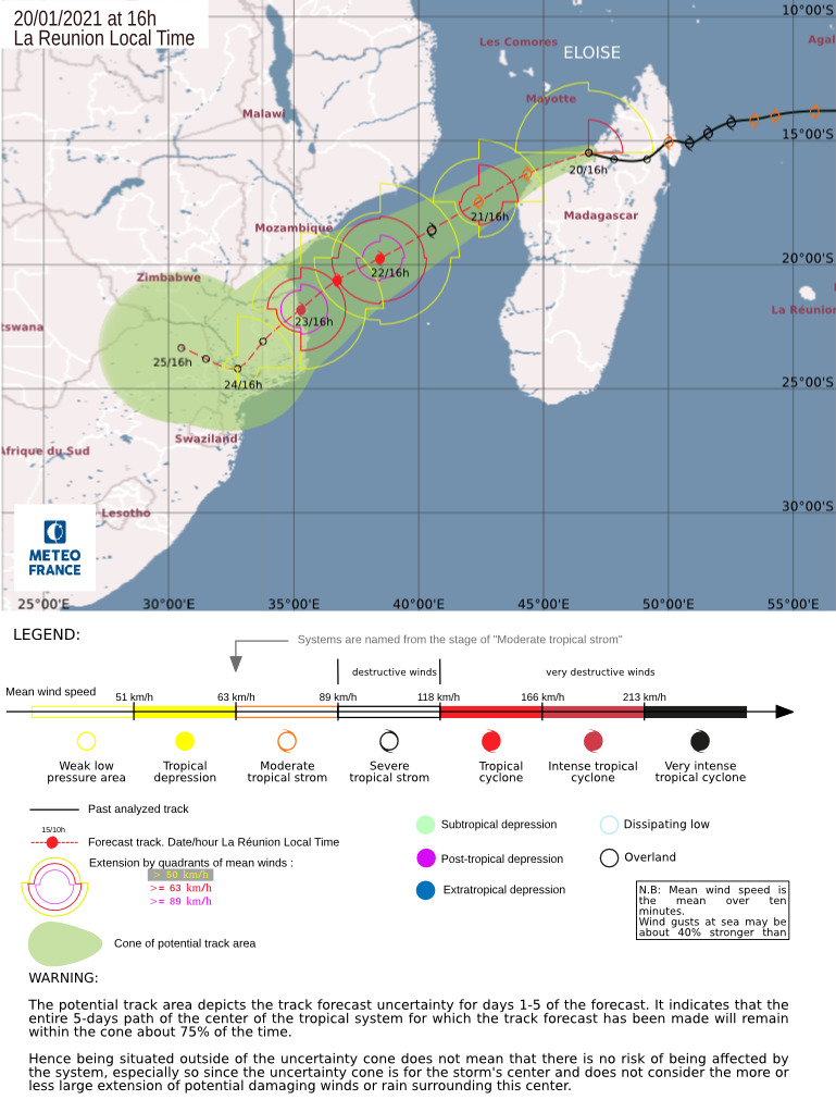
Tropical Storm Eloise over the Mahajanga Province, Madagascar. 17:45, 20|01|2021.Torrential Rain condusive to flooding and landslides and Gale-to Stormforce Windgusts continue. – Source SWAICSA
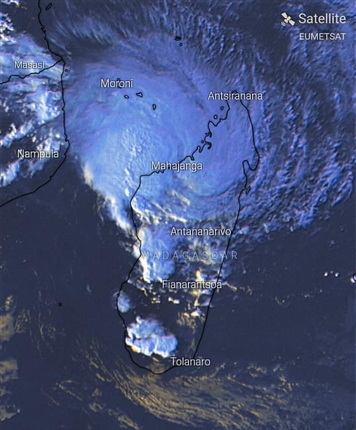
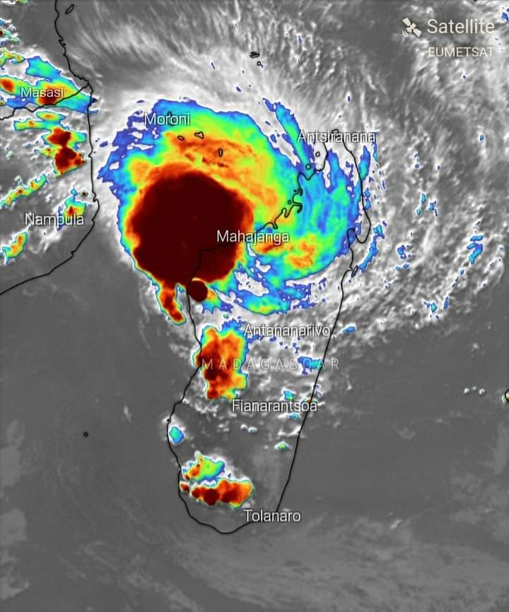
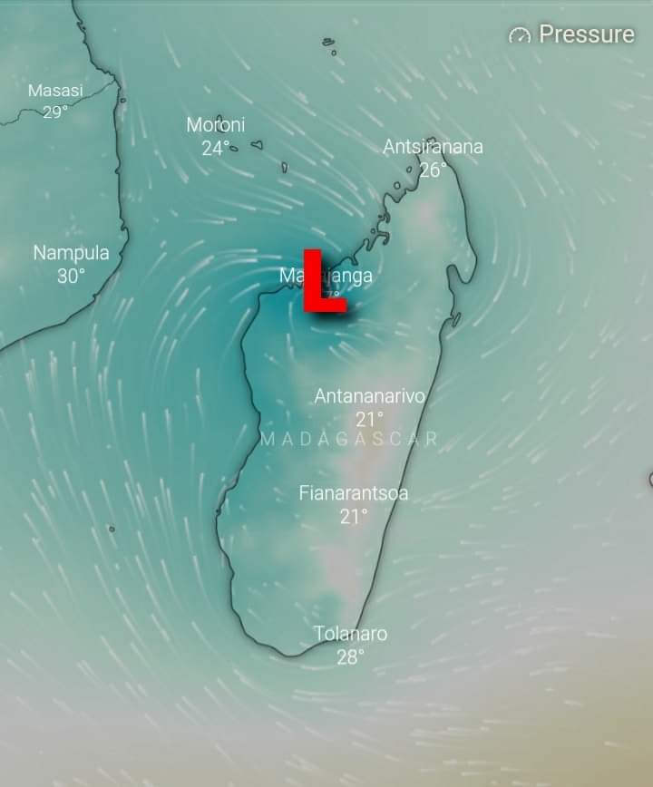
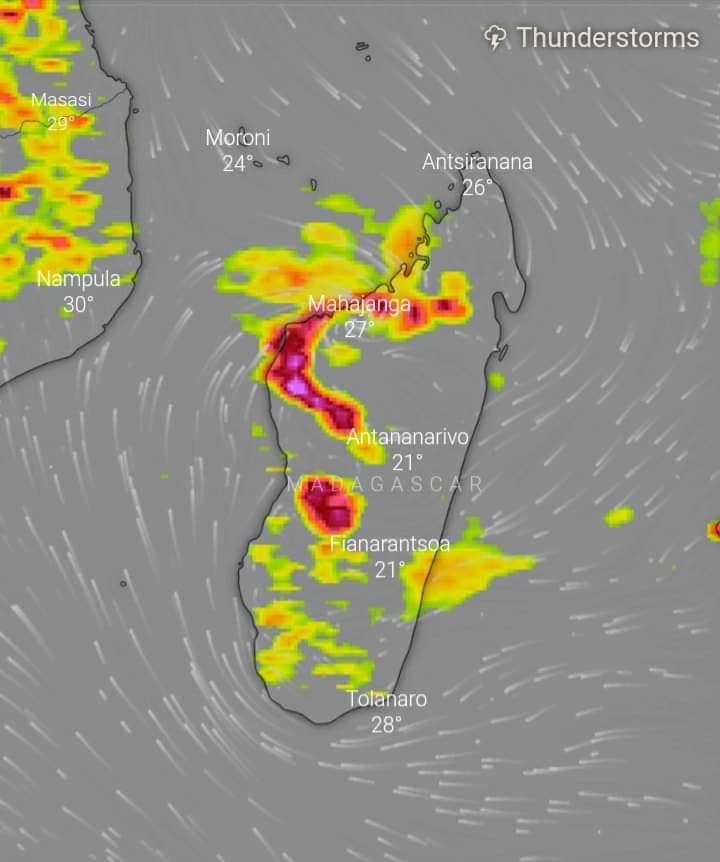
Latest trajectory update on Tropical Storm Eloise from Meteo France as of Wednesday 20 January 2021 at 14h00 SAST
Latest High Definition Satellite Photos of Tropical Storm Eloise as of Wednesday 20 January 2021 – 15h12 SAST
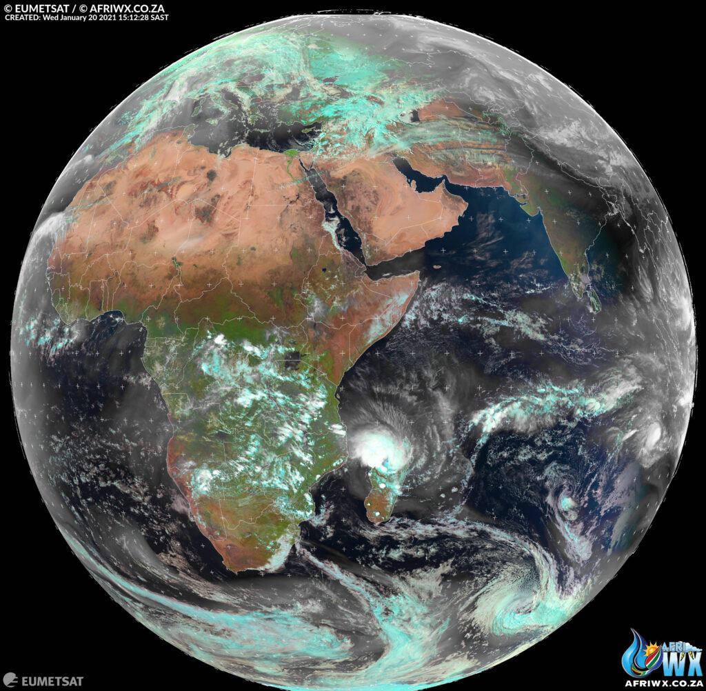
A report out of Mahajanga Airport reveals a pressure near 998mb as the storm passed just to its south.
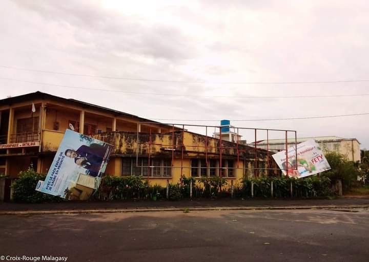
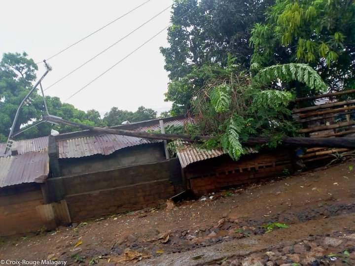
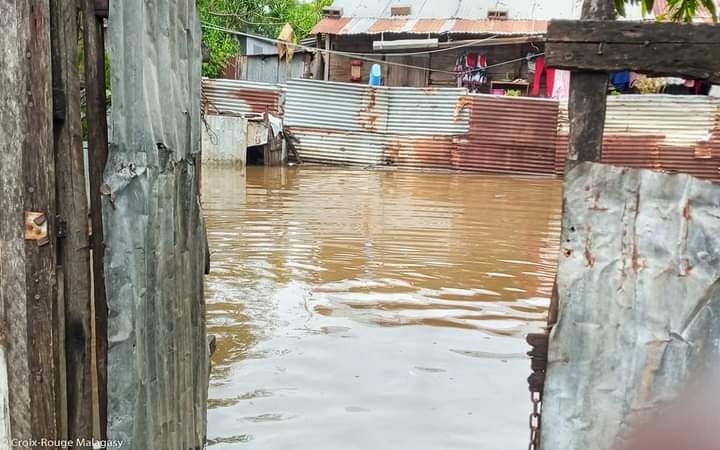
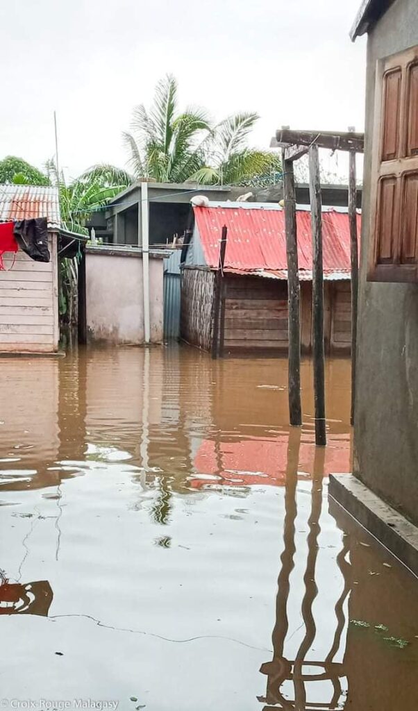
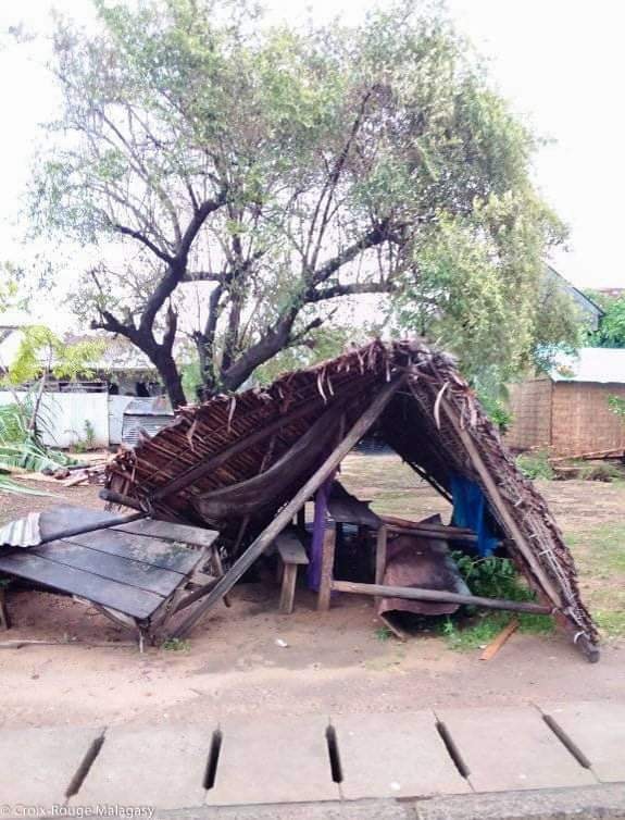
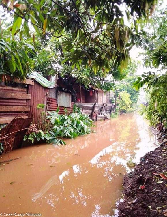
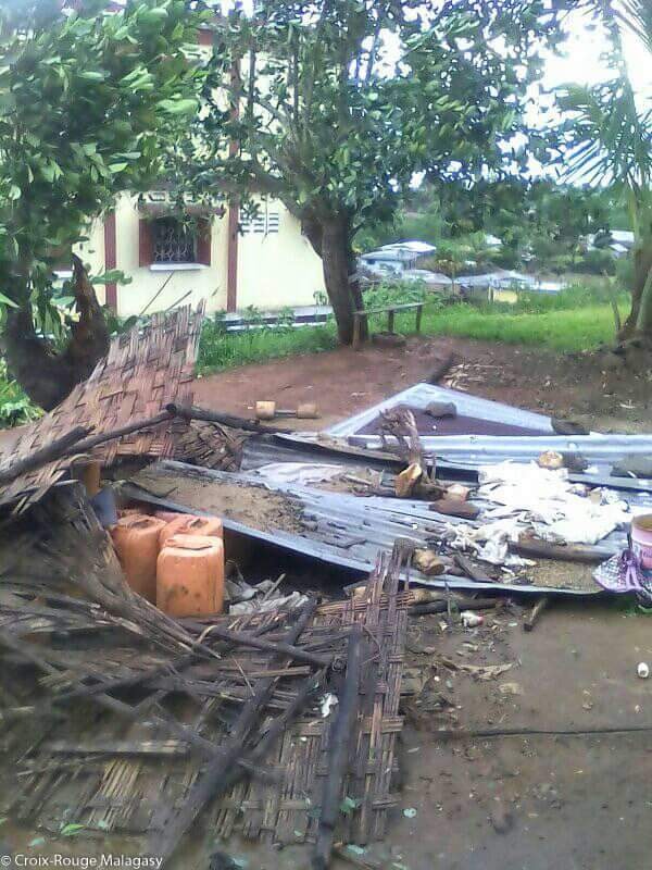
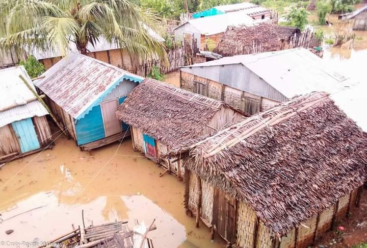
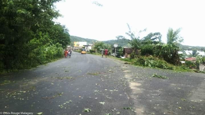
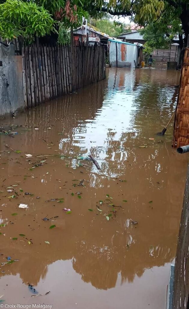
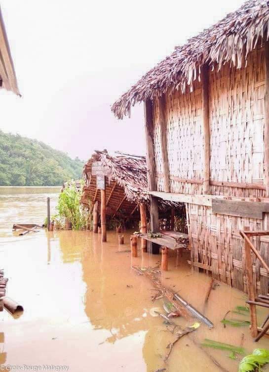
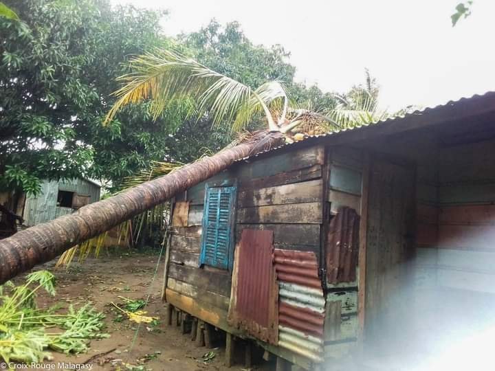
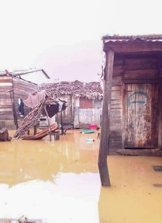
STORM DAMAGE AND FLOODING due to TS Eloise. Antalaha District, Madagascar.
Photos from Antalaha District, Madagascar by Croix-Rouge Malagasy – Supplied via SWAICSA
LATEST Update on Tropical Storm Eloise (TC12S)
Wednesday 20 January 2021
10h00 SAST
ELOISE Current Status (Overland Depression)
> Current Wind Speed 30 knots / MPH
> Max Predicted Wind Speed 90 knots / MPH at Saturday, 23 Jan 2021 8:00 AM
Please AVOID a recent post by another page claiming absolutely ridiculous and very incorrect wind speeds this morning on this storm system. Some very inaccurate guesswork is being circulated.
Maps and Text:
Joint Typhoon Warning Centre (JTWC)
Cycloncane
Eumetsat
AfriWX
JTWC Remarks:
TROPICAL CYCLONE (TC) 12S (ELOISE), LOCATED APPROXIMATELY 200 NM NORTH OF ANTANANARIVO, MADAGASCAR, HAS TRACKED WESTWARD AT 15 KNOTS (KTS) OVER THE PAST SIX HOURS.
ANIMATED MULTISPECTRAL SATELLITE IMAGERY (MSI) REVEALS THAT TC 12S HAS STEADILY WEAKENED AS IT MOVED INLAND.
THE MAJORITY OF THE DEEP CONVECTION HAS ERODED OVER THE LOW LEVEL CIRCULATION CENTER WITH SOME FLARING DEEPER CONVECTION OVER THE NORTHERN SEMICIRCLE.
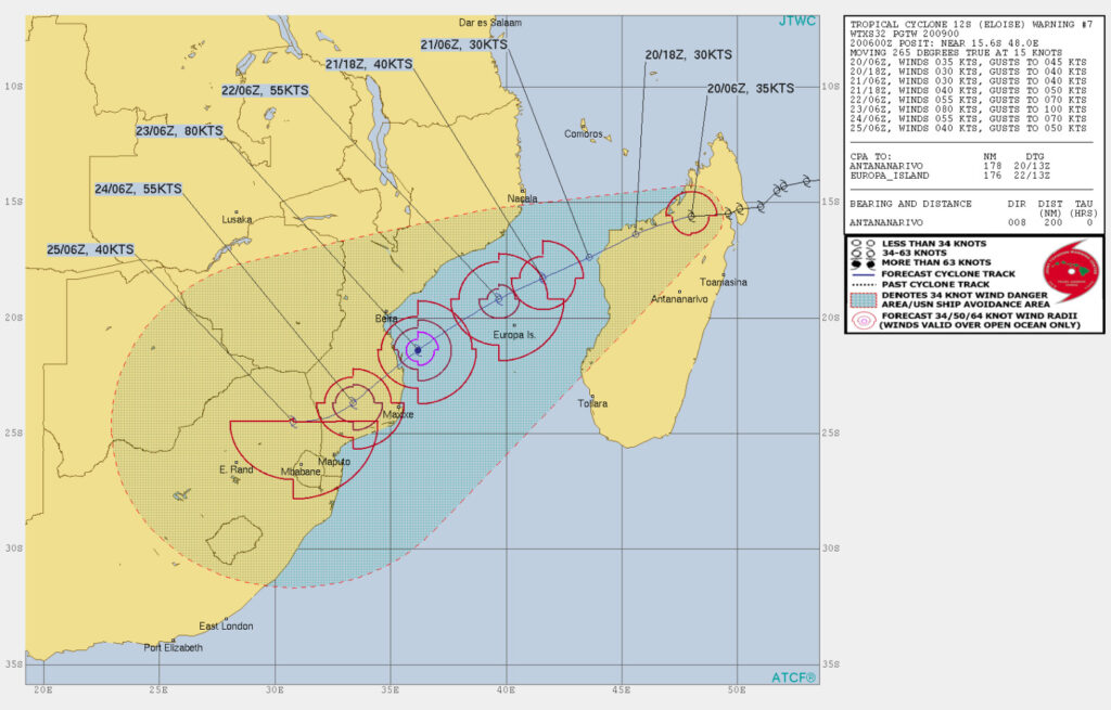
THE INITIAL POSITION IS PLACED WITH FAIR CONFIDENCE USING LOW-CLOUD TRACING IN THE ANIMATED MSI ALONG WITH ANALYSIS OF THE BROAD BANDING EVIDENT IN A 200546Z MHS 89 GHZ MICROWAVE IMAGE.
THE INITIAL INTENSITY OF 35 KTS IS BASED ON A WEAKENING TREND IN UNOFFICIAL PGTW DVORAK CURRENT INTENSITY ESTIMATES AS THE SYSTEM HAS MOVED OVER THE RUGGED TERRAIN OF MADAGASCAR.
ENVIRONMENTAL ANALYSIS DEPICTS ROBUST EQUATORWARD OUTFLOW BEING OFFSET BY MODERATE (15-20 KTS) VERTICAL WIND SHEAR (VWS) AND THE FRICTIONAL TERRAIN EFFECTS REFLECTED IN THE WEAKENING STRUCTURE.
THROUGHOUT THE FORECAST PERIOD, THE SYSTEM IS EXPECTED TO TRACK GENERALLY WEST-SOUTHWESTWARD ALONG THE NORTHWESTERN PERIPHERY OF A SUBTROPICAL RIDGE (STR) POSITIONED TO THE SOUTHEAST.
TC 12S WILL CONTINUE TO WEAKEN AS IT TRACKS OVER MADAGASCAR PRIOR TO EMERGING OVER THE MOZAMBIQUE CHANNEL PRIOR TO TAU 24. WITHIN THE CHANNEL, THE WARM (29-30 CELSIUS) SEA SURFACE TEMPERATURES AND LOW VWS VALUES WILL ALLOW THE SYSTEM TO STEADILY RE-INTENSIFY TO 80 KTS BY TAU 72.
AFTERWARDS, TC 12S WILL MAKE LANDFALL IN SOUTHERN MOZAMBIQUE AND LAND INTERACTION WILL BEGIN TO WEAKEN THE SYSTEM THEREAFTER AS IT TRACKS INLAND.
NUMERICAL MODELS REMAIN IN TIGHT AGREEMENT THROUGHOUT THE FORECAST PERIOD, PLACING HIGH CONFIDENCE IN THE JTWC FORECAST TRACK WHICH LIES NEAR THE MULTI-MODEL CONSENSUS.
NEXT WARNINGS AT 202100Z AND 210900Z.

Eloise this morning (Wednesday 20 Jan 2021) is now an Overland Depression.
Current Wind Speed 30 knots / MPH
Max Predicted Wind Speed 80 knots / 92 MPH at Saturday, 23 Jan 2021 8:00 PM
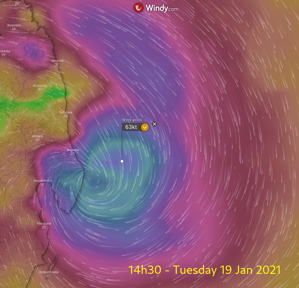
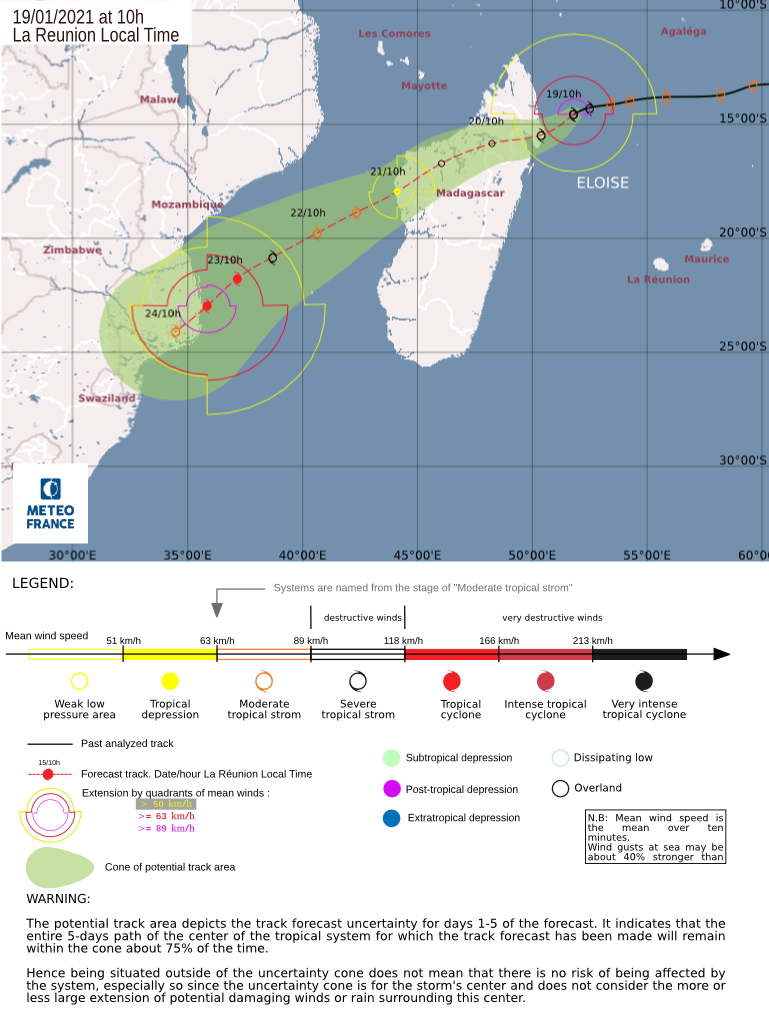
Update on Tropical Storm (TC12S) #eloise as of Tuesday 19 Jan @ 23h00 SAST and 02h00 Wednesday 20 Jan.
Next update to follow later this morning.
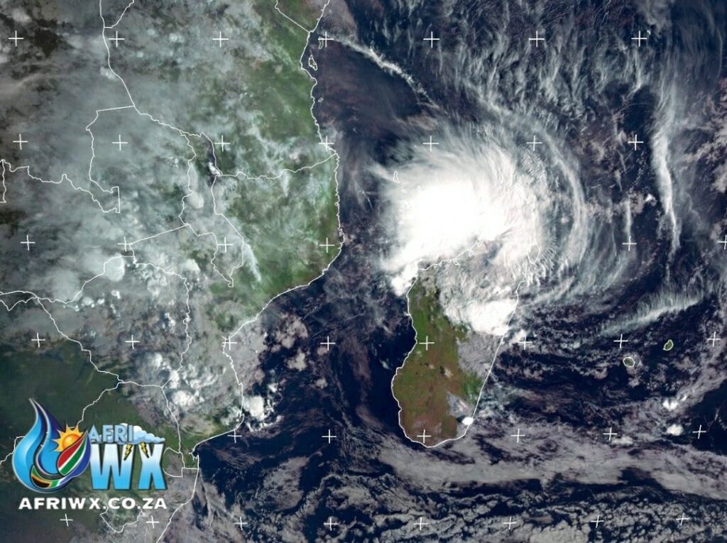
Maps and Text:
Joint Typhoon Warning Centre JTWC
Meteo France
Eumetsat
AfriWX
JTWC Remarks:
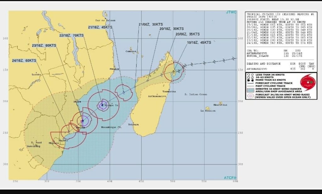
TROPICAL CYCLONE 12S (ELOISE), LOCATED APPROXIMATELY 262 NM NORTHEAST OF ANTANANARIVO, MADAGASCAR, HAS TRACKED WESTWARD AT 09 KNOTS OVER THE PAST SIX HOURS.
ANIMATED ENHANCED INFRARED (EIR) SATELLITE IMAGERY SHOWS THE SYSTEM HAS SLIGHTLY ERODED AFTER IT MADE LANDFALL OVER NORTHEASTERN MADAGASCAR NEAR ANTALAHA.
THE CYCLONE WILL TRACK SOUTHWESTWARD ALONG THE NORTHWESTERN PERIPHERY OF A DEEP-LAYERED SUBTROPICAL RIDGE
(STR) TO THE SOUTHEAST THROUGHOUT THE FORECAST, DRAG ACROSS THE ISLAND, THEN EXIT INTO THE MOZAMBIQUE CHANNEL AROUND TAU 36, AND BY TAU 96 WILL MAKE LANDFALL INTO SOUTHERN MOZAMBIQUE NORTH OF MAXIXE.

THE RUGGED MADAGASCAR TERRAIN WILL WEAKEN THE CYCLONE TO 30KTS BY TAU 24; HOWEVER, AFTER IT EXITS INTO THE WARM MOZAMBIQUE CHANNEL, IT WILL GRADUALLY RE-INTENSIFY TO 80KTS BEFORE LANDFALL.
BY TAU 120, LAND INTERACTION WILL REDUCE IT TO 60KTS. NUMERICAL MODELS REMAIN IN TIGHT AGREEMENT, LENDING HIGH CONFIDENCE TO THE JTWC TRACK FORECAST.
AT TAU 120, A STRAND OF MODELS INCLUDING AFUM, UEMN, AND AVNO
DEFLECT THE VORTEX SOUTHEASTWARD BACK INTO THE CHANNEL, AN UNLIKELY SCENARIO.

THE JTWC TRACK IS A BIT FURTHER INLAND AT THE TERMINATION POINT TO OFFSET THIS UNLIKELY DEFLECTION.
NEXT WARNINGS AT 200900Z
AND 202100Z.//

Latest Update: Tuesday 19 Jan 2020 – 20h21 SAST
ALERTS, Madagascar.Avis d’advertisement= Notice of Warning (green) Avis de manace= Threat Notice (yellow)Avis de danger imminent= Notice of imminent danger (red). #swaicsa #eloise
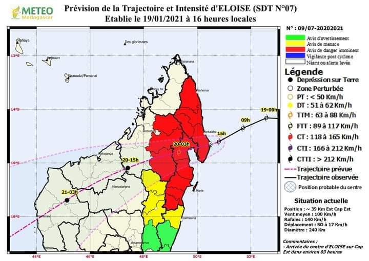
Latest Update: Tuesday 19 Jan 2020 – 19h52 SAST
Severe Tropical Cyclone Eloise has made landfall to Madagascar! Torrential rain, Hurricane force windgusts, storm surge and at least 2 (unconfirmed) tornadoes near Vinanivao, Antsiranana were reported. #swaicsa #eloise – Dr Angelo Ricardo Hoorn.
ELOISE Current Status
Current Wind Speed 55 knots / MPH
Max Predicted Wind Speed 90 knots / MPH at Saturday, 23 Jan 2021 2:00 PM
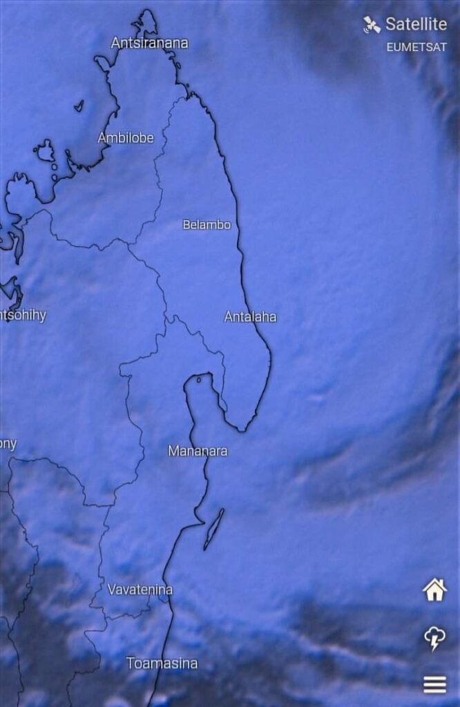
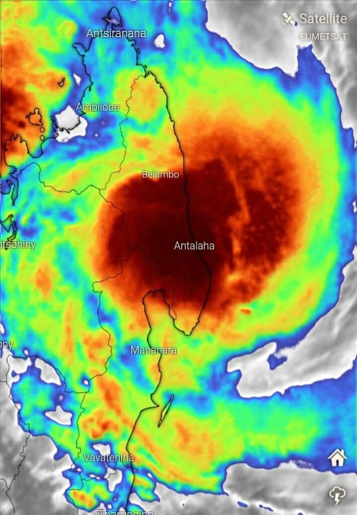
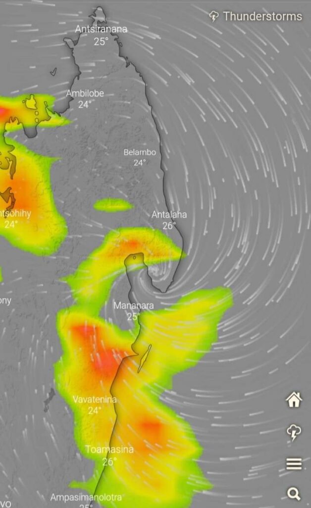
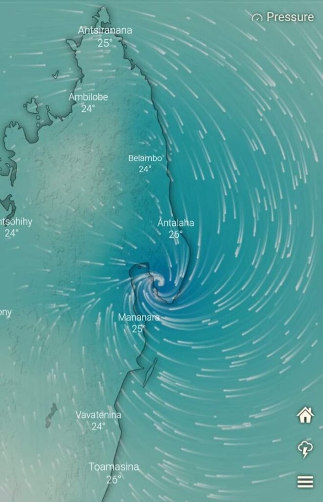
From Meteorologist Angelo Ricardo Hoorn of Severe Weather and Information Centre Southern Africa – SWAICSA
In the interest of whether Severe Tropical Storm Eloise will impact SA or not, we would like to emphasize it again that Tropical Systems are erractic in both movement and intensity.
It is very difficult to say if the Severe Tropical Storm will impact SA or not at this stage.
There are a lot of messages going around saying that Eloise will make landfall to SA as a Tropical Cyclone.
Those making such claims are very irrespossible, because their statements may cause mass panic and confusion to say the least.
Jumping the gun with untimely warnings will only worsen speculation and panic.
1. Is there a need to panic? NO.
2. Will Eloise impact SA? Possibly.
3. Will Eloise impact SA as a Full-fledged Tropical Cyclone with winds in excess of 118km/h? Too early to say, but not likely.
4. If Eloise or any other Tropical System makes impact to SA as a Tropical Cyclone, Tropical Storm or Tropical Depression, what will the POSSIBLE hazards be?
Worse Case Scenario: Widespread Torrential Rain condusive to Flooding and Landslides, winds, Damaging Storm Surge along the coast, Damage to infrastructure, Tornadoes.
5. Is the National Disaster Management Centre aware of Eloise? Yes, and other Emergency Stakeholders will be activated within the next 5 days or asoon as there is EVIDENCE of a threat to SA.
6. Is the SAWS reliable with the dissemination of information regarding Eloise? Yes.
7. Will the Group and its Associates be updated of any developments of Eloise? Yes, a few times per day.
There will always be a possibility of a Tropical Cyclone making landfall to SA when they are positioned in the Mosambique Channel.
We will do a Special Daily Topic later today on HOW TO PREPARE FOR A TROPICAL STORM OR CYCLONE.
It will not serve as a Warning or confirmation of impact of Eloise to SA, but rather as a precautionary tool.
#swaicsa #eloise
Also read: How to Prepare for a Tropical Cyclone or Storm by Angelo
ELOISE Current Status
Current Wind Speed 55 knots / MPH
Max Predicted Wind Speed 90 knots / MPH at Saturday, 23 Jan 2021 2:00 PM
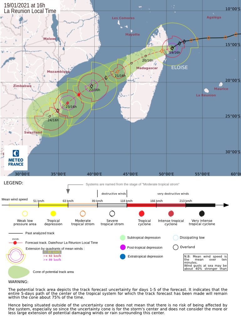
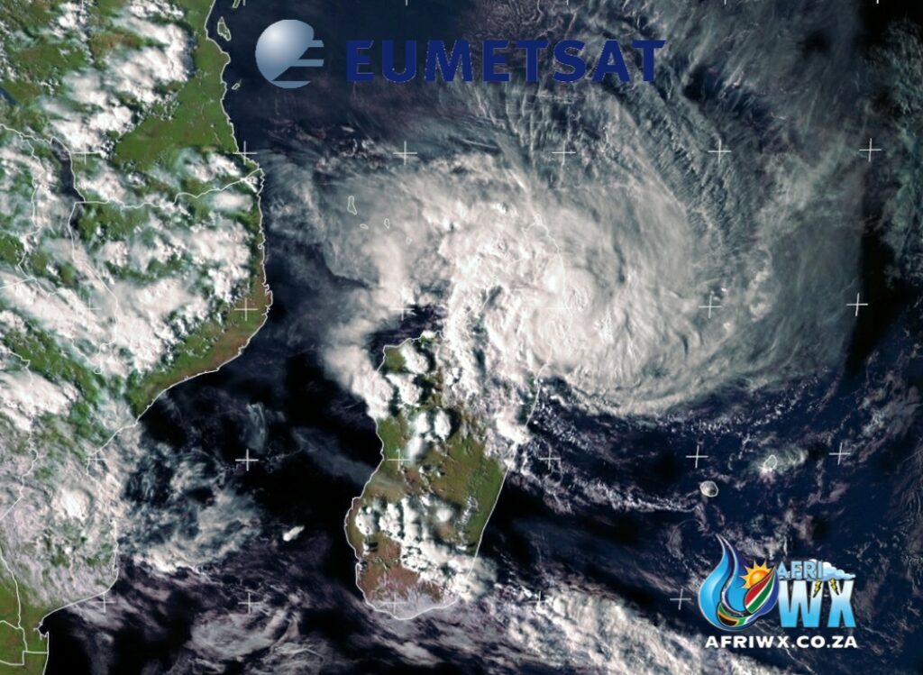
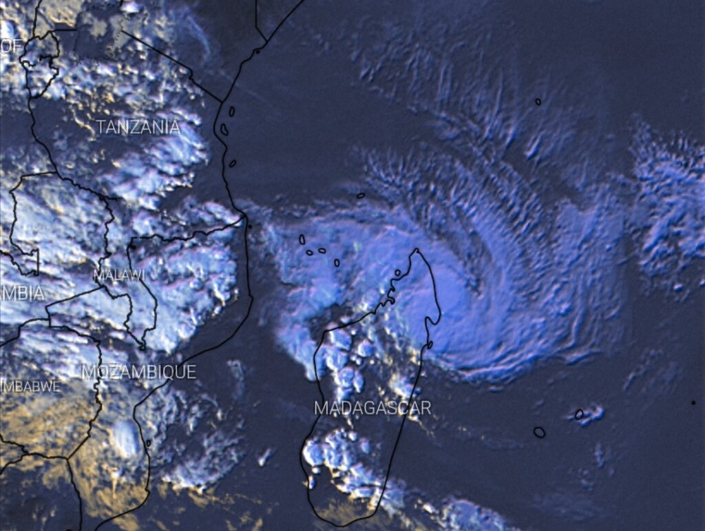
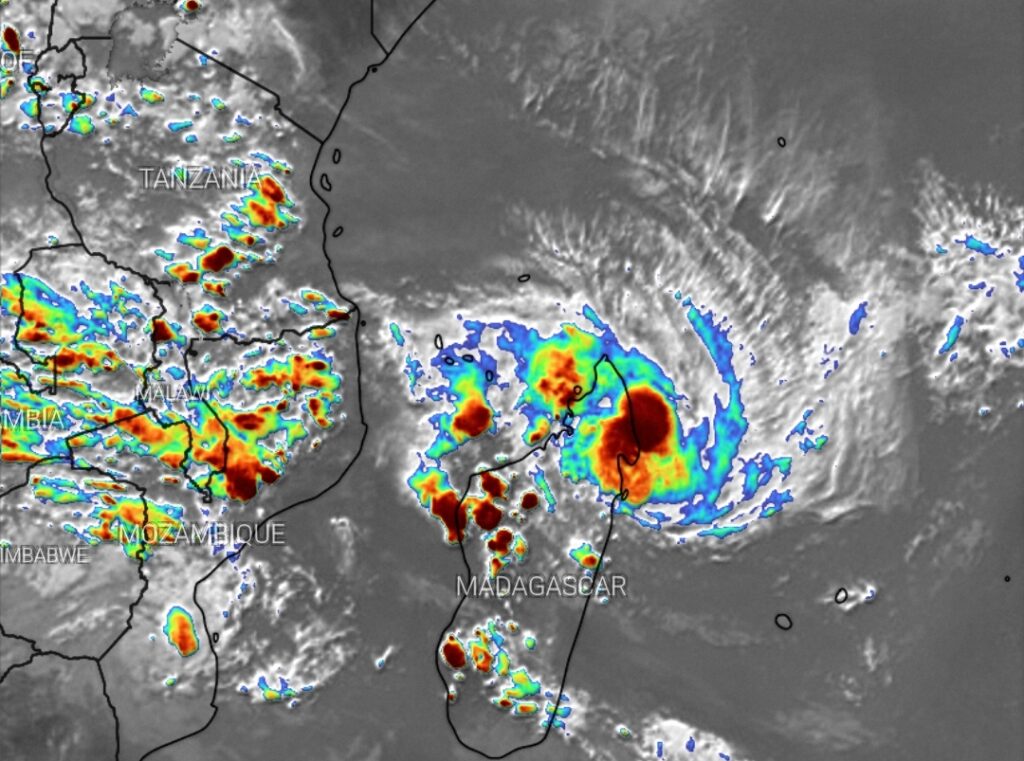
Join our AfriWX Telegram Weather Group
Don’t forget to join the free AfriWX group on Telegram Messenger, please download Telegram for Android or iPhone if you want to always be up to date with the latest weather maps.
Click to join our Telegram Group
ELOISE (TC 12 S) Current Status
Current Wind Speed 50 knots / MPH
Max Predicted Wind Speed 70 knots / 81 MPH at Saturday, 23 Jan 2021 8:00 AM (Source: Cyclocane)
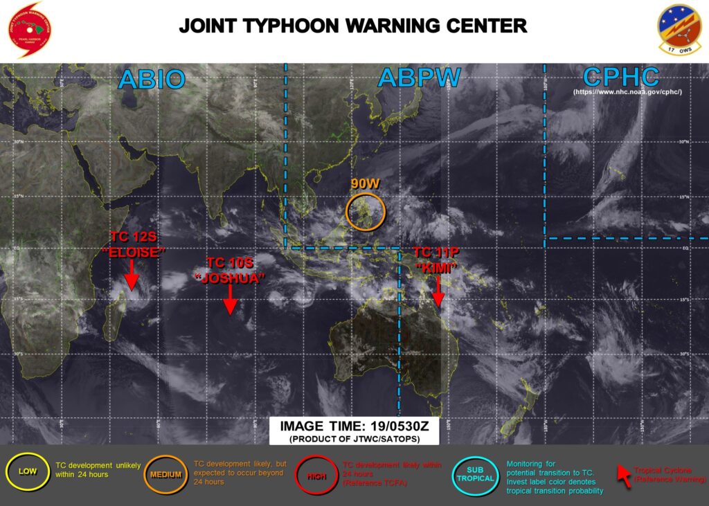
🌀 Severe Tropical Storm (TC10s) #Eloise
Latest Update
🗓 Tuesday 19 January 2021
⏰ 11h00 SAST
Current Wind Speed 50 knots / MPH
Max Predicted Wind Speed 65 knots / MPH at Saturday, 23 Jan 2021 8:00 AM
Maps and Text:
Joint Typhoon Warning Centre (JTWC)
Cyclocane
Eumetsat
AfriWX
JTWC REMARKS:
(NM = Nautical Miles)
(TAU = Hours eg TAU24 = 24 hours / 1 day)
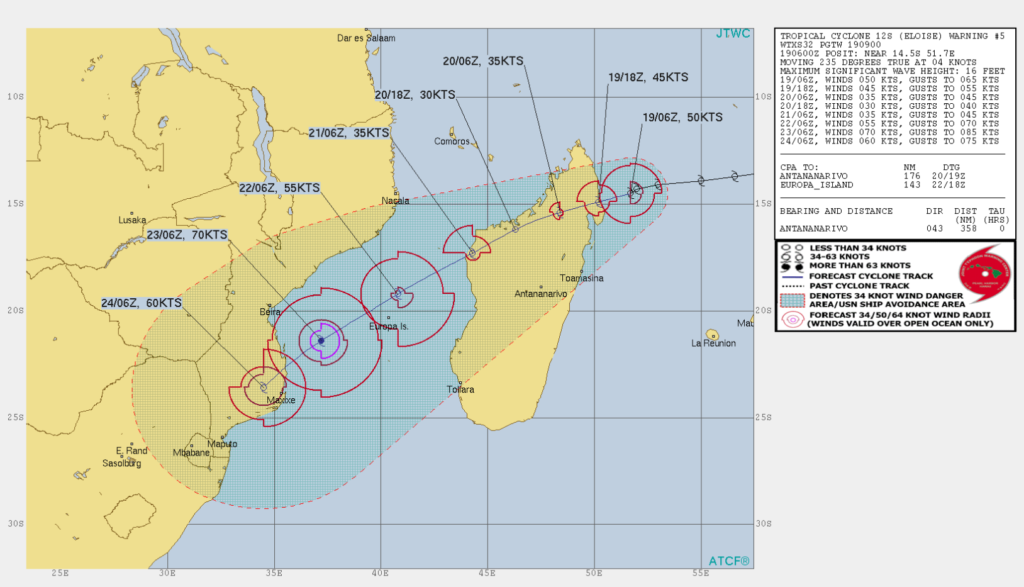
TROPICAL CYCLONE (TC) 12S (ELOISE), LOCATED APPROXIMATELY 358NM NORTHEAST OF ANTANANARIVO, MADAGASCAR, HAS TRACKED
SOUTHWESTWARD AT 04 KNOTS (KTS) OVER THE PAST SIX HOURS.
ANIMATED MULTISPECTRAL SATELLITE IMAGERY (MSI) REVEALS A PARTIALLY EXPOSED LOW LEVEL CIRCULATION CENTER (LLCC) WITH DEEP CONVECTION WRAPPING AROUND THE NORTHERN AND EASTERN QUADRANTS. BASED ON THE MSI AND A 190608Z MHS 89 GHZ MICROWAVE IMAGE, THERE IS GOOD CONFIDENCE IN THE INITIAL POSITION.
THE INITIAL INTENSITY IS ASSESSED AT 50 KTS.

TC 12S IS FORECAST TO TRACK GENERALLY SOUTHWESTWARD THROUGHOUT THE FORECAST PERIOD UNDER THE STEERING INFLUENCE OF A SUBTROPICAL RIDGE POSITIONED TO THE SOUTHEAST. IN THE NEAR TERM, TC 12S IS EXPECTED TO MAKE LANDFALL IN NORTHEASTERN MADAGASCAR BY TAU 12 THEN SLOWLY WEAKEN TO 30 KTS AS IT TRANSITS ACROSS THE RUGGED ISLAND TERRAIN BEFORE EXITING OVER THE MOZAMBIQUE CHANNEL NEAR TAU 54.
THE WARM WATERS OF THE MOZAMBIQUE CHANNEL WILL ENABLE TC 12S TO STEADILY RE-INTENSIFY TO 70 KTS PRIOR TO MAKING FINAL LANDFALL NEAR MAXIXE IN SOUTHERN MOZAMBIQUE. NUMERICAL MODEL GUIDANCE REMAINS IN FAIRLY TIGHT AGREEMENT THROUGHOUT THE FORECAST.
OF NOTE, THE GFS AND GFS ENSEMBLE TRACKERS MAINTAIN THE SYSTEM ALONG A SLIGHTLY MORE NORTHERN TRACK THAN THE OTHER CONSENSUS MODELS.
THE 19/00Z ECMWF ENSEMBLE SOLUTION SHOWS GOOD AGREEMENT AMONG THE ENSEMBLE MEMBERS IN THE EXTENDED FORECAST, LENDING OVERALL HIGH CONFIDENCE TO THE JTWC TRACK FORECAST WHICH IS PLACED NEAR THE MULTI-MODEL CONSENSUS.
MAXIMUM SIGNIFICANT WAVE HEIGHT AT 190600Z IS
16 FEET.
#tropicalstorm #cyclone #afriwx

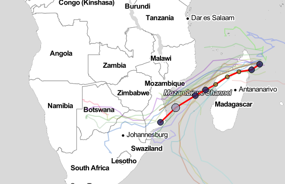


From the South African Weather Service on 18 January 2021
FIRST UPDATE REGARDING TROPICAL STORM “ELOISE”
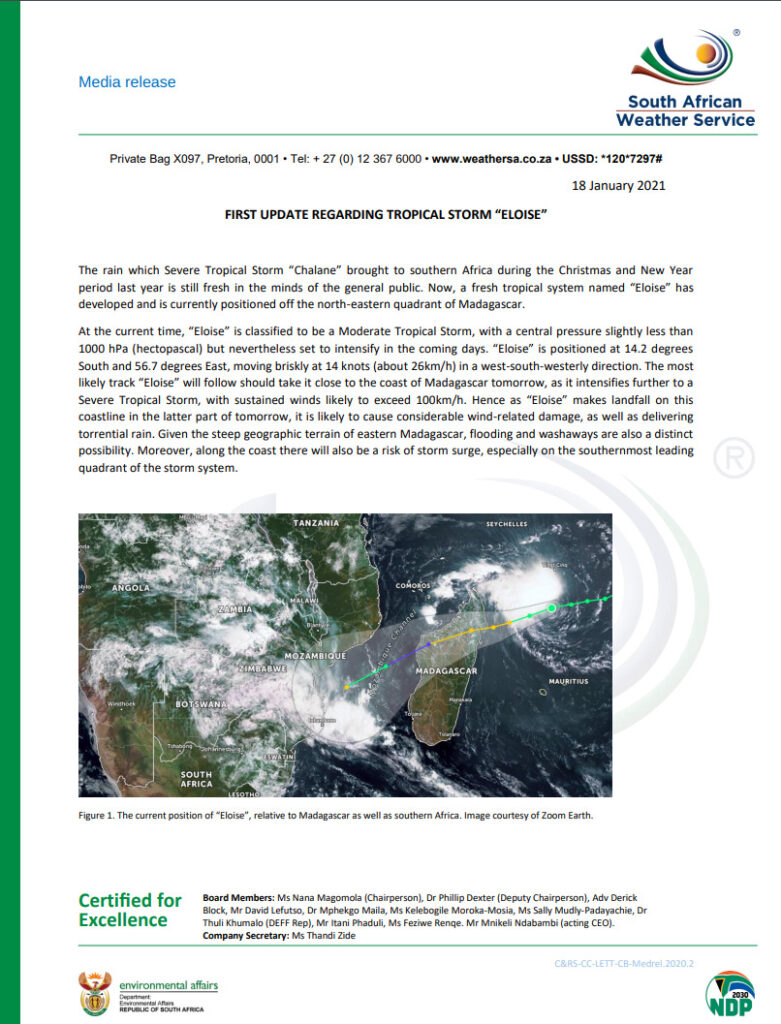
The rain which Severe Tropical Storm “Chalane” brought to southern Africa during the Christmas and New Year period last year is still fresh in the minds of the general public. Now, a fresh tropical system named “Eloise” hasdeveloped and is currently positioned off the north-eastern quadrant of Madagascar.
At the current time, “Eloise” is classified to be a Moderate Tropical Storm, with a central pressure slightly less than1000 hPa (hectopascal) but nevertheless set to intensify in the coming days. “Eloise” is positioned at 14.2 degreesSouth and 56.7 degrees East, moving briskly at 14 knots (about 26km/h) in a west-south-westerly direction.
The most likely track “Eloise” will follow should take it close to the coast of Madagascar tomorrow, as it intensifies further to a Severe Tropical Storm, with sustained winds likely to exceed 100km/h.
Hence as “Eloise” makes landfall on this coastline in the latter part of tomorrow, it is likely to cause considerable wind-related damage, as well as delivering torrential rain. Given the steep geographic terrain of eastern Madagascar, flooding and washaways are also a distinct possibility.
Moreover, along the coast there will also be a risk of storm surge, especially on the southernmost leading quadrant of the storm system.
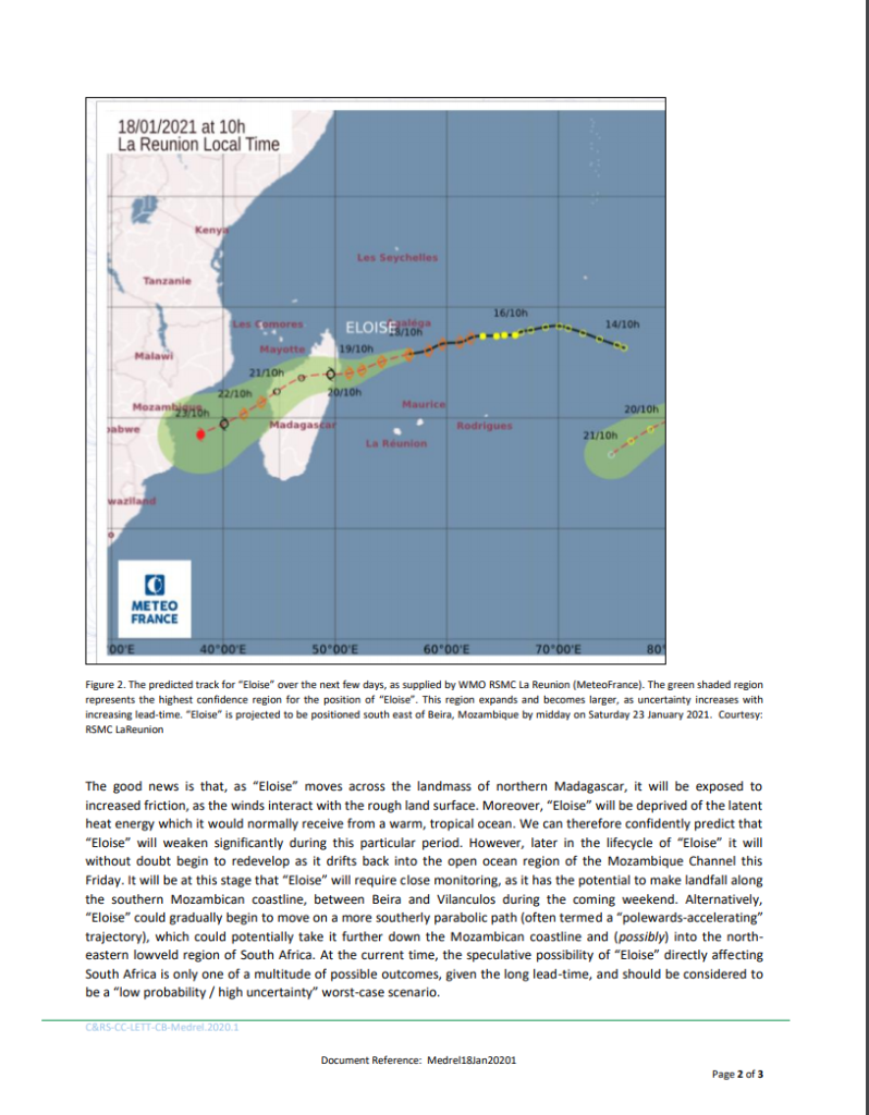
The good news is that, as “Eloise” moves across the landmass of northern Madagascar, it will be exposed to increased friction, as the winds interact with the rough land surface. Moreover, “Eloise” will be deprived of the latent heat energy which it would normally receive from a warm, tropical ocean.
We can therefore confidently predict that “Eloise” will weaken significantly during this particular period. However, later in the lifecycle of “Eloise” it will without doubt begin to redevelop as it drifts back into the open ocean region of the Mozambique Channel this Friday.
It will be at this stage that “Eloise” will require close monitoring, as it has the potential to make landfall along the southern Mozambican coastline, between Beira and Vilanculos during the coming weekend.
Alternatively, “Eloise” could gradually begin to move on a more southerly parabolic path (often termed a “polewards-accelerating” trajectory), which could potentially take it further down the Mozambican coastline and (possibly) into the northeastern lowveld region of South Africa.
At the current time, the speculative possibility of “Eloise” directly affecting
South Africa is only one of a multitude of possible outcomes, given the long lead-time, and should be considered to be a “low probability / high uncertainty” worst-case scenario.
In light of the above, the South African Weather Service (SAWS) wish to strongly emphasise that, as with any and every tropical system worldwide, there is much uncertainty surrounding the prediction of future development and movement of “Eloise”.
Tropical systems are notoriously fickle and unpredictable, often exhibiting very erratic movement.
Modern satellite remote sensing as well as advanced ensemble numeric modelling techniques do, however, mitigate much of this uncertainty, at least in the short-term.
Notwithstanding the above, the general public can rest assured that SAWS will continue to be vigilant and to closely monitor the future evolution of “Eloise”. Further timely updates in relation to “Eloise” will be issued as and
when necessary.
