Last Updated on 6th June 2024 7:15 PM by AfriWX
THE REGIONAL WEATHER FORECAST
FOR TOMORROW 2024-06-07
ISSUED AT 1600 SAST
BY THE SOUTH AFRICAN WEATHER SERVICE. THIS FORECAST WILL BE UPDATED AT 0500 SAST.
SEVERE WEATHER ALERTS
IMPACT-BASED
WARNINGS
A. An Orange Level 5 Warning Storm surge is expected along the coast between Plettenberg Bay and Buffalo City, resulting in coastal flooding due to an increased sea level of 0.4m above the highest astronomical high tide combined with already flooding rivers. B. A Yellow Level 2 Warning Damaging winds and waves leading to difficulty in navigation at sea of small vessels and personal watercraft are expected between Plettenberg and Kosi Bay. C. A Yellow level 2 warning Damaging waves resulting in difficulty in navigation and small vessels taking on water are expected is expected along the coast between Plettenberg Bay and East London, spreading to Port Edward by Friday morning. D. A yellow level 2 warning Disruptive snow leading to icy roads and traffic disruption with some passes being closed for a short period over the north eastern parts of the Eastern Cape. FIRE DANGER
WARNINGS
– Nil. ADVISORIES – Very cold, wet and windy conditions are expected over the southern parts of both Free State and Northern Cape, as well as the Karoo Hoogland and Beaufort West municipalities in the Western Cape.
PROVINCIAL WEATHER OVERVIEW
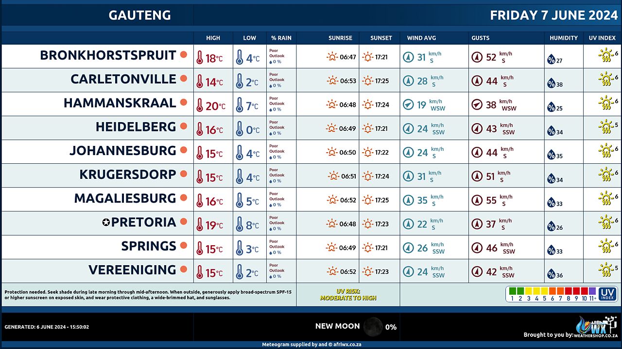
GAUTENG PROVINCE
Fine and cool to cold. The expected UVB sunburn Index Very High
MPUMALANGA PROVINCE
Fine and cold to cool, but warm in the east.
LIMPOPO PROVINCE
– Fine and col to warm.
NORTH-WEST PROVINCE
Fine in the east, otherwise partly cloudy, windy and cold to cool.
FREE STATE
Morning fog patches in places, otherwise partly cloudy, windy and cold to cool, but very cold in the extreme south.
NORTHERN CAPE
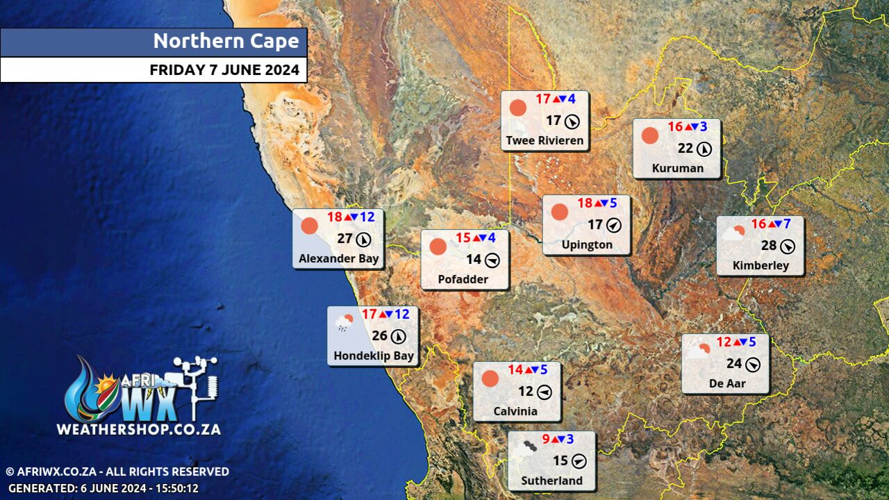
Morning fog patches in places in the east, otherwise partly cloudy and cold to cool but very cold in the southern parts, becoming partly cloudy from the afternoon. Wind along the coast will be light and variable becoming moderate to fresh southerly from the late afternoon.
WESTERN CAPE
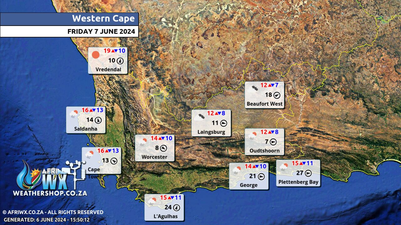
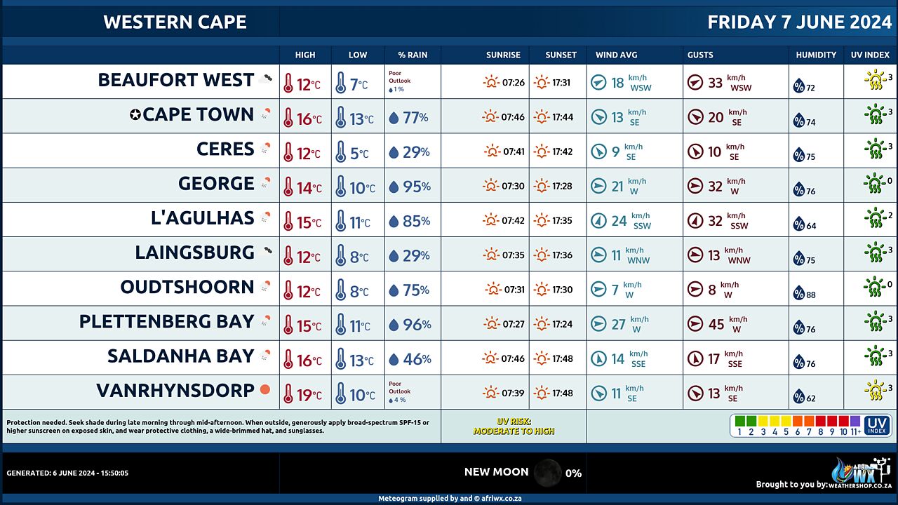
– Cloudy and cold to cool with isolated showers and rain, except in the extreme west. It will become partly cloudy towards the end of the period. The wind along the coast will be moderate northerly north of Cape Columbine becoming moderate south- easterly to easterly from the afternoon but fresh to strong westerly to south-westerly east of Cape Agulhas becoming light and variable between Cape Agulhas and Still Bay from the afternoon spreading to east. The expected UVB sunburn Index Low
WESTERN HALF OF THE EASTERN CAPE
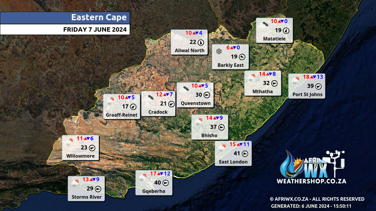
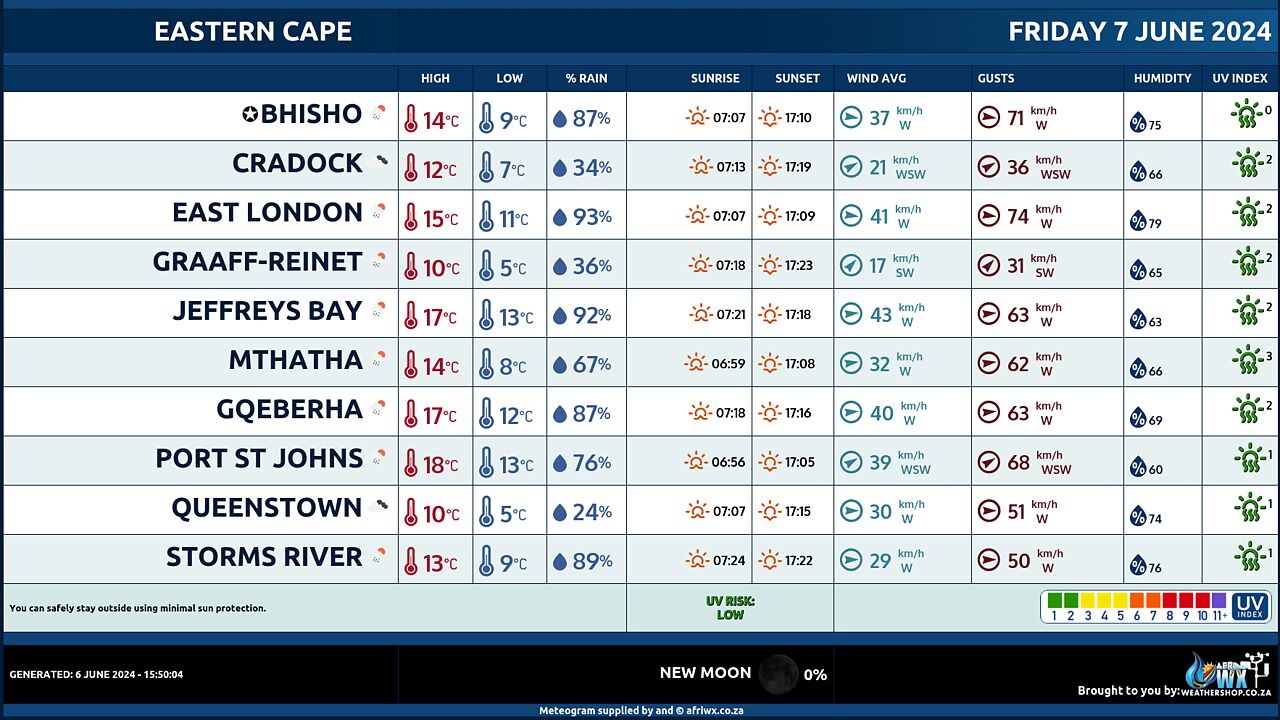
Cloudy and cold with isolated showers and rain, but scattered along the coast. Light snowfalls may be possible over the northern high-lying areas. The wind along the coast will be Moderate to fresh south-westerly, becoming southerly in the east in the afternoon.
EASTERN HALF OF THE EASTERN CAPE
Cloudy and cold with isolated showers and rain but scattered along the coast. Light snowfalls may be possible over the northern high-lying areas where it will be very cold. The wind along the coast will be Fresh to strong south-westerly, but moderate southerly in the south, spreading to the east in the afternoon.
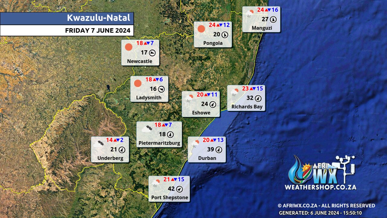
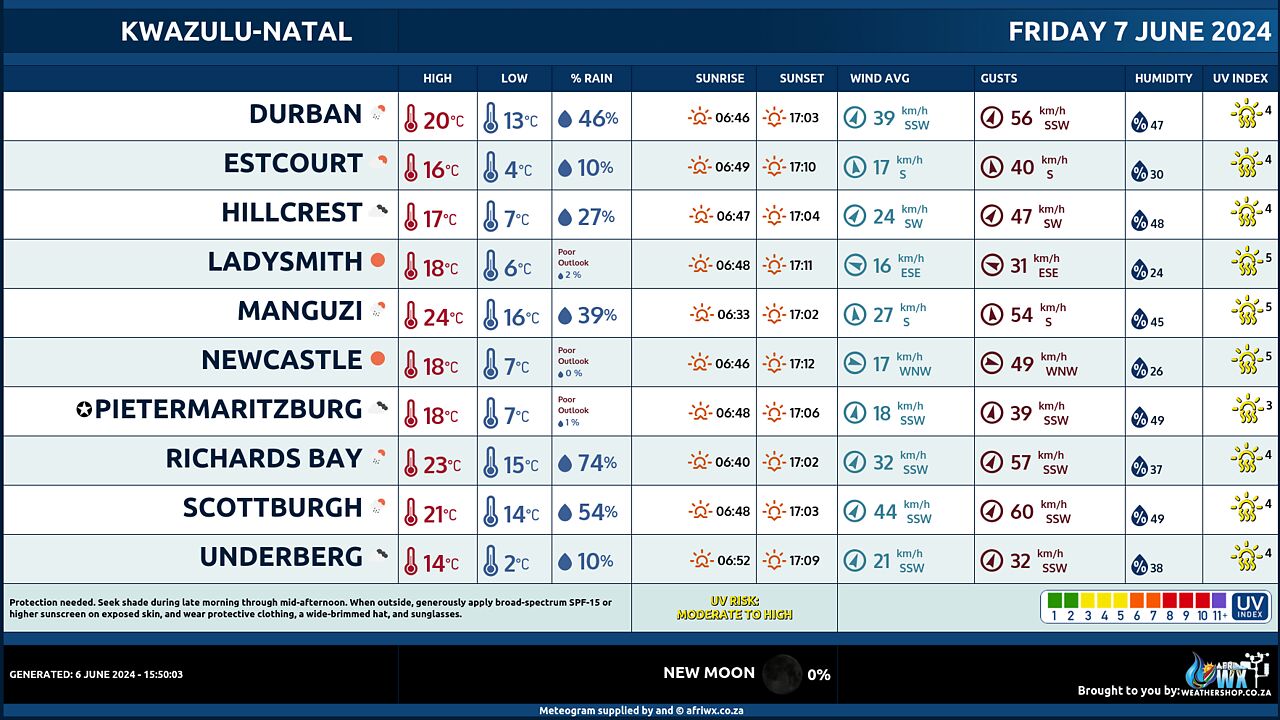
KWAZULU-NATAL
Partly cloudy in the south at first, becoming cloudy and cold to cool with isolated showers and rain along the coast and adjacent interior. The wind along the coast will be the wind along the coast will be fresh to strong north-easterly in the north at first, becoming fresh to strong south-westerly, reaching gale force in places at times. The expected UVB sunburn Index Low
JOIN OUR FREE AFRIWX WEATHER GROUP on Telegram Messenger
Please download Telegram for Android or iPhone if you want to always be up to date with the latest weather maps.
CLICK HERE TO JOIN our Telegram Group Now
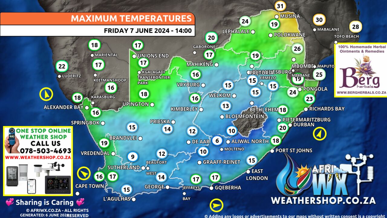
Maximum Temperatures Forecast for South Africa Friday 7 June 2024
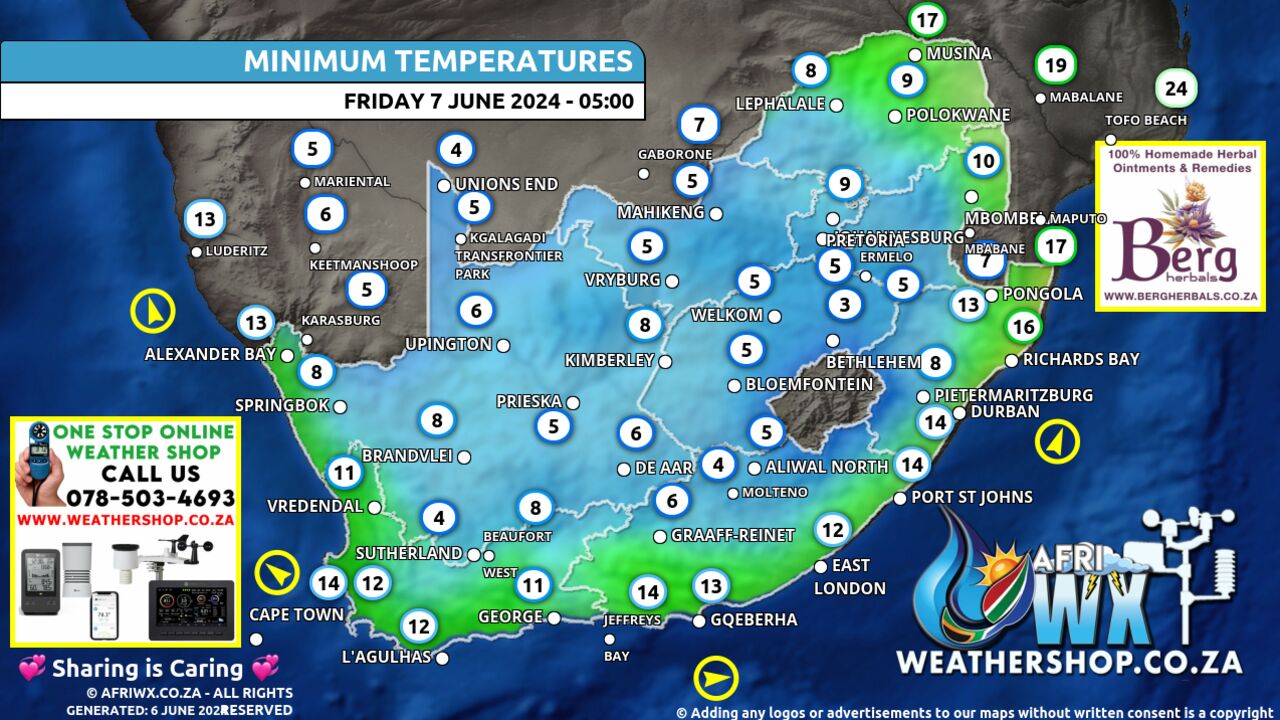
Minimum Temperatures Forecast for South Africa Friday 7 June 2024
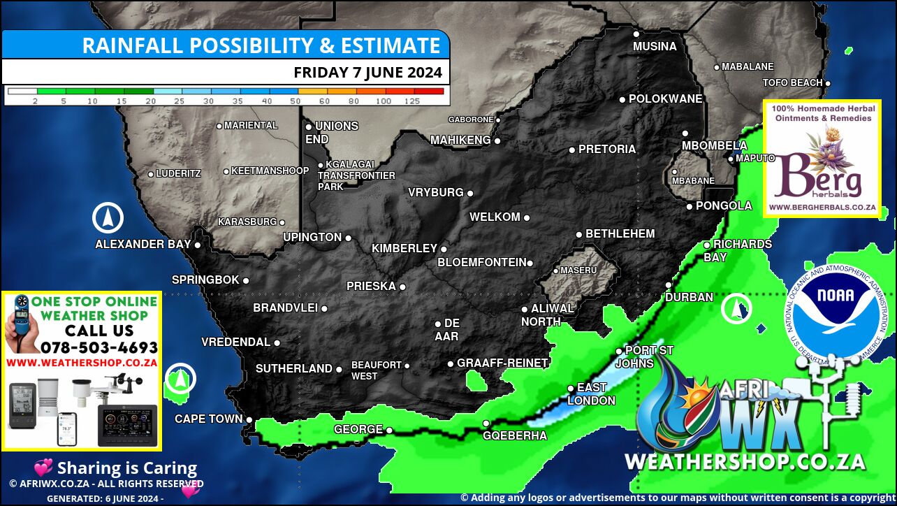
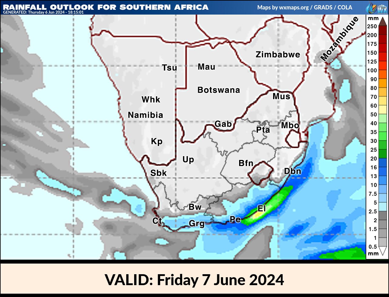
Rainfall Outlook for South Africa Friday 7 June 2024
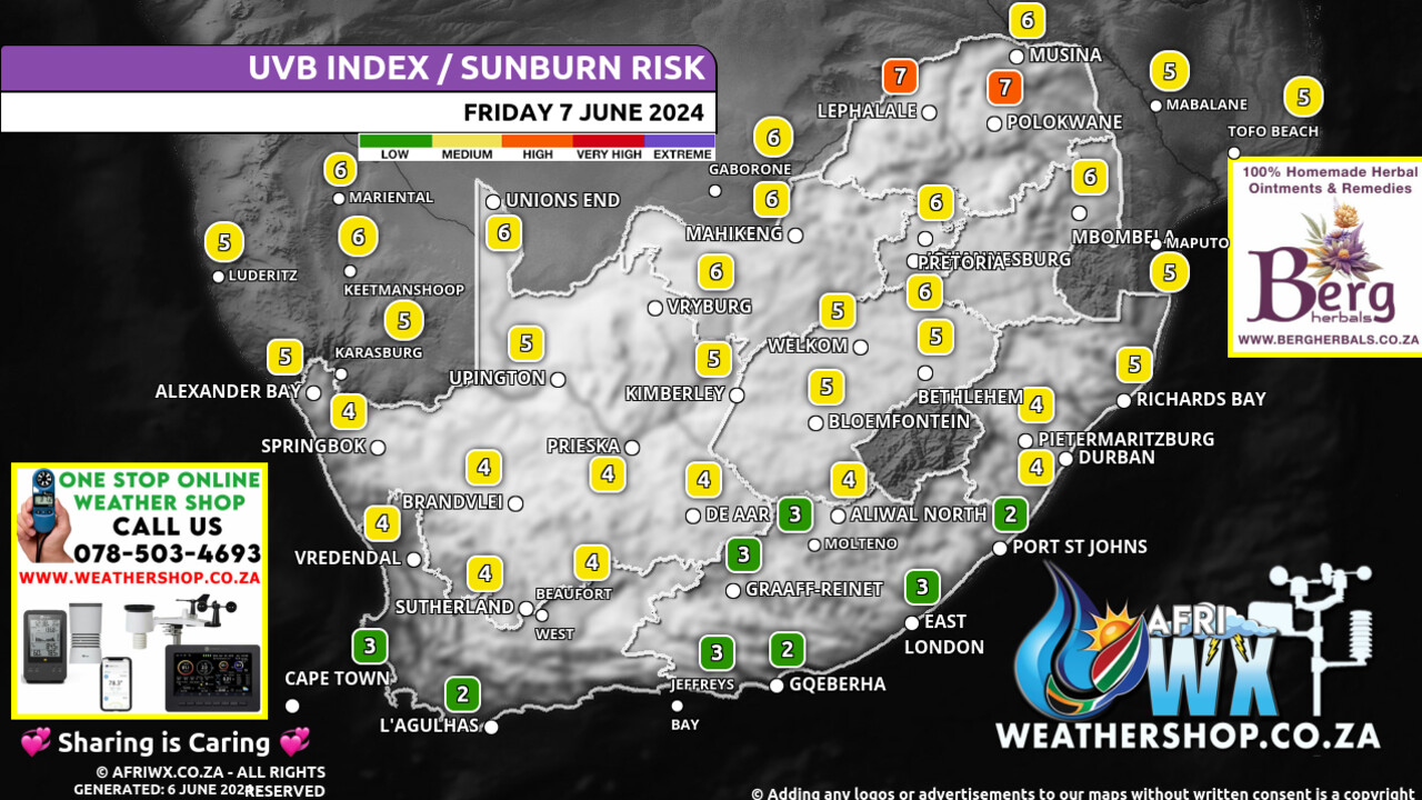
UVB Index Outlook for South Africa Friday 7 June 2024
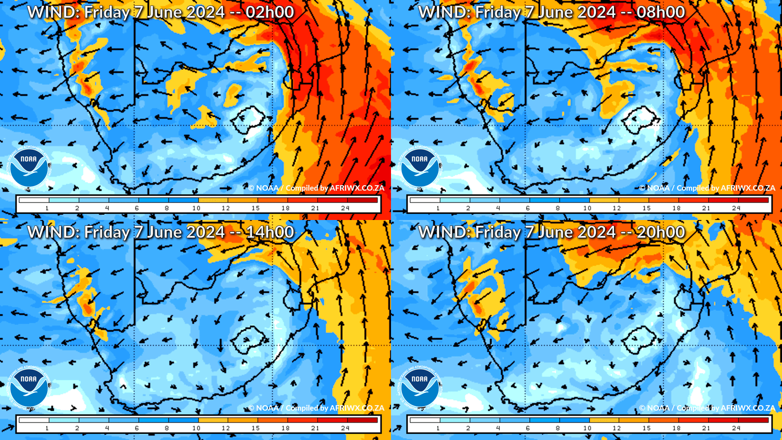
Wind Speed Direction and Gusts Map for South Africa Friday 7 June 2024
TRAVELLERS WEATHER FORECAST
FOR TOMORROW 2024-06-07
ISSUED AT 1530 SAST BY THE SOUTH AFRICAN WEATHER SERVICE.
SEVERE WEATHER ALERTS
IMPACT-BASED
WARNINGS
– A.
An Orange Level 5 Warning Storm surge is expected along the coast between Plettenberg Bay and Buffalo City, resulting in coastal flooding due to an increased sea level of 0.
4m above the highest astronomical high tide combined with already flooding rivers.
B.
A Yellow Level 2 Warning Damaging winds and waves leading to difficulty in navigation at sea of small vessels and personal watercraft are expected between Plettenberg and Kosi Bay.
C.
A Yellow level 2 warning Damaging waves resulting in difficulty in navigation and small vessels taking on water are expected is expected along the coast between Plettenberg Bay and East London, spreading to Port Edward by Friday morning.
D.
A yellow level 2 warning Disruptive snow leading to icy roads and traffic disruption with some passes being closed for a short period over the north eastern parts of the Eastern Cape.
FIRE DANGER
WARNINGS
Nil.
ADVISORIES – Very cold, wet and windy conditions are expected over the southern parts of both Free State and Northern Cape, as well as the Karoo Hoogland and Beaufort West municipalities in the Western Cape.
WEATHER IN OUR TOP CITIES
PRETORIA
– Fine.
Minimum/Maximum 6/18 The expected UVB Sunburn Index Very High
JOHANNESBURG
Fine.
Minimum/Maximum 0/15
VEREENIGING
Fine.
Minimum/Maximum 0/16
MBOMBELA
Fine.
Minimum/Maximum 10/24
POLOKWANE
– Fine.
Minimum/Maximum 7/19
MAHIKENG
Fine and windy, becoming partly cloudy in the afternoon.
Minimum/Maximum 3/15
VRYBURG
Partly cloudy and windy.
Minimum/Maximum 1/15
BLOEMFONTEIN
Morning fog, otherwise partly cloudy to cloudy.
Minimum/Maximum 2/14
KIMBERLEY
Partly cloudy.
Minimum/Maximum 3/15
UPINGTON
Partly cloudy.
Minimum/Maximum 4/17
CAPE TOWN
Cloudy with isolated showers becoming fine towards the end of the period.
Wind Light and variable in the morning and evening, otherwise moderate southerly.
Minimum/Maximum 12/16 The expected UVB Sunburn Index Low
GEORGE
– Cloudy with isolated showers becoming partly cloudy.
Wind Moderate to fresh westerly becoming light to moderate south-westerly.
It will be light north-westerly by the end of the period.
Minimum/Maximum 9/14 GQEBERHA Cloudy with scattered showers and rain.
Wind Moderate to fresh south-westerly, becoming moderate southerly in the afternoon.
Minimum/Maximum 10/17
EAST LONDON
– Cloudy with scattered showers and rain.
Wind Fresh to strong south-westerly, becoming moderate southerly by late morning.
Minimum/Maximum 13/17
DURBAN
– Fine, becoming cloudy in the morning with isolated afternoon showers and rain.
Wind fresh to strong south-westerly, reaching near-gale at times.
Minimum/Maximum 14/21 The expected UVB Sunburn Index Low
RICHARDS BAY
– Fine, becoming cloudy in the afternoon with isolated showers and rain.
Wind Fresh to strong south-westerly, reaching gale at times.
Minimum/Maximum 13/23
PIETERMARITZBURG
– Fine, becoming cloudy in afternoon.
Minimum/Maximum 7/17
JOIN OUR FREE AFRIWX WEATHER GROUP on Telegram Messenger
Please download Telegram for Android or iPhone if you want to always be up to date with the latest weather maps.
CLICK HERE TO JOIN our Telegram Group Now
Rainfall Outlook for Tomorrow Friday 7 June 2024
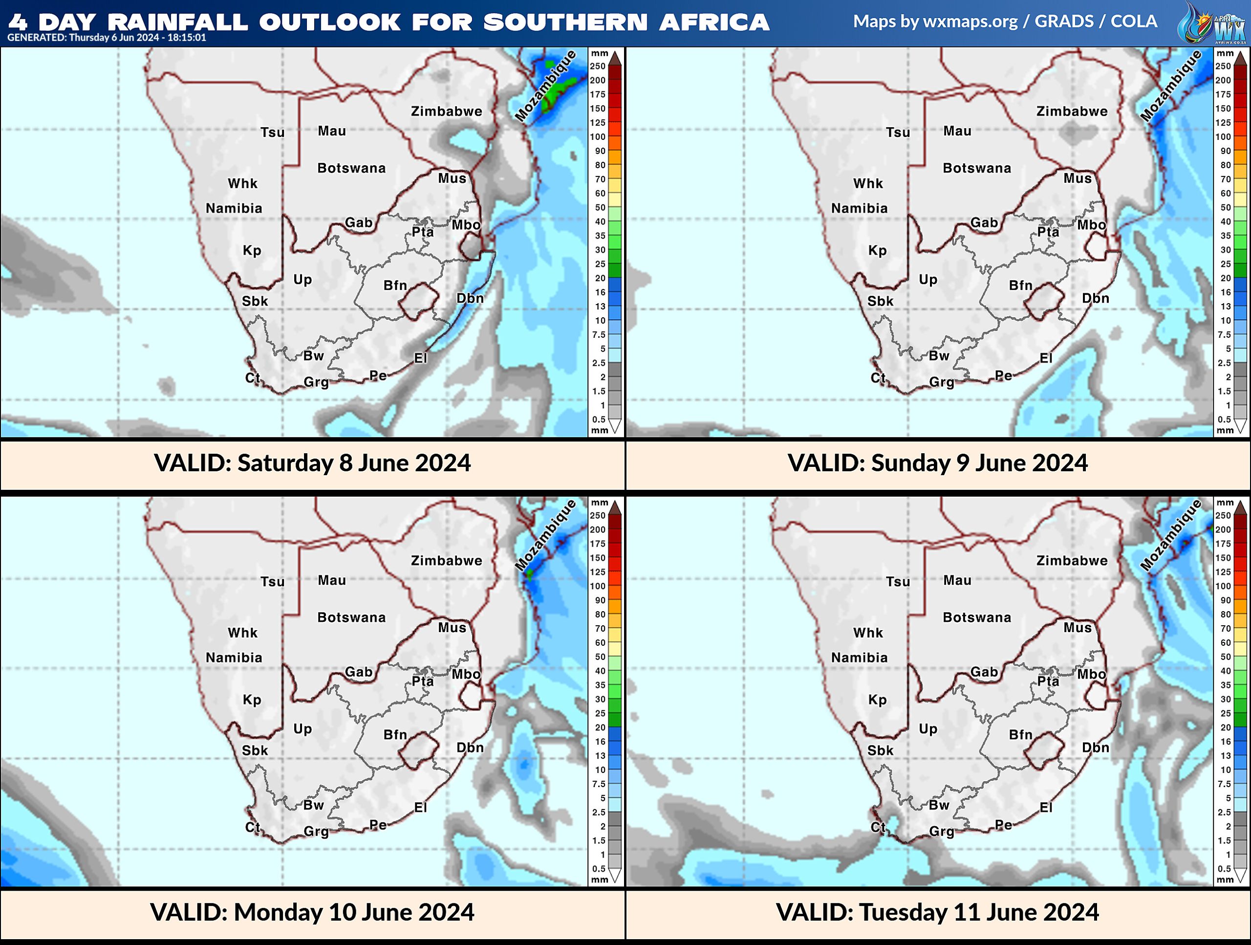
4 Day Rainfall Outlook for Southern Africa
14 Day Rainfall Outlook for Southern Africa
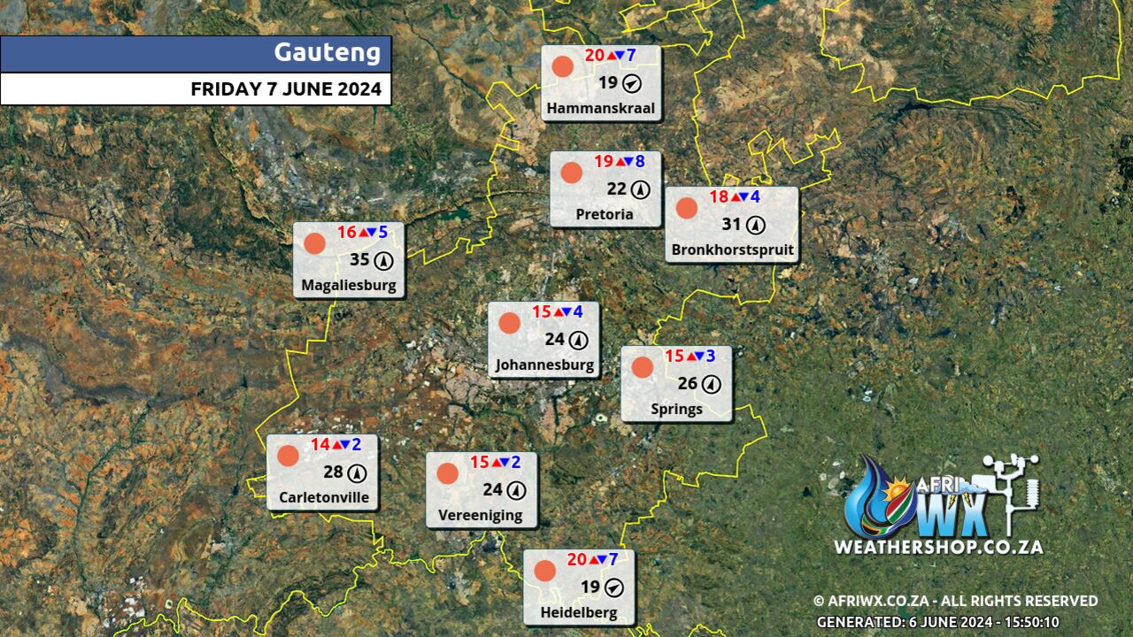
Gauteng Province Weather Map Friday 7 June 2024
Gauteng Province Weather Meteogram Friday 7 June 2024
Kwazulu-Natal Province Weather Map Friday 7 June 2024
Kwazulu-Natal Province Weather Meteogram Friday 7 June 2024
Eastern Cape Province Weather Map Friday 7 June 2024
Eastern Cape Province Weather Meteogram Friday 7 June 2024
Western Cape Province Weather Map Friday 7 June 2024
Western Cape Province Weather Meteogram Friday 7 June 2024
Northern Cape Province Weather Map Friday 7 June 2024
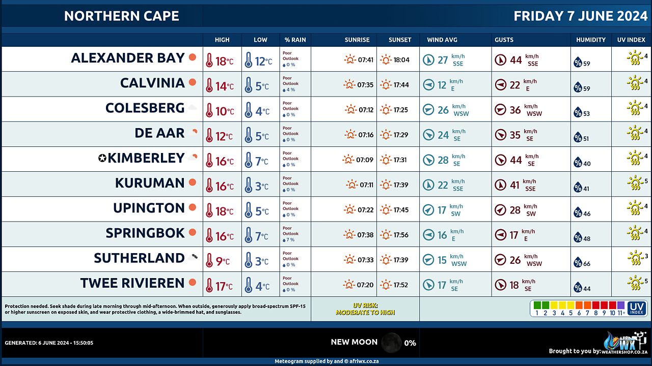
Northern Cape Province Weather Meteogram Friday 7 June 2024
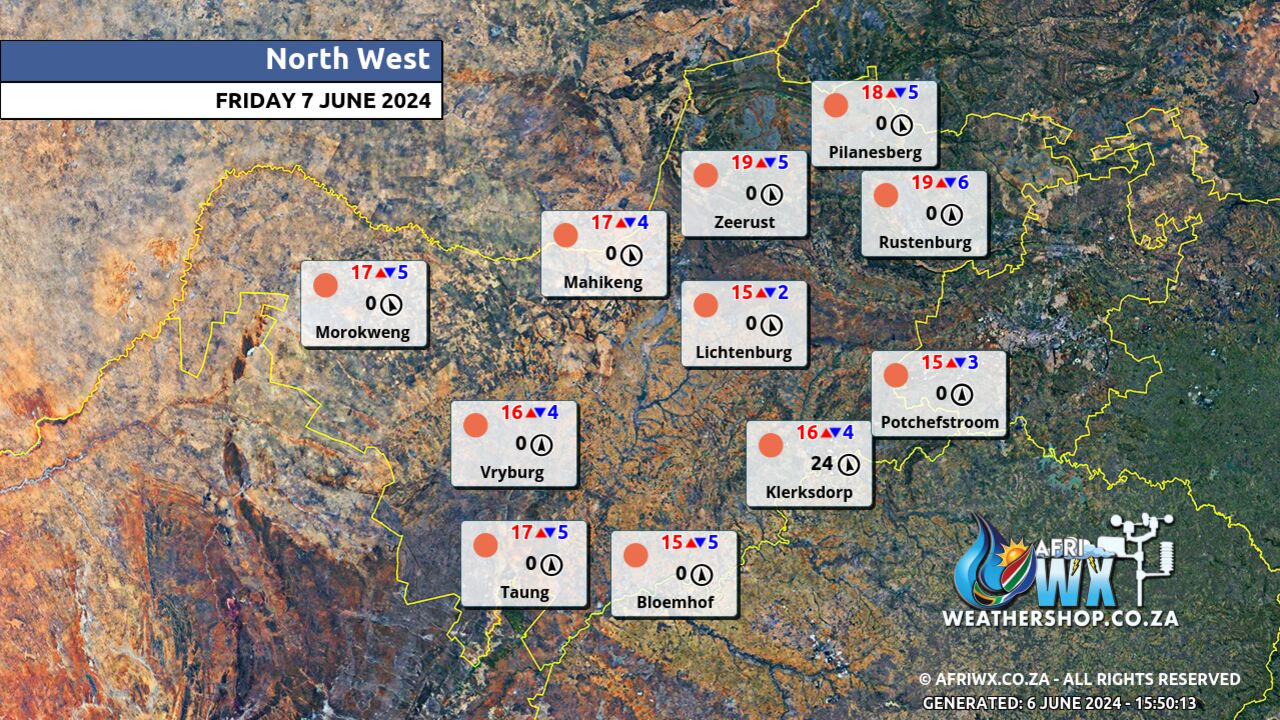
North-West Province Weather Map Friday 7 June 2024
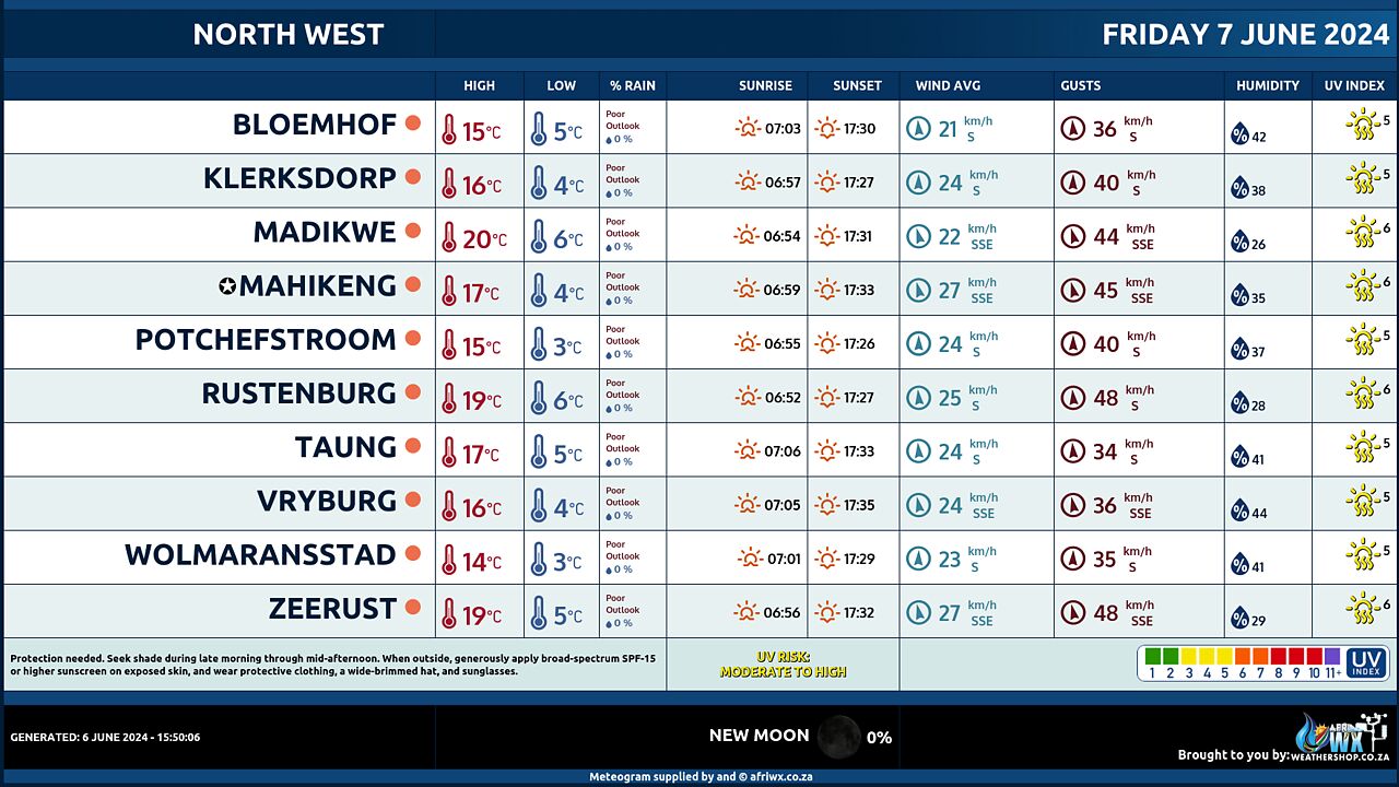
North-West Province Weather Meteogram Friday 7 June 2024
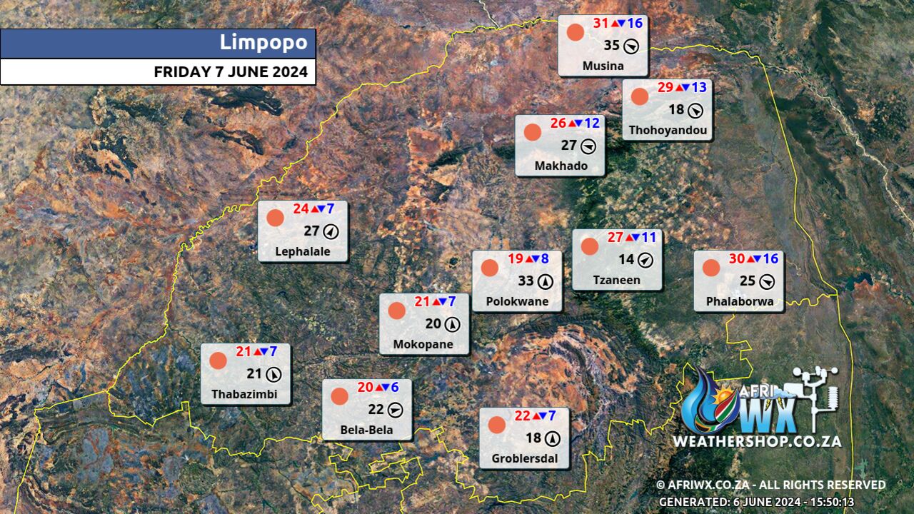
Limpopo Province Weather Map Friday 7 June 2024
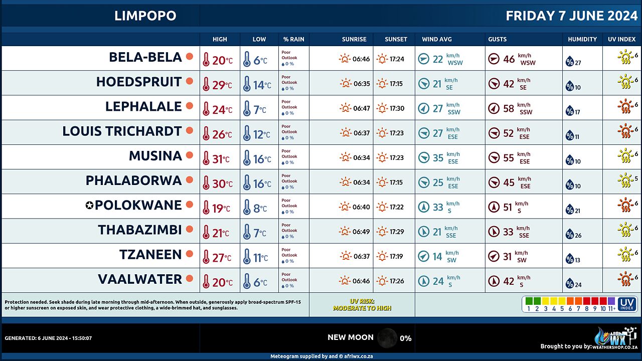
Limpopo Province Weather Meteogram Friday 7 June 2024
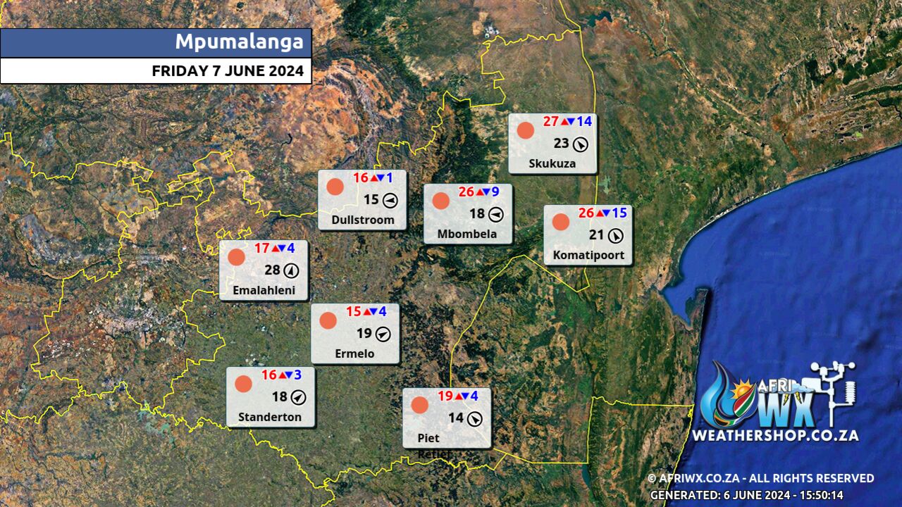
Mpumalanga Province Weather Map Friday 7 June 2024
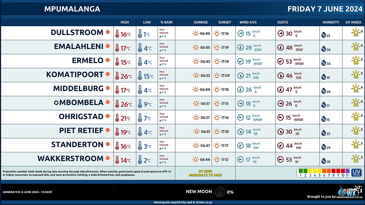
Mpumalanga Province Weather Meteogram Friday 7 June 2024
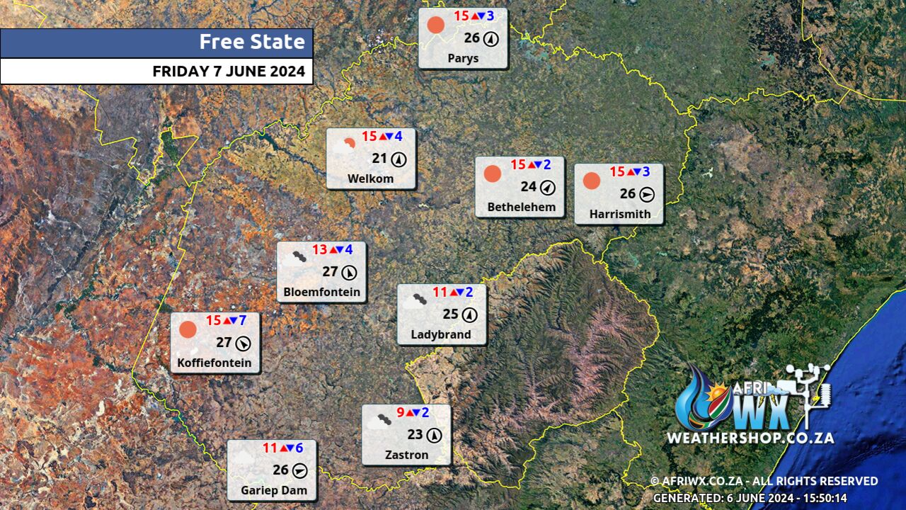
Free State Province Weather Map Friday 7 June 2024
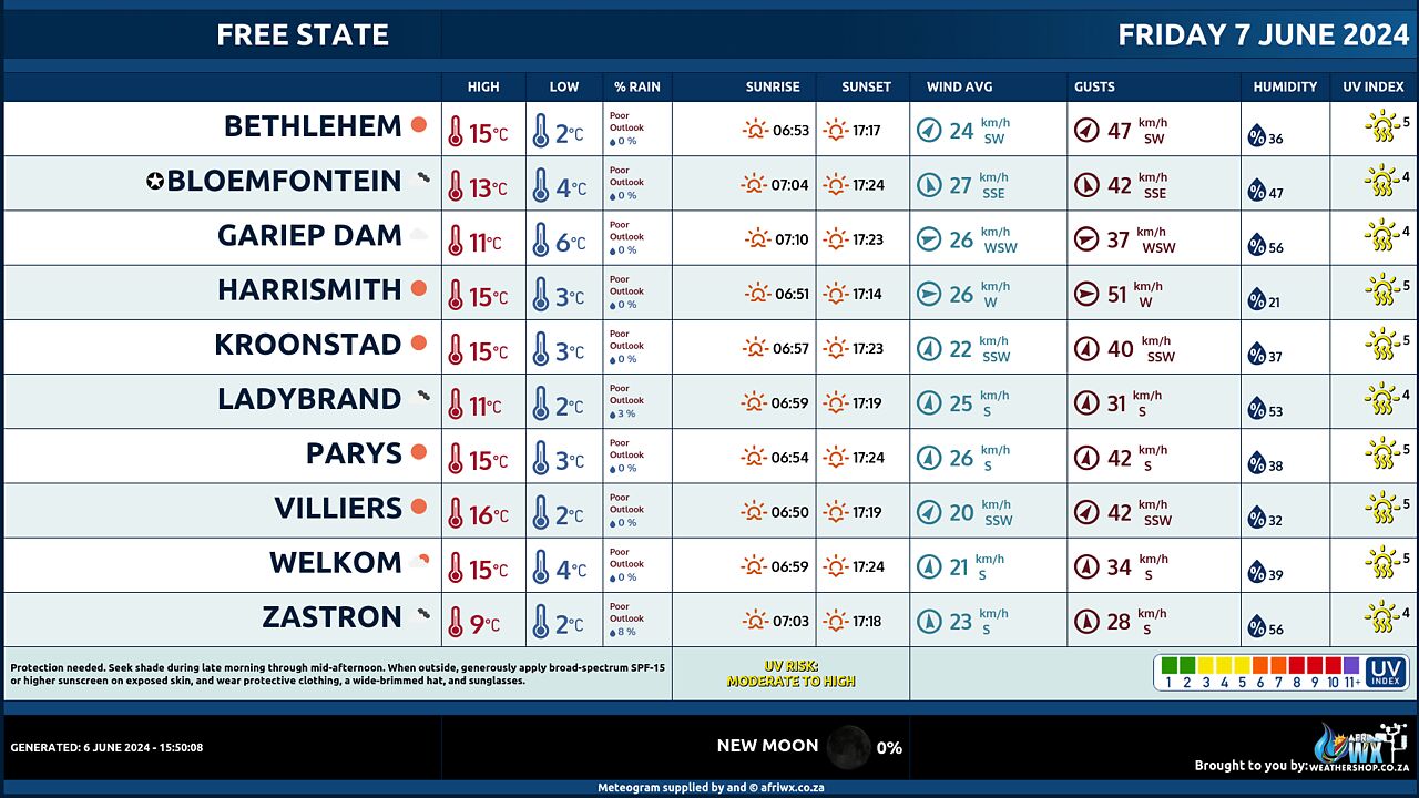
Free State Province Weather Meteogram Friday 7 June 2024
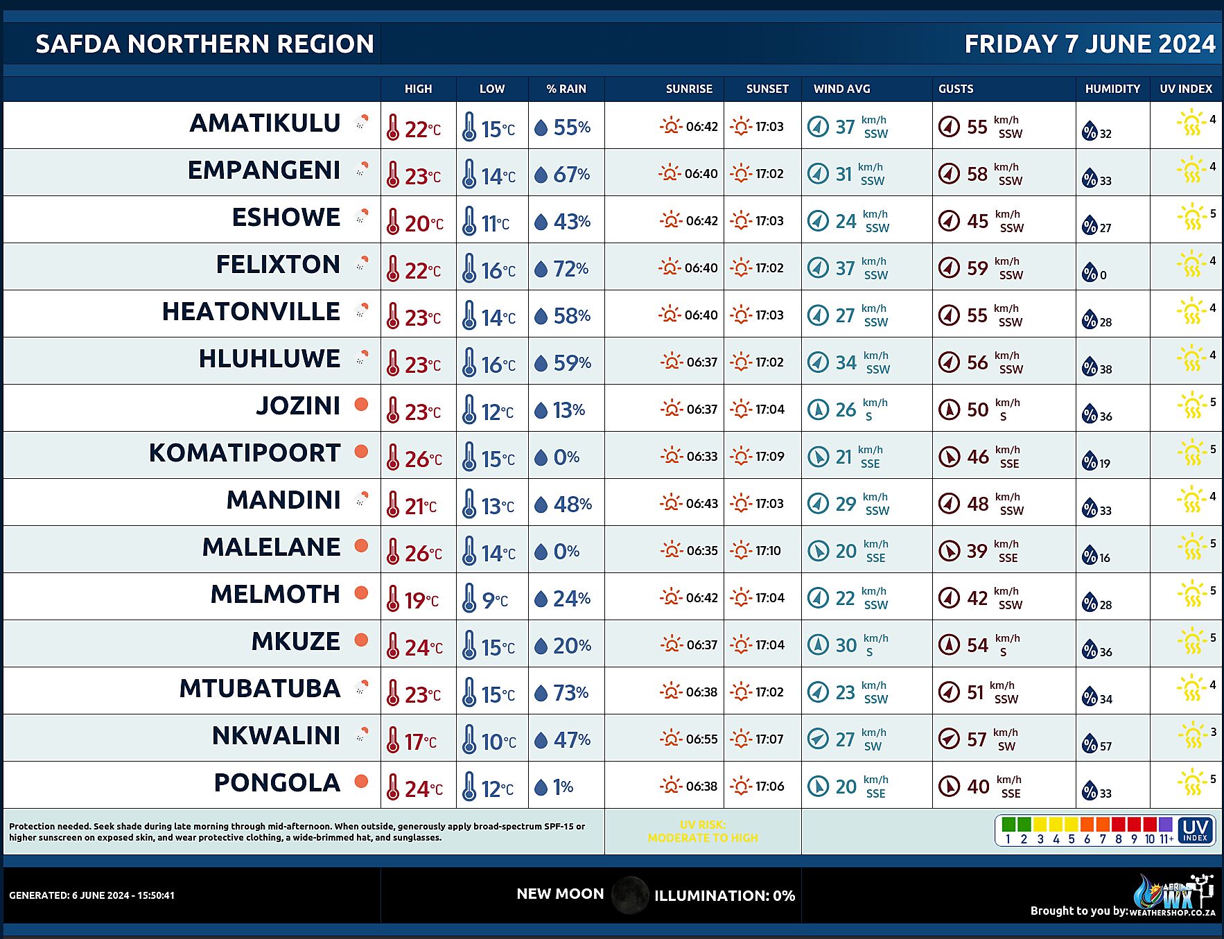
SAFDA Sugar Cane Farming (Northern Kwazulu-Natal) Weather Forecast Friday 7 June 2024
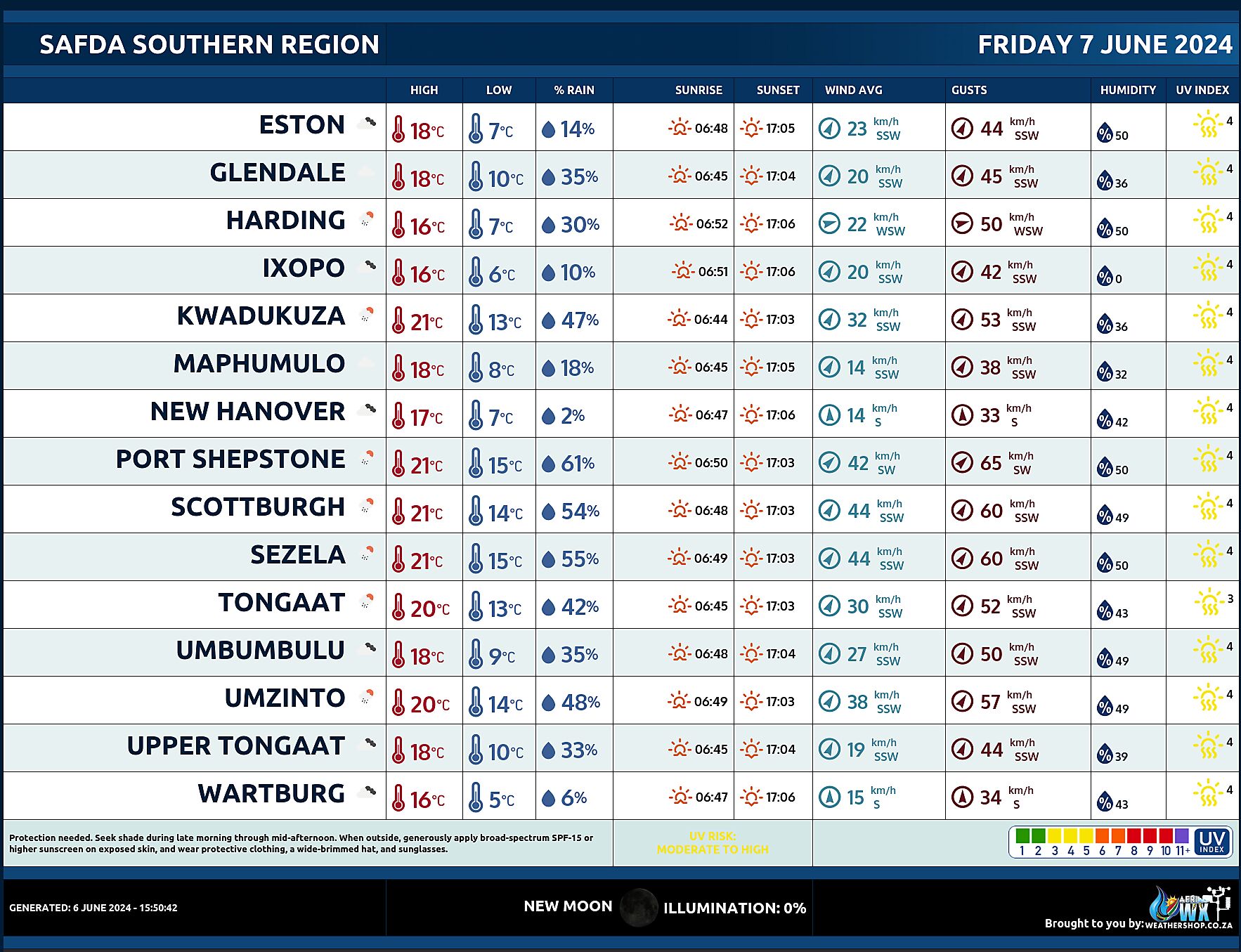
SAFDA Sugar Cane Farming (Southern Kwazulu-Natal) Weather Forecast Friday 7 June 2024
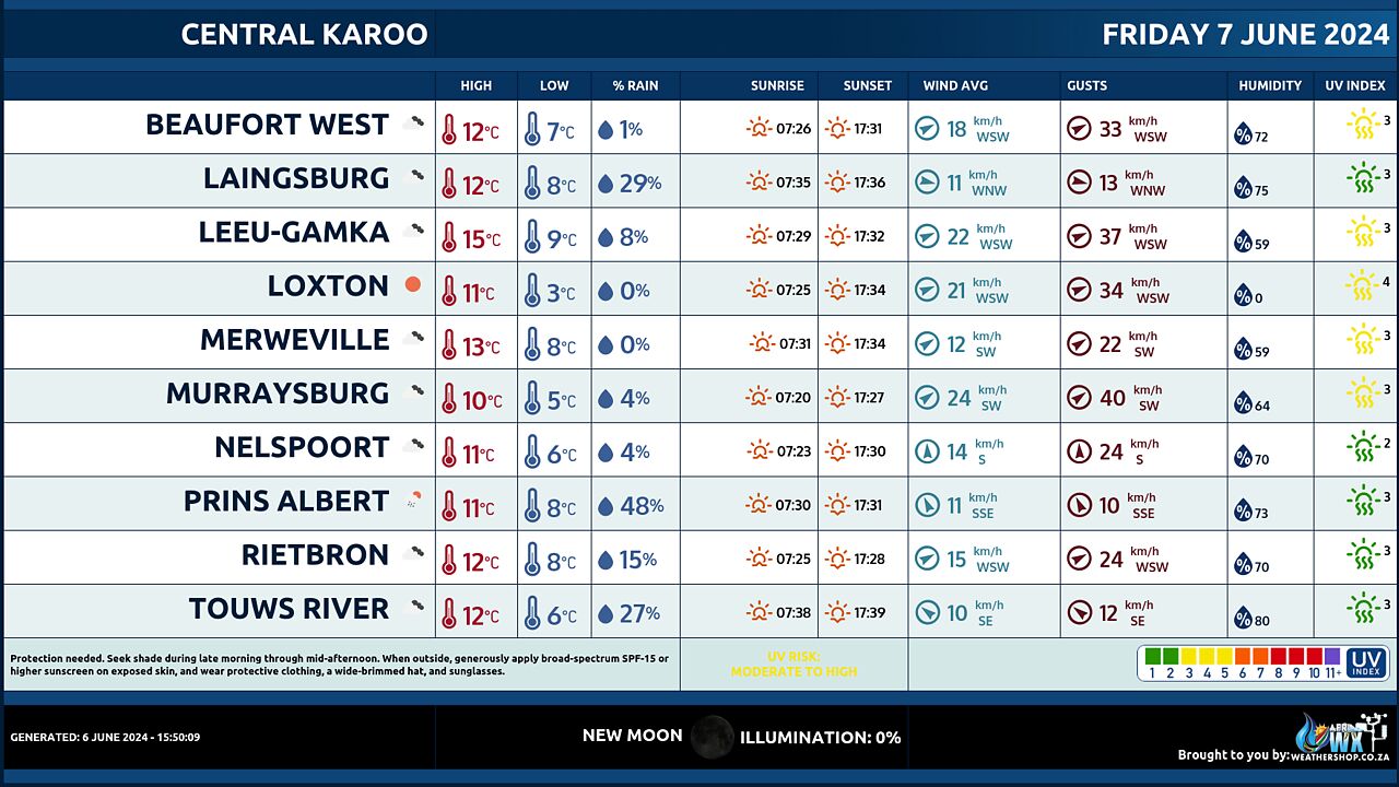
Central Karoo (Northern Cape) Farming Weather Forecast Friday 7 June 2024
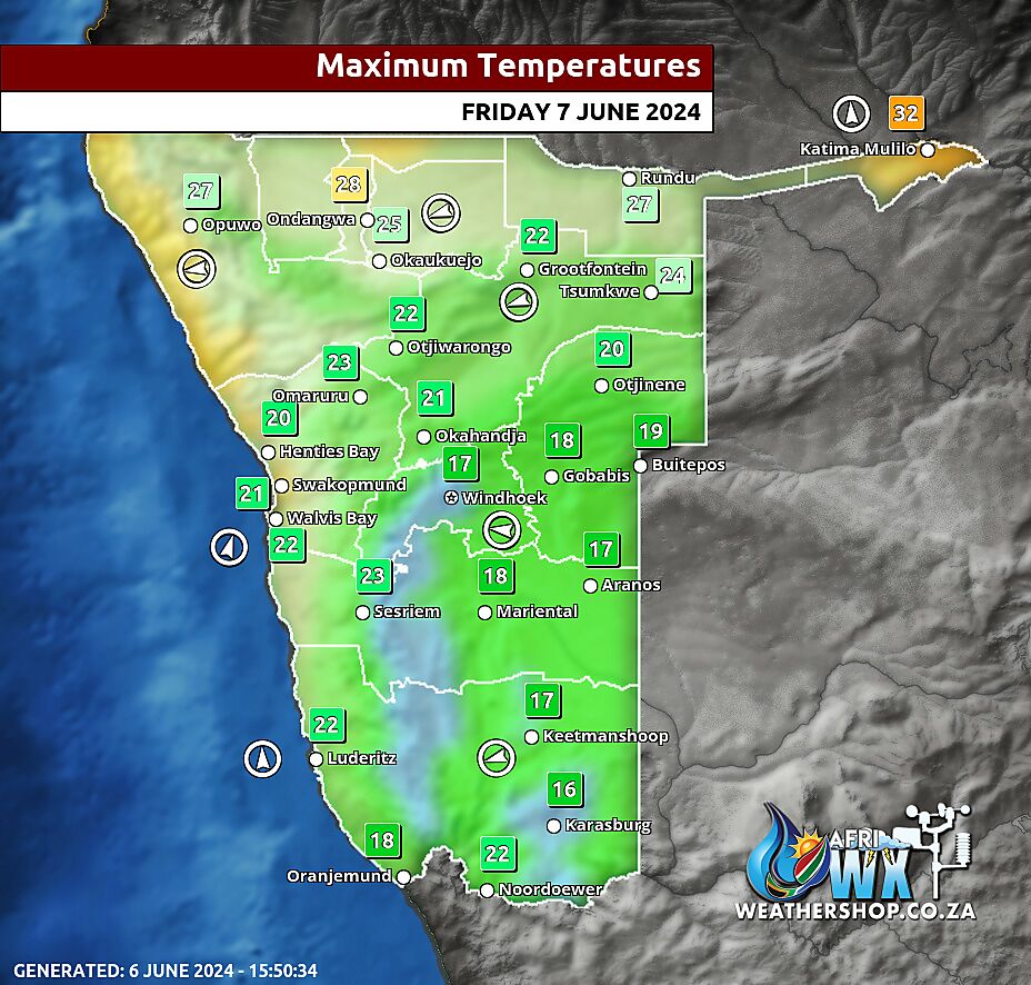
Namibia Maximum Temperatures Friday 7 June 2024
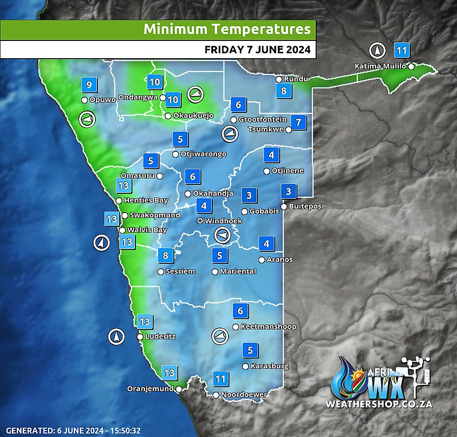
Namibia Minimum Temperatures Friday 7 June 2024
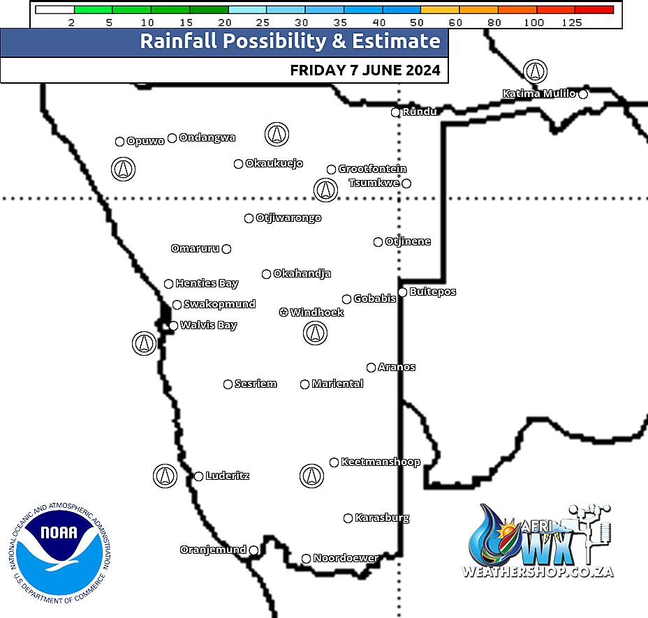
Namibia Rainfall Probability Map Friday 7 June 2024
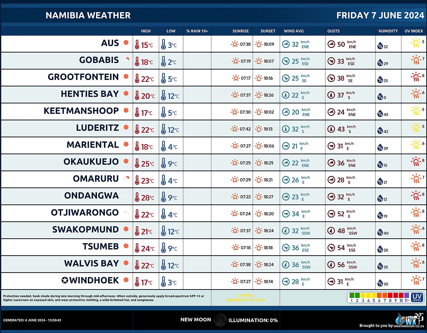
Namibia Weather Meteogram Friday 7 June 2024
Namibia Meteorological Services METEONA Weather Forecast Friday 7 June 2024
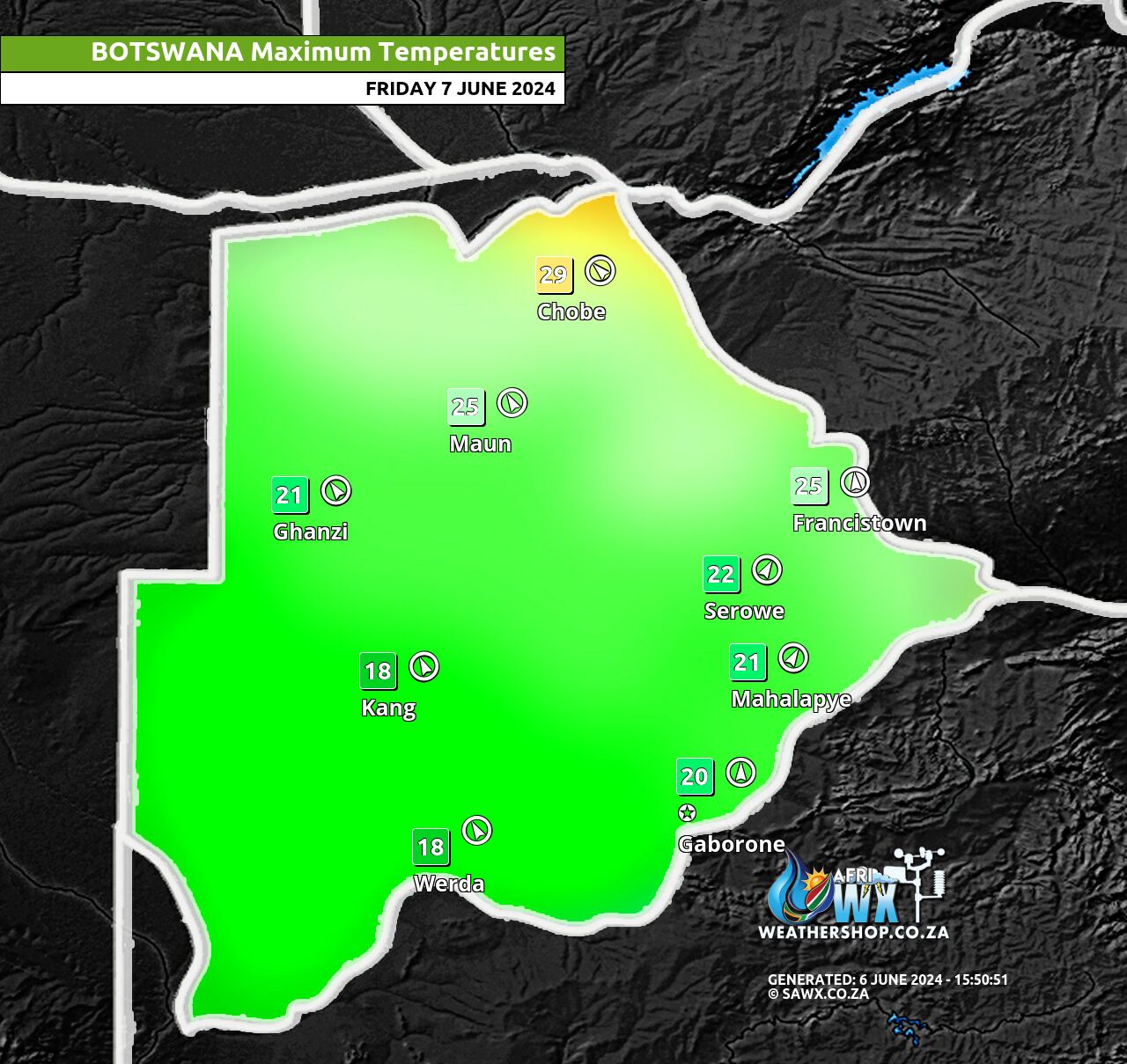
Botswana Maximum Temperatures Friday 7 June 2024
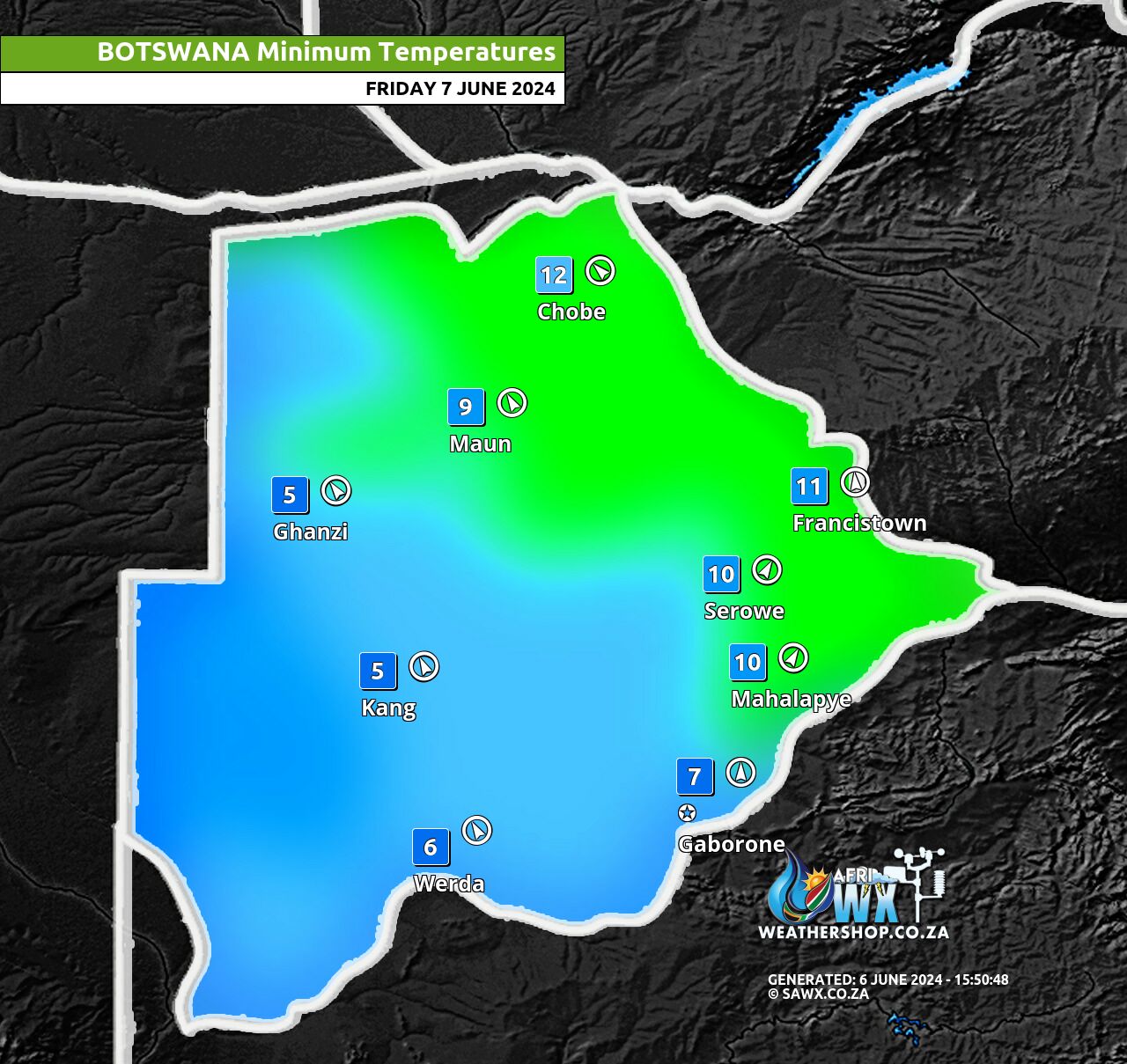
Botswana Minimum Temperatures Friday 7 June 2024
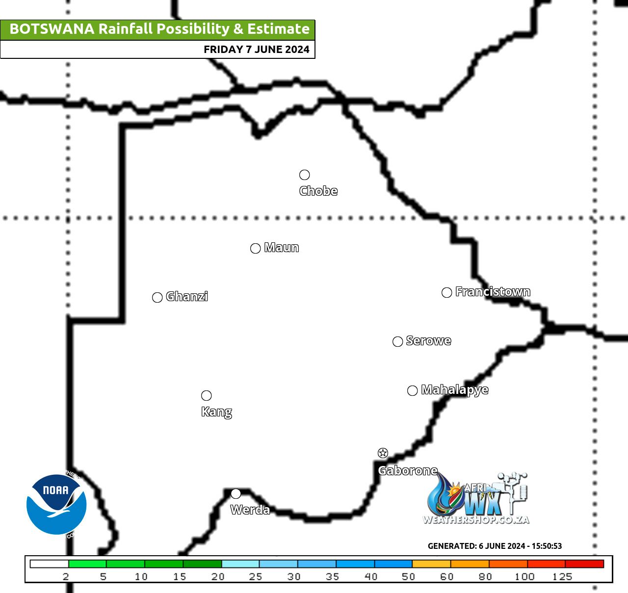
Botswana Rainfall Possibility Map Friday 7 June 2024
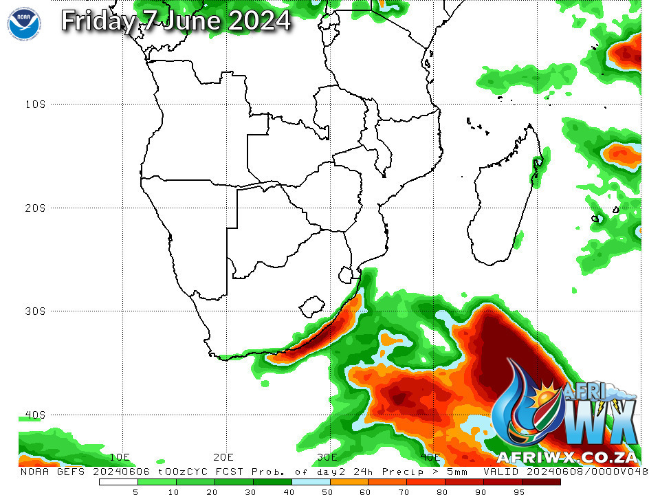
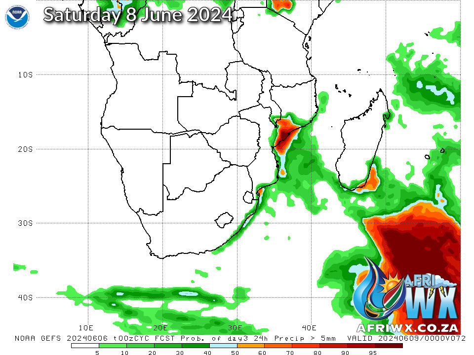
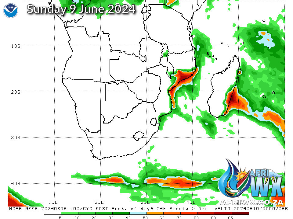
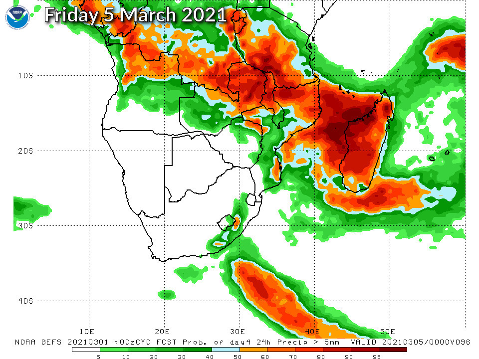
NOAA GEFS Global Ensemble Rainfall Outlook Southern Africa
JOIN OUR FREE AFRIWX WEATHER GROUP on Telegram Messenger
Please download Telegram for Android or iPhone if you want to always be up to date with the latest weather maps.
CLICK HERE TO JOIN our Telegram Group Now


