Last Updated on 4th August 2020 10:52 AM by AfriWX
Possibility of Light Snow
A cold front brings with it a chance of light snowfall across parts of the Western Cape, Eastern Cape, Northern Cape (extreme South), Lesotho and the Drakensberg mountain range of KwaZulu-Natal over the next 2 days or two.
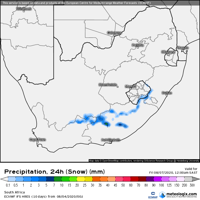
The Swartberg mountain range could start to see some light snow from today while the chances of better snowfalls are more likely from Wednesday through Thursday.
Another cold snap ahead
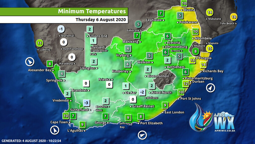
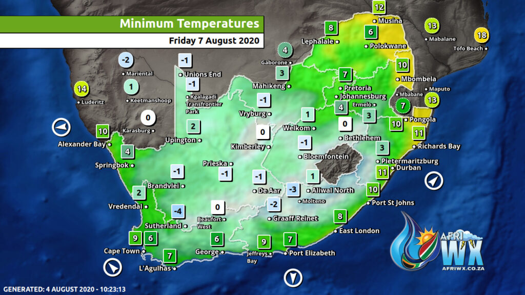
There will be a noticeable drop in temperatures as the first of a series of strong cold fronts has penetrated south Namibia and nearly all the Cape Provinces.
Don’t forget to join the free AfriWX channel on Telegram Messenger, please download Telegram for Android or iPhone if you want to always be up to date with the latest weather maps.
Click to join our Telegram Channel
Gale force winds expected
Strong south-west gales are expected on the coastal regions of the south-east and east, especially Kwazulu-Natal on Wednesday. The cold fronts will be enforced and again pushed northwards by an encroaching anti-cyclone.
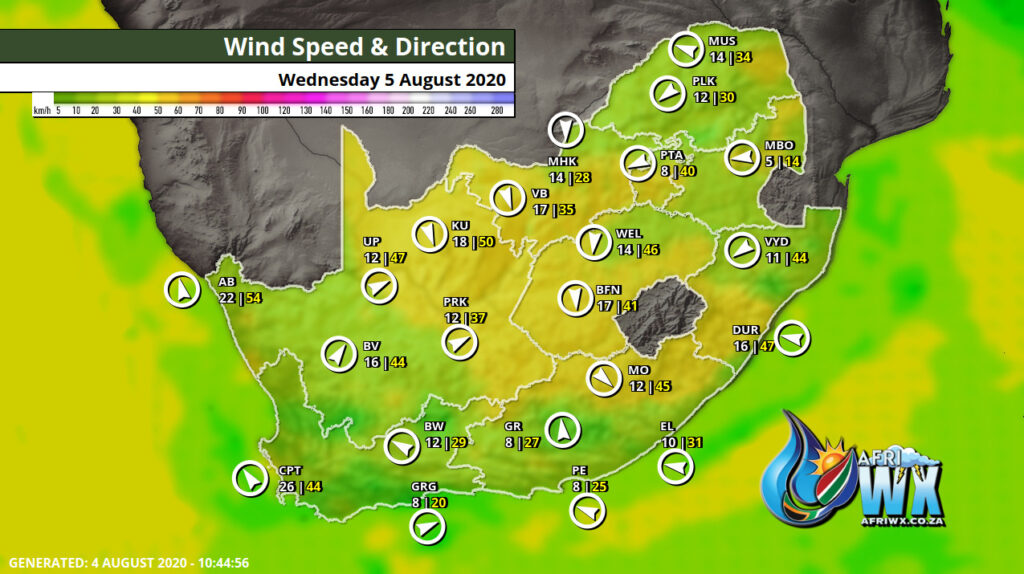
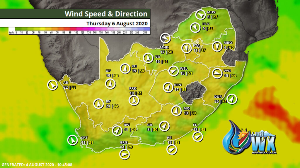
Weather Forecast for the next few days from Mike Berridge of Weather Today Southern Africa
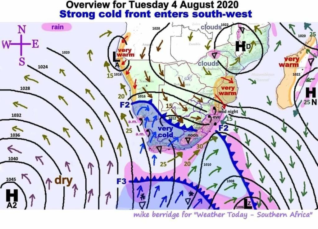
There are three observations to note here:
- The first of a series of strong cold fronts (“F2”) has penetrated south Namibia and nearly all the Cape Provinces. The next in the series is “F3”. The intense anti-cyclone “HA2” in the Atlantic Ocean has remained temporarily stationary, so the feed of very cold air from very far south will continue to flow northward towards the south coast. New fronts will keep forming within this stream of very cold air.
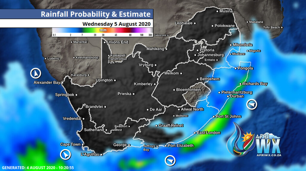
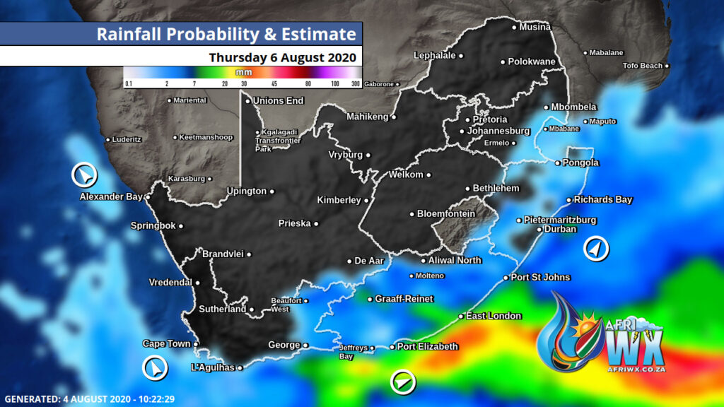
- The weak rain areas will tend to move from west to north-east. Because the diagram must cover an entire day, I have indicated the times when showers are expected. The drizzle on the Cape west coast will be morning only (a.m.), and not widespread. Around noon some showers will develop in the east Cape highlands. Clouds will then proceed to form in KZN with light rain at the coast and evening drizzle commencing inland up to the escarpment. By mid-night, the drizzle will reach Eswatini and probably the city of Maputo in Mozambique.
- Tomorrow, Wednesday, the “stage” will be set for a Thursday drama. The atmospheric pressure will fall over the southern interior. This will stall the fronts and force them into a reverse direction. I have in one of my earlier bulletins on this system mentioned that severe disturbances are possible when very cold air meets warm humid air from the north. This will happen very early on Thursday to produce a severe frontal Low out at sea off the south-east and east coasts of the Republic. The resulting pressure gradient as the anti-cyclone edges in closer will set up strong south-west gales on the coastal regions of the south-east and east (especially KZN) throughout the day. The cold fronts will be enforced and again pushed northwards by the encroaching anti-cyclone
Don’t forget to join the free AfriWX channel on Telegram Messenger, please download Telegram for Android or iPhone if you want to always be up to date with the latest weather maps.
Click to join our Telegram Channel

Pingback: Snowing in South Africa, Antarctic air dropped temperatures 15°C below average – mkweather