Last Updated on 18th August 2020 5:52 PM by AfriWX
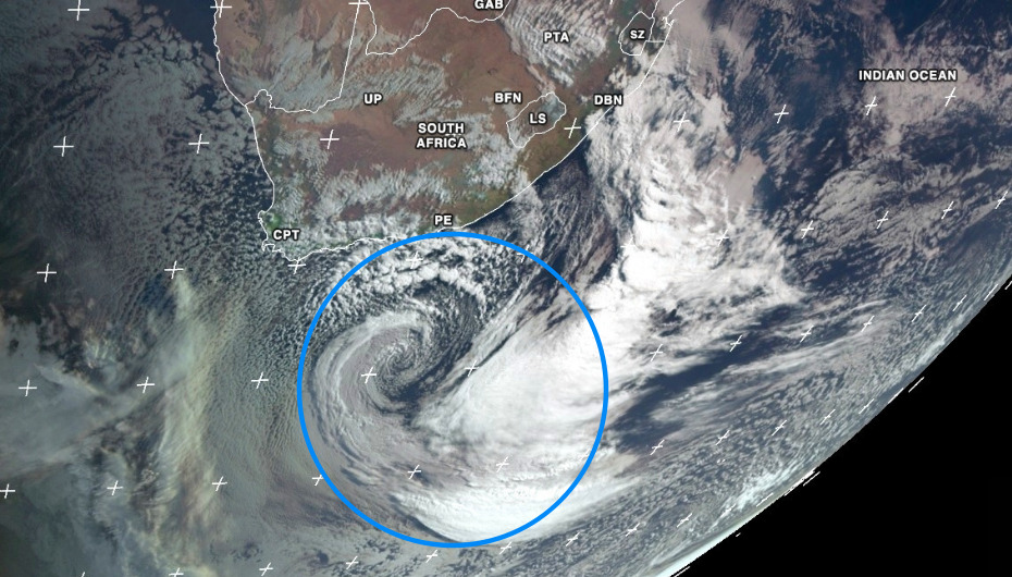
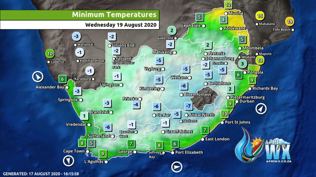
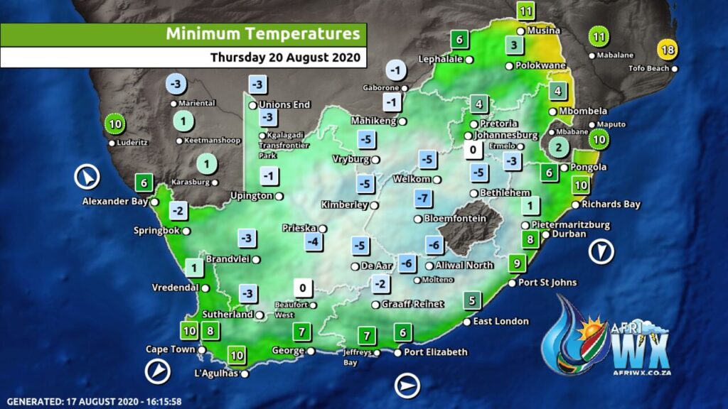
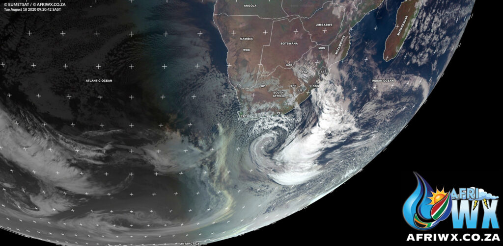
As the cold front moves off into the Indian Ocean the icy cold air and cold snap following in behind is yet to come with freezing temperatures expected across much of the country for the next two days.
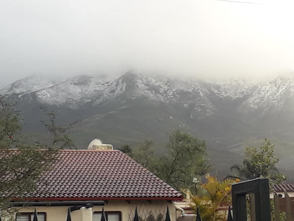
Lots of snow has fallen across the Western and Eastern Cape during the night and is continuing this morning. With lots of snow on the ground be prepared for a very cold 2 days ahead.
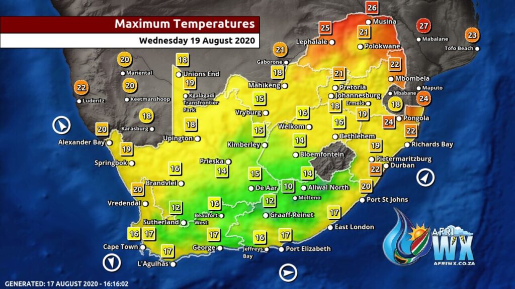
Even the daytime highs for Wednesday 19 August are looking very cool especially for the Western, Eastern, Northern Cape and Free State.
Stay safe and stay warm as there is also a high risk of Load Shedding and power cuts.
Join our AfriWX Telegram Weather Group
Don’t forget to join the free AfriWX group on Telegram Messenger, please download Telegram for Android or iPhone if you want to always be up to date with the latest weather maps.
Click to join our Telegram Group
It’s currently snowing in BloemfonteinVideo sent to us by: Isoldé Laesecke
📽️ Isoldé Laesecke

