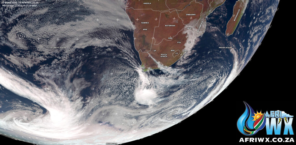
Last Updated on 17th August 2020 3:37 PM by AfriWX
☃️❄️⛄🥶
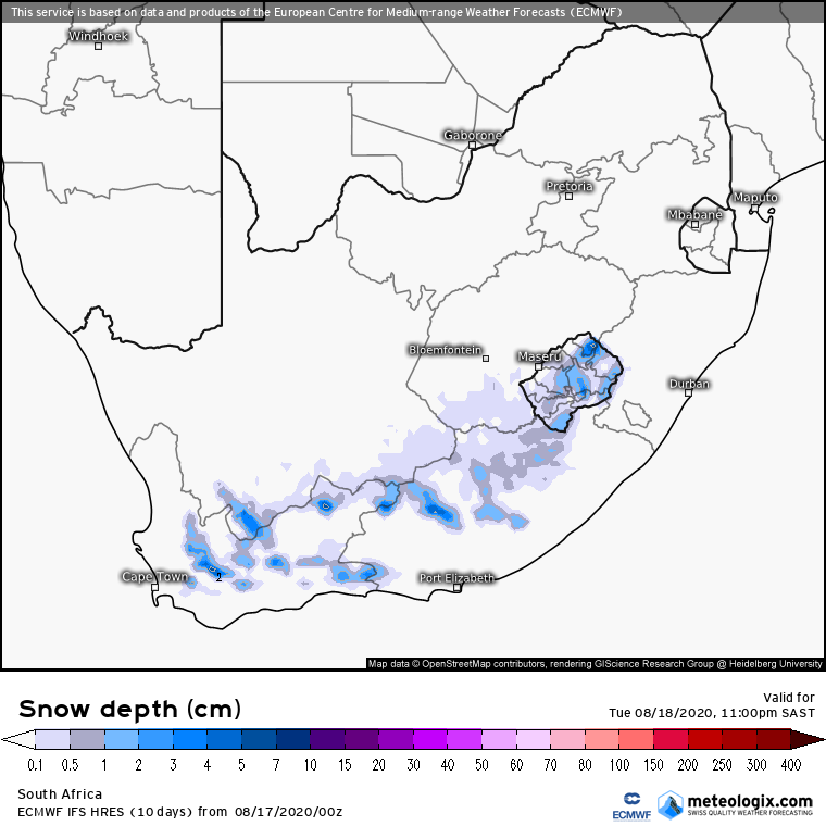
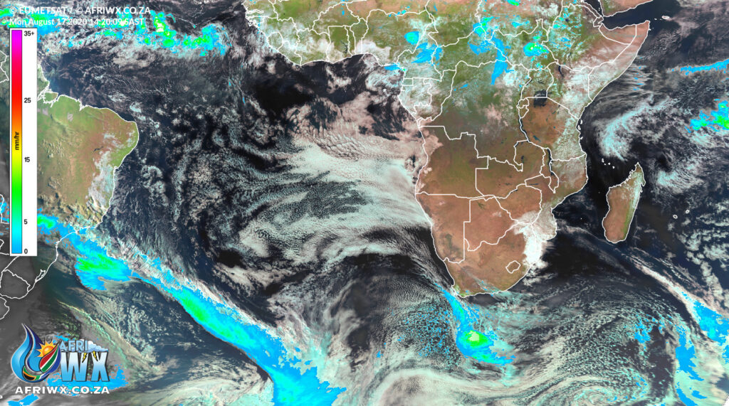
Significant widespread snowfall is expected over the country from this evening.
Weather models are showing a strengthening of the cold front due to make landfall tonight.
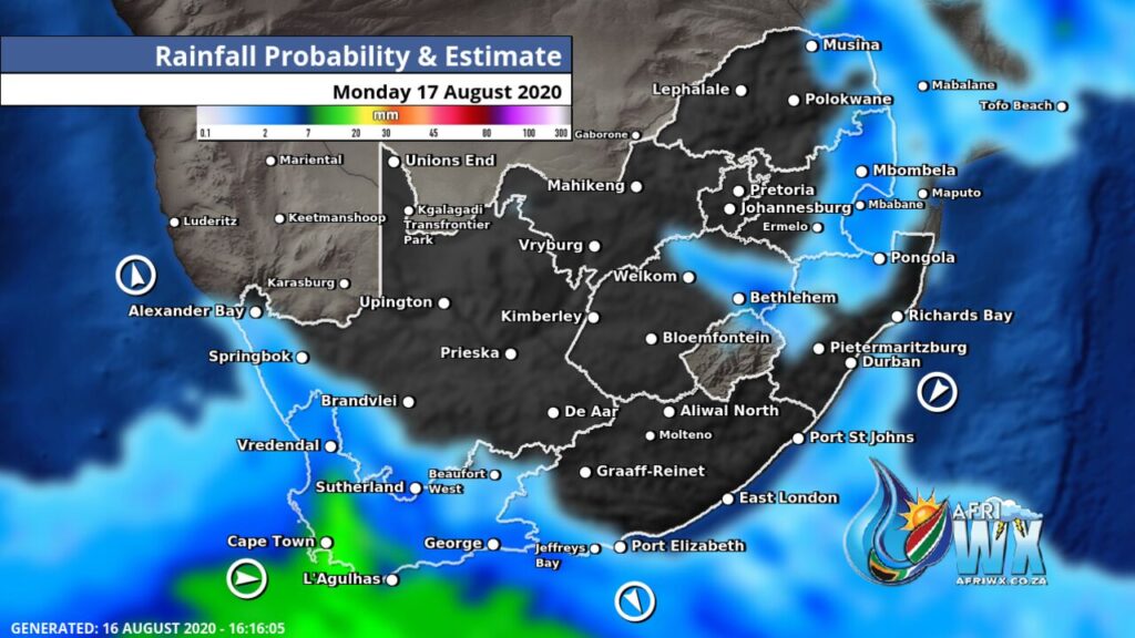
Widespread snowfall, up to 5-15 cm in places, is expected on mountain ranges of the Western & Eastern Cape & Lesotho with low-level snow in other places.
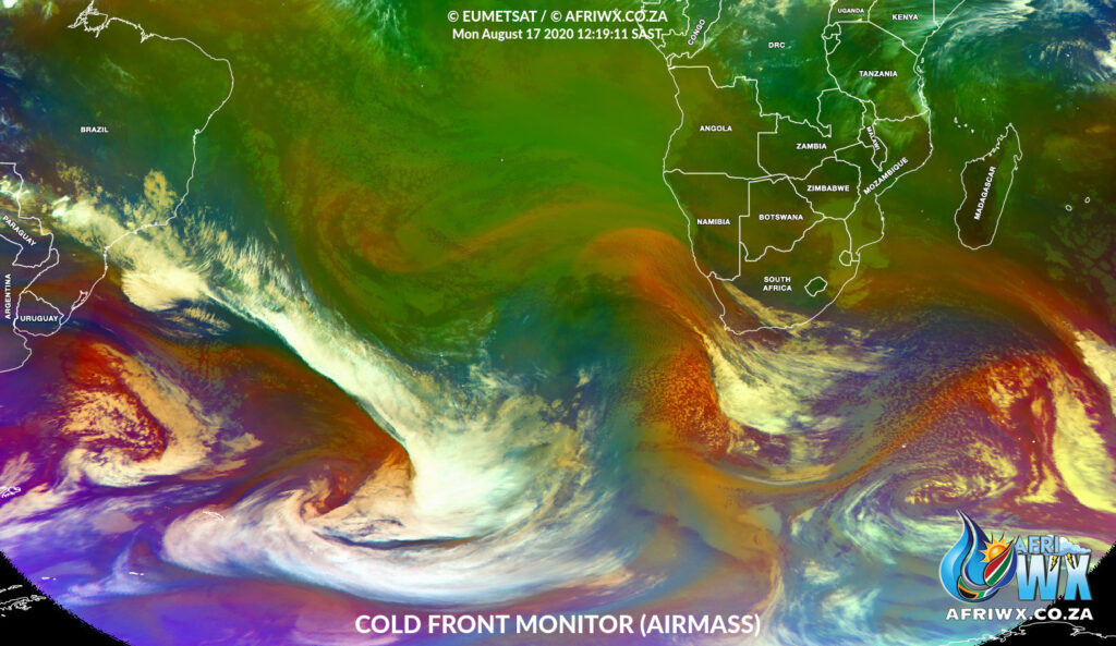
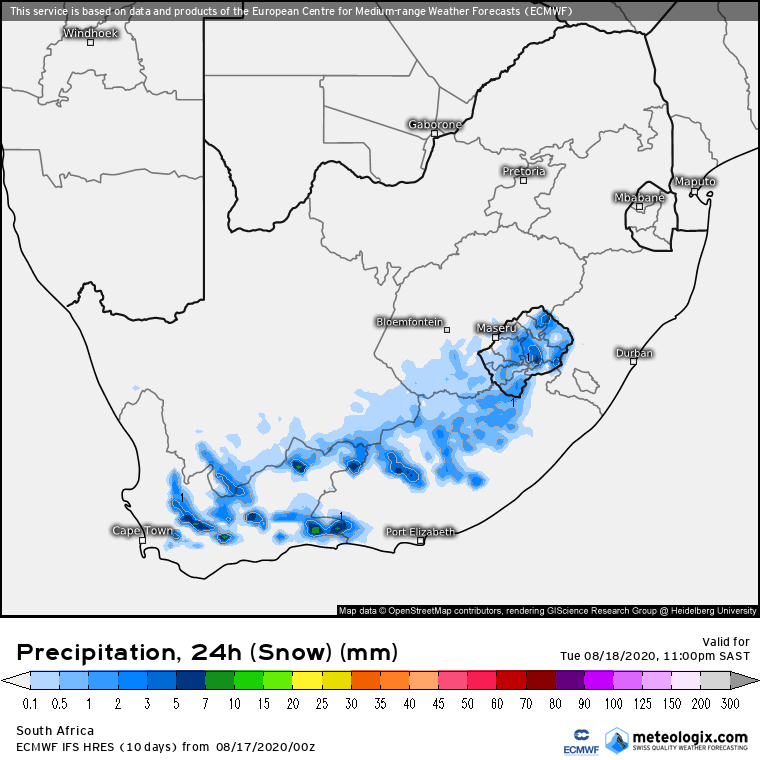
This #coldfront will reach far into the interior by Tuesday reaching the Free State, Gauteng, the North West, Mpumalanga and even parts of Limpopo but weather models do Not currently indicate any snow for these provinces only light rainfall.
Join our AfriWX Telegram Weather Group
Don’t forget to join the free AfriWX group on Telegram Messenger, please download Telegram for Android or iPhone if you want to always be up to date with the latest weather maps.
Click to join our Telegram Group
Stay safe and stay warm.
Weather Service Warnings and Advisories
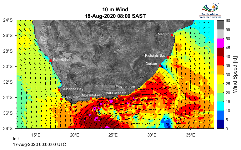
🌧️Gale force winds are expected along the SW and south coast of Western Cape and along the Eastern Cape coast from tonight into tomorrow (Tuesday). Disruptive snowfall possible over parts of Western and Eastern Cape tomorrow with good amounts of rain for parts of the south coast.
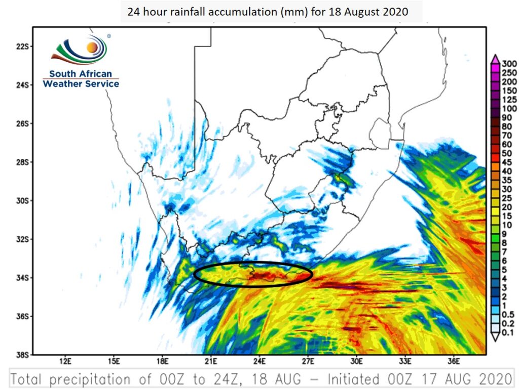
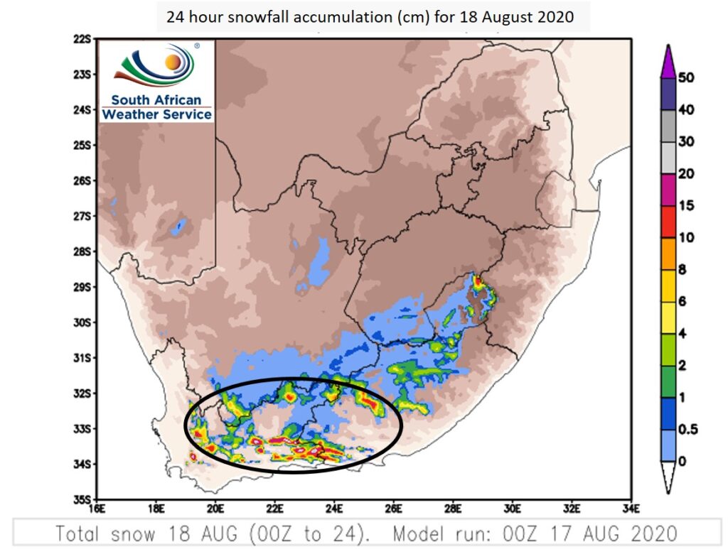
Snowfall is expected across the high lying areas of the Western Cape, Eastern Cape, southern high ground of the Northern Cape and Lesotho on Tuesday (18 August 2020).
WARNING: Disruptive snowfall is expected over the high ground of the Western Cape and southern high ground of the Northern Cape from overnight tonight into tomorrow (Tuesday 18 August 2020).
WARNING: Heavy rain is possible in the southern parts of Cape Winelands, Overberg and the Garden Route District tonight into tomorrow (Tuesday 18 August 2020).
WARNING: Localized flooding is expected over the Cape Metropole and Overberg Regions this afternoon into the evening (Monday 17 August 2020).
WARNING: High seas of 6.0 to 9.0m are expected between Cape Agulhas and Port Edward tomorrow (Tuesday 18 August 2020).
WARNING: Gale force SW winds of 65-80km/h are expected along the coast between Cape Agulhas and Port St Johns tomorrow (Tuesday 18 August 2020).
Join our AfriWX Telegram Weather Group
Don’t forget to join the free AfriWX group on Telegram Messenger, please download Telegram for Android or iPhone if you want to always be up to date with the latest weather maps.
Click to join our Telegram Group
Satellite Airmass

