Last Updated on 27th June 2021 6:48 PM by AfriWX
THE REGIONAL WEATHER FORECAST
FOR TOMORROW 2021-06-28
ISSUED AT 1500 SAST
BY THE SOUTH AFRICAN WEATHER SERVICE. THIS FORECAST WILL BE UPDATED AT 0500 SAST.
SEVERE WEATHER ALERTS
IMPACT-BASED
WARNINGS
1. Orange level 5 warning for RAIN resulting in flooding is expected over the City of Cape Town.
2. Yellow level 2 warning for RAIN resulting in localized flooding is expected over the southern parts of the West Coast, Cape Winelands and Overberg Districts of the Western Cape.
3. Yellow level 2 warning for WIND leading to difficulty in navigation at sea is expected between Cape Columbine and Cape Agulhas.
4. Yellow Level 2 Warning for WAVES resulting in difficulty in navigation at sea is expected between Cape Columbine and Plettenberg Bay.
5. Yellow level 2 Warning for Winds resulting in problems for high sided vehicles, localized power interruptions and localized infrastructure damages is expected over the West Coast, Cape Winelands and Central Karoo of the Western Cape, the southern Namakwa District and south-eastern parts of the Northern Cape and the Sarah Baartman, Chris Hani, Joe Gqabi and Raymond Mhlaba Districts of the Eastern Cape. FIRE DANGER
WARNINGS
Extremely high fire danger conditions are expected over the Central Karoo of the Western Cape, the eastern parts of the Northern Cape, Free State, southern half of the North West Province, southern parts of Gauteng and in places over the Eastern Cape. ADVISORIES Nil.
PROVINCIAL WEATHER OVERVIEW
GAUTENG PROVINCE
Windy in the south, otherwise fine and cool. The expected UVB sunburn Index High
MPUMALANGA PROVINCE
Fine and cool, but warm to hot in the Lowveld. It will be windy over the south-western Highveld.
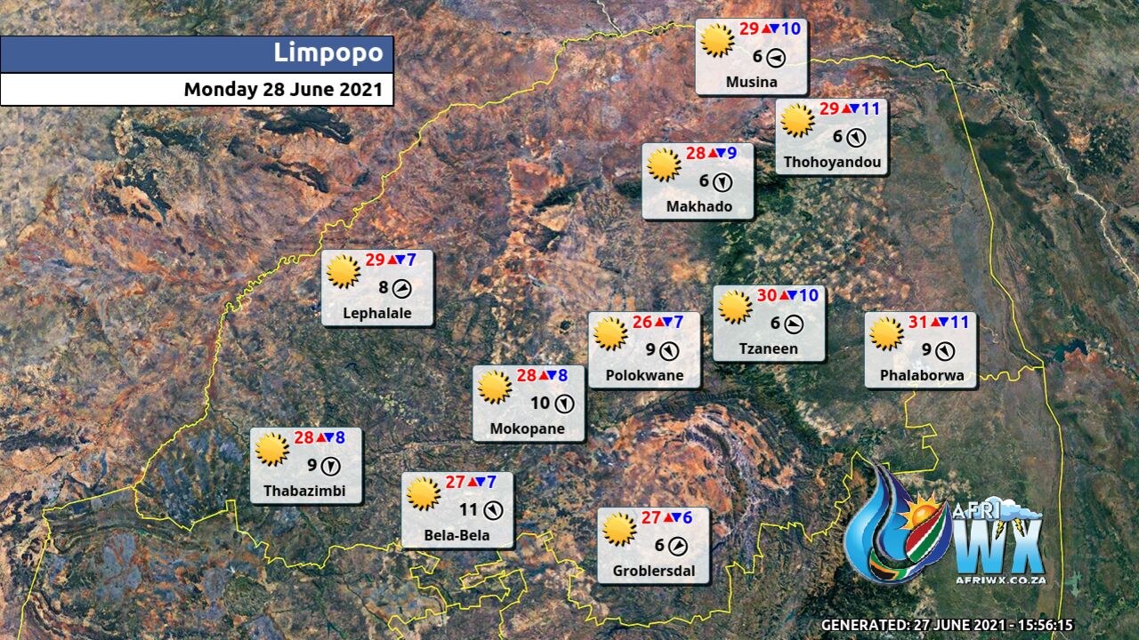
LIMPOPO PROVINCE
Fine and warm.
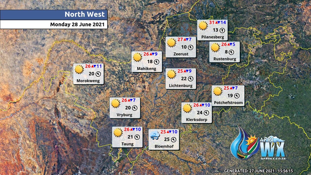
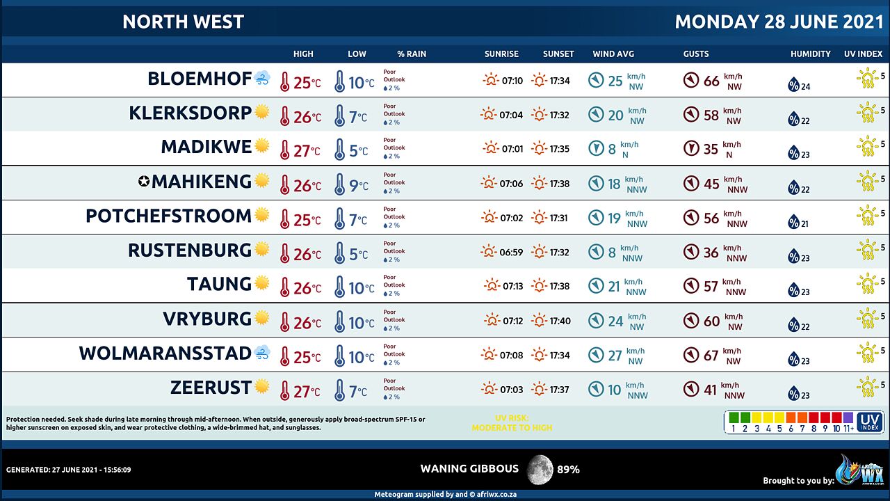
NORTH-WEST PROVINCE
Fine, windy and cool.
FREE STATE
Fine, windy and cool.
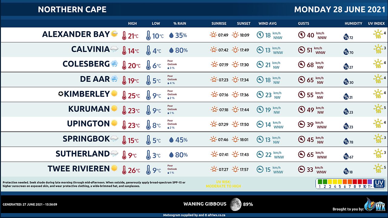
NORTHERN CAPE
Partly cloudy in the west and south-west where it will become cloudy from the afternoon with isolated to scattered showers and rain in the extreme south-west, otherwise fine, windy and cool but cold in the south-west. The wind along the coast will be moderate to fresh north-westerly north of Hondeklip Bay at first, otherwise strong to near gale moderating by the afternoon, but fresh to strong south-easterly in the south by the evening.
WESTERN CAPE
Fine in the east at first, otherwise cloudy, windy and cold to cool with scattered to widespread showers and rain over the western parts spreading to the eastern parts by the afternoon. The wind along the coast will be fresh to strong north-westerly to westerly reaching gale between Cape Columbine and Cape Agulhas until mid-morning becoming south-westerly to southerly south of Langebaan by the afternoon but moderating north of Cape Agulhas by the evening. The expected UVB sunburn Index Low
WESTERN HALF OF THE EASTERN CAPE
Warm in the south east, otherwise partly cloudy and cool, but windy over the interior. It will become cloudy with isolated showers and rain in the south-west from late afternoon. The wind along the coast will be light to moderate north-westerly, becoming fresh to strong south-westerly from late morning.
EASTERN HALF OF THE EASTERN CAPE
Warm along the coast, otherwise fine and cool, but windy in the north. It will become partly cloudy in the west from evening. The wind along the coast will be light to moderate north-easterly, becoming fresh to strong south-westerly from the south in the afternoon.
KWAZULU-NATAL
Fine and warm but hot in the north-east. It will be windy over the western interior. The wind along the coast will be moderate northerly to north-easterly, becoming fresh in the north at times. The expected UVB sunburn Index Very High
JOIN OUR FREE AFRIWX WEATHER GROUP on Telegram Messenger
Please download Telegram for Android or iPhone if you want to always be up to date with the latest weather maps.
CLICK HERE TO JOIN our Telegram Group Now
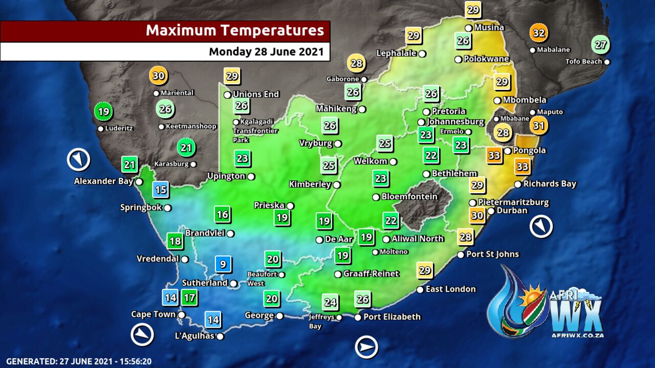
Maximum Temperatures Forecast for South Africa Monday 28 June 2021
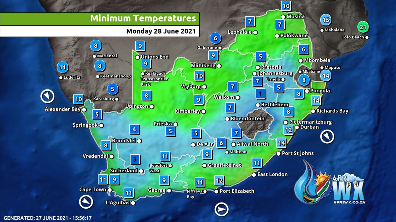
Minimum Temperatures Forecast for South Africa Monday 28 June 2021
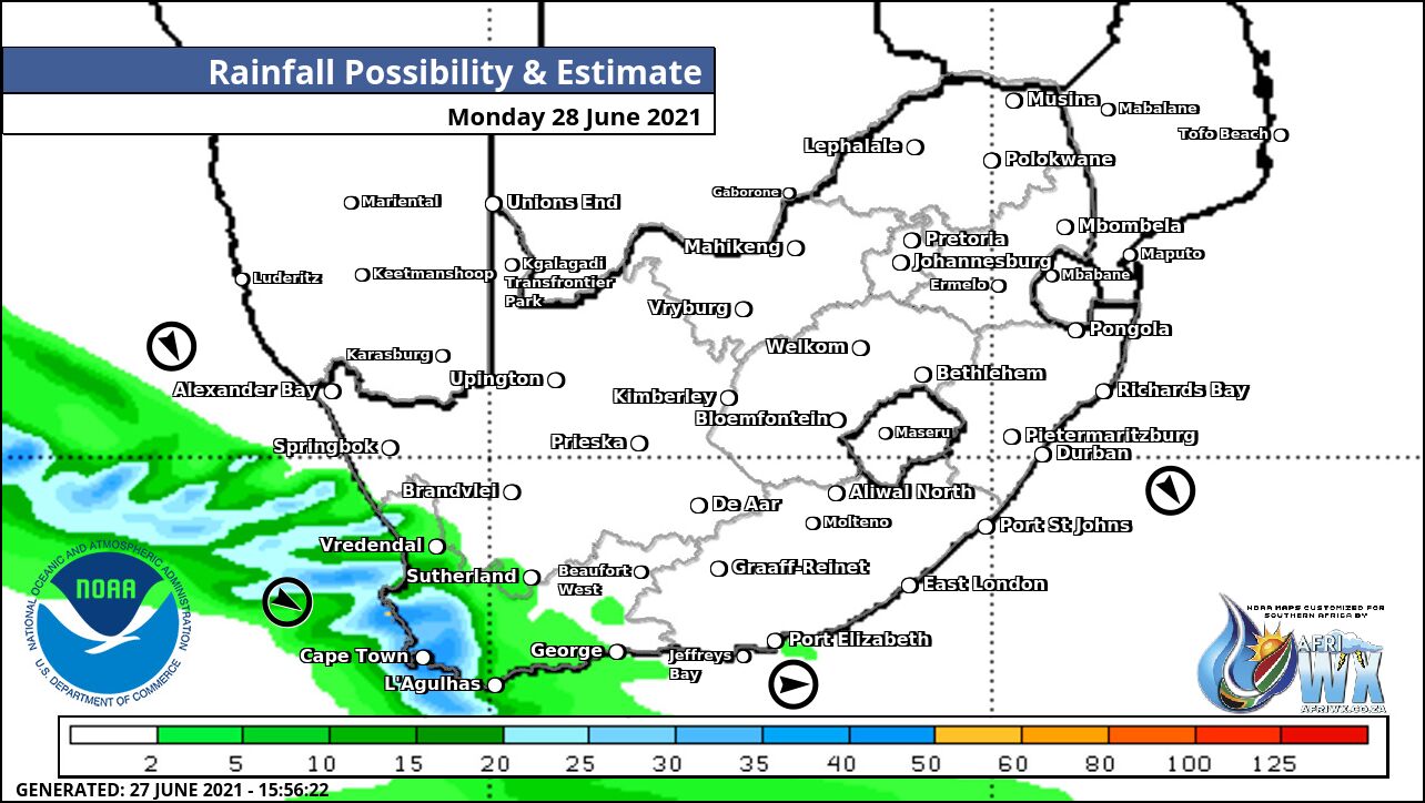
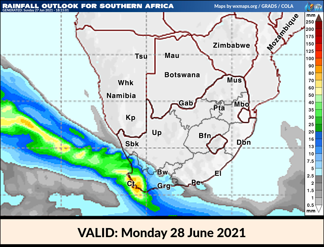
Rainfall Outlook for South Africa Monday 28 June 2021
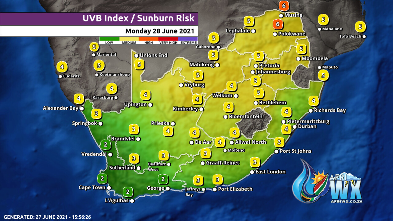
UVB Index Outlook for South Africa Monday 28 June 2021
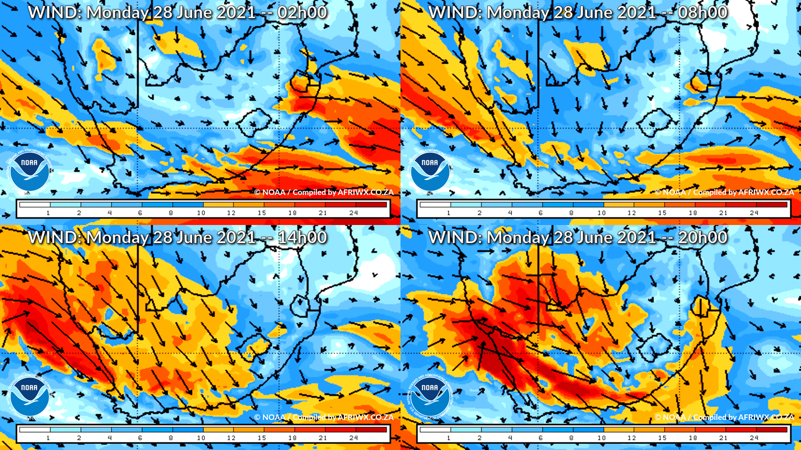
Wind Speed Direction and Gusts Map for South Africa Monday 28 June 2021
TRAVELLERS WEATHER FORECAST
FOR TOMORROW 2021-06-28
ISSUED AT 1500 SAST
BY THE SOUTH AFRICAN WEATHER SERVICE.
SEVERE WEATHER ALERTS
IMPACT-BASED
WARNINGS
1.
Orange level 5 warning for RAIN resulting in flooding is expected over the City of Cape Town.
2.
Yellow level 2 warning for RAIN resulting in localized flooding is expected over the southern parts of the West Coast, Cape Winelands and Overberg Districts of the Western Cape.
3.
Yellow level 2 warning for WIND leading to difficulty in navigation at sea is expected between Cape Columbine and Cape Agulhas.
4.
Yellow Level 2 Warning for WAVES resulting in difficulty in navigation at sea is expected between Cape Columbine and Plettenberg Bay.
5.
Yellow level 2 Warning for Winds resulting in problems for high sided vehicles, localized power interruptions and localized infrastructure damages is expected over the West Coast, Cape Winelands and Central Karoo of the Western Cape, the southern Namakwa District and south-eastern parts of the Northern Cape and the Sarah Baartman, Chris Hani, Joe Gqabi and Raymond Mhlaba Districts of the Eastern Cape.
FIRE DANGER
WARNINGS
Extremely high fire danger conditions are expected over the Central Karoo of the Western Cape, the eastern parts of the Northern Cape, Free State, southern half of the North West Province, southern parts of Gauteng and in places over the Eastern Cape.
ADVISORIES Nil.
WEATHER IN OUR TOP CITIES
PRETORIA
Fine.
Minimum/Maximum 4/24 The expected UVB Sunburn Index High
JOHANNESBURG
Fine and windy.
Minimum/Maximum 3/21
VEREENIGING
Fine and windy.
Minimum/Maximum 0/22
MBOMBELA
Fine.
Minimum/Maximum 8/23
POLOKWANE
Fine.
Minimum/Maximum 5/25
MAHIKENG
Fine and windy.
Minimum/Maximum 5/26
VRYBURG
Fine and windy.
Minimum/Maximum 4/23
BLOEMFONTEIN
Fine and windy.
Minimum/Maximum 1/22
KIMBERLEY
Fine and windy.
Minimum/Maximum 5/24
UPINGTON
Fine and windy.
Minimum/Maximum 4/22
CAPE TOWN
Cloudy with widespread showers and rain.
Wind Strong to near gale north-westerly becoming moderate south-westerly by the early afternoon but light and variable in the evening.
Minimum/Maximum 13/14 The expected UVB Sunburn Index Low
GEORGE
Fine at first, otherwise cloudy with scattered rain showers from the afternoon.
Wind Light to moderate north-westerly to westerly reaching fresh at times in the afternoon.
Minimum/Maximum 9/17 GQEBERHA Fine, becoming cloudy from late afternoon with isolated evening showers.
Wind Moderate north-westerly, becoming moderate to fresh south-westerly from late morning, but strong from late afternoon.
Minimum/Maximum 9/23
EAST LONDON
Fine, becoming cloudy in the evening.
Wind Moderate north-westerly, becoming moderate to fresh south-westerly in the afternoon.
Minimum/Maximum 12/26
DURBAN
Fine.
Wind Moderate northerly to north-easterly.
Minimum/Maximum 11/30 The expected UVB Sunburn Index Very High
RICHARDS BAY
Fine.
Wind Moderate north-easterly, becoming fresh at times.
Minimum/Maximum 13/30
PIETERMARITZBURG
Fine.
Minimum/Maximum 7/28
JOIN OUR FREE AFRIWX WEATHER GROUP on Telegram Messenger
Please download Telegram for Android or iPhone if you want to always be up to date with the latest weather maps.
CLICK HERE TO JOIN our Telegram Group Now
Rainfall Outlook for Tomorrow Monday 28 June 2021
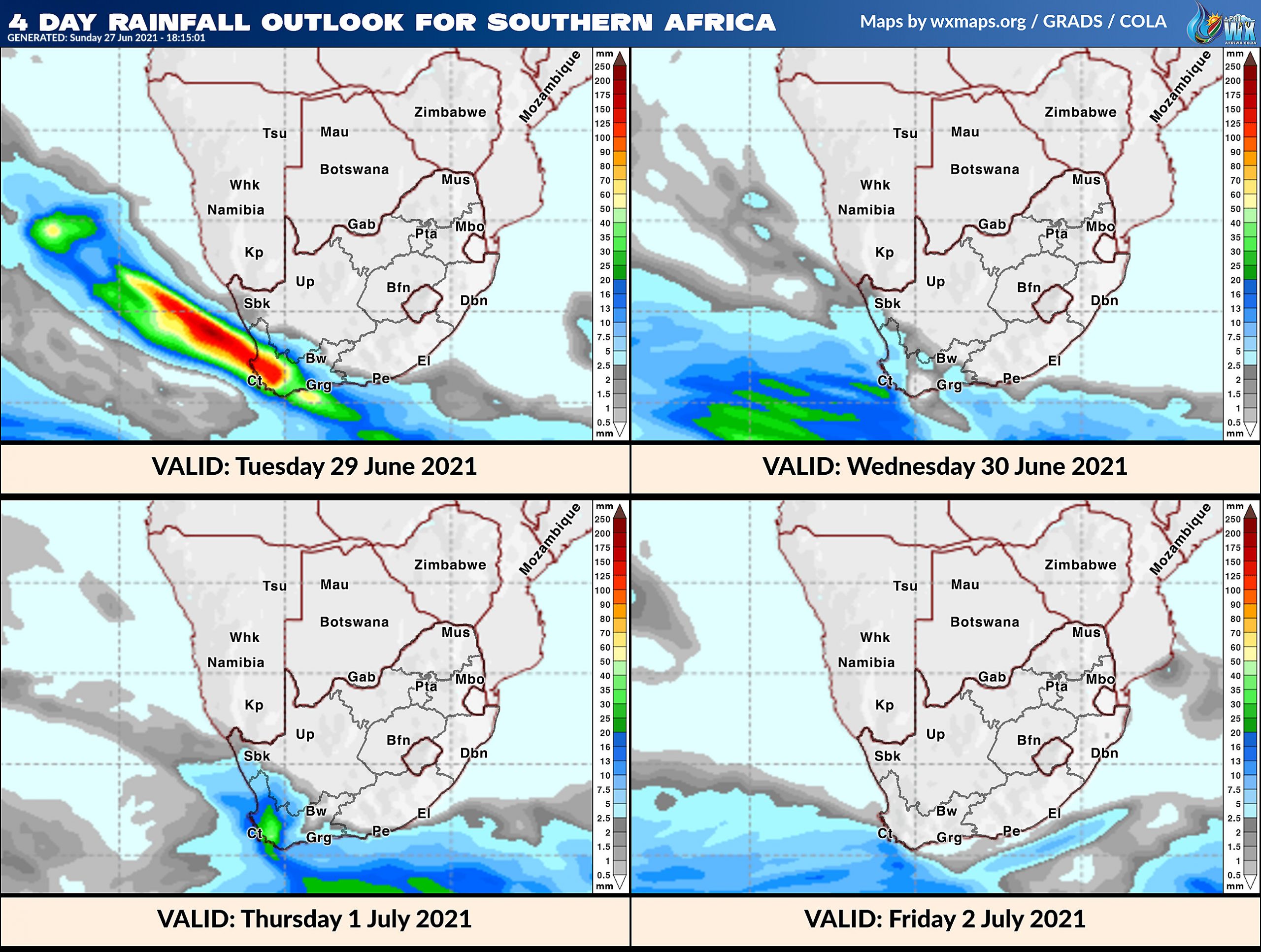
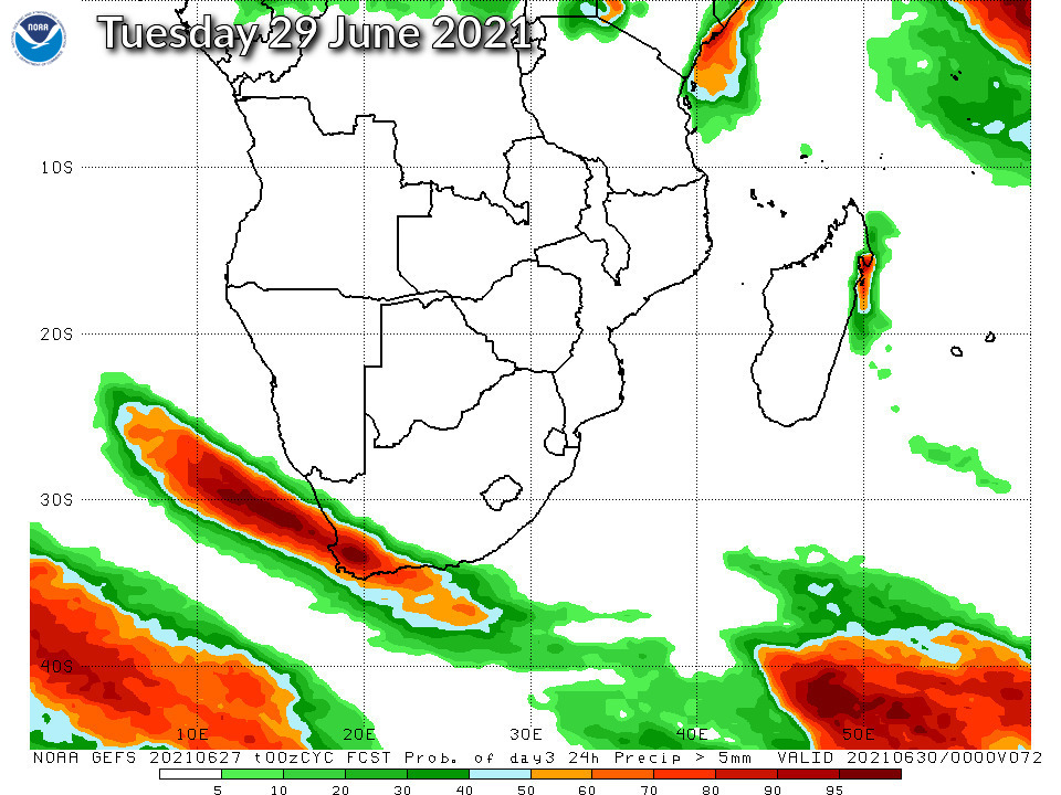
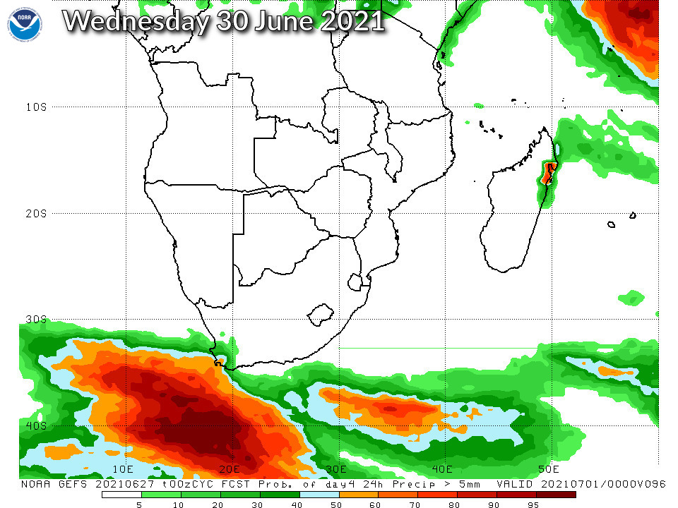
4 Day Rainfall Outlook for Southern Africa
14 Day Rainfall Outlook for Southern Africa
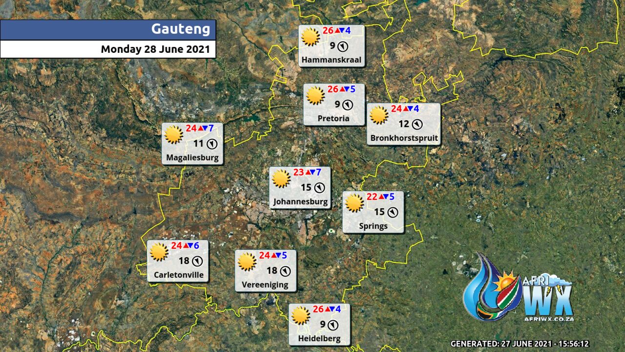
Gauteng Province Weather Map Monday 28 June 2021
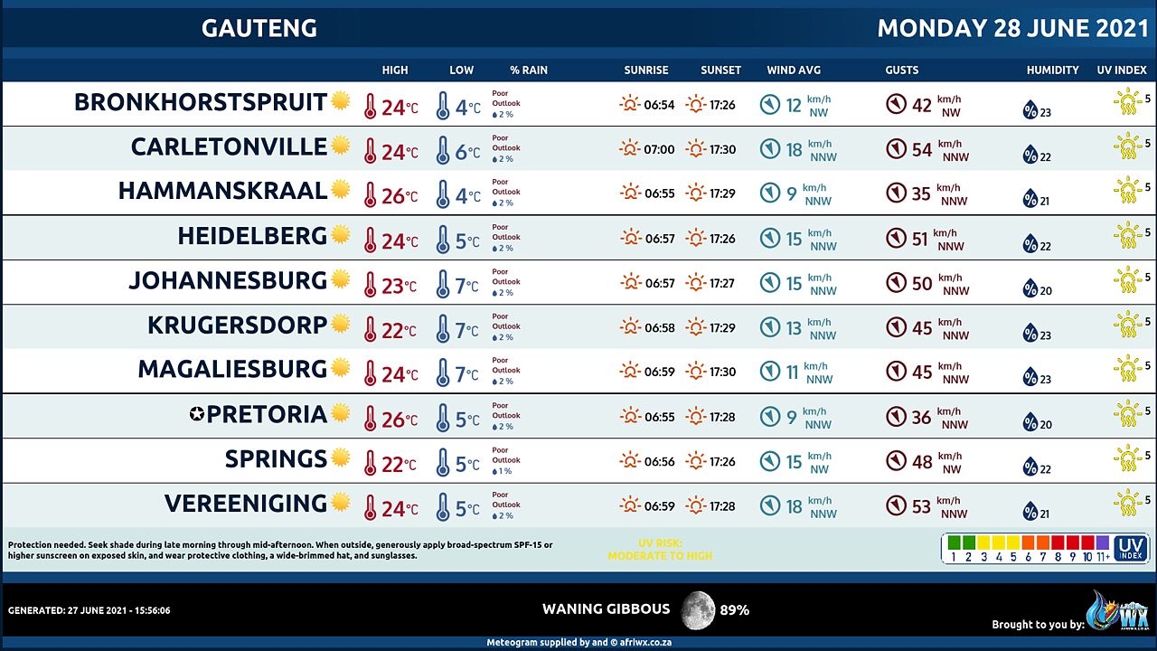
Gauteng Province Weather Meteogram Monday 28 June 2021
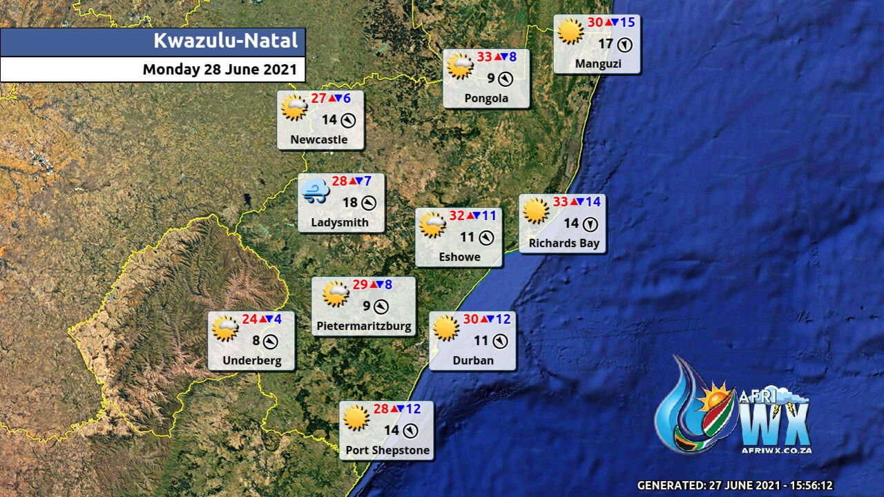
Kwazulu-Natal Province Weather Map Monday 28 June 2021
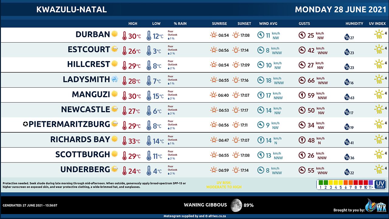
Kwazulu-Natal Province Weather Meteogram Monday 28 June 2021
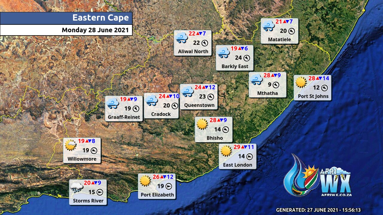
Eastern Cape Province Weather Map Monday 28 June 2021
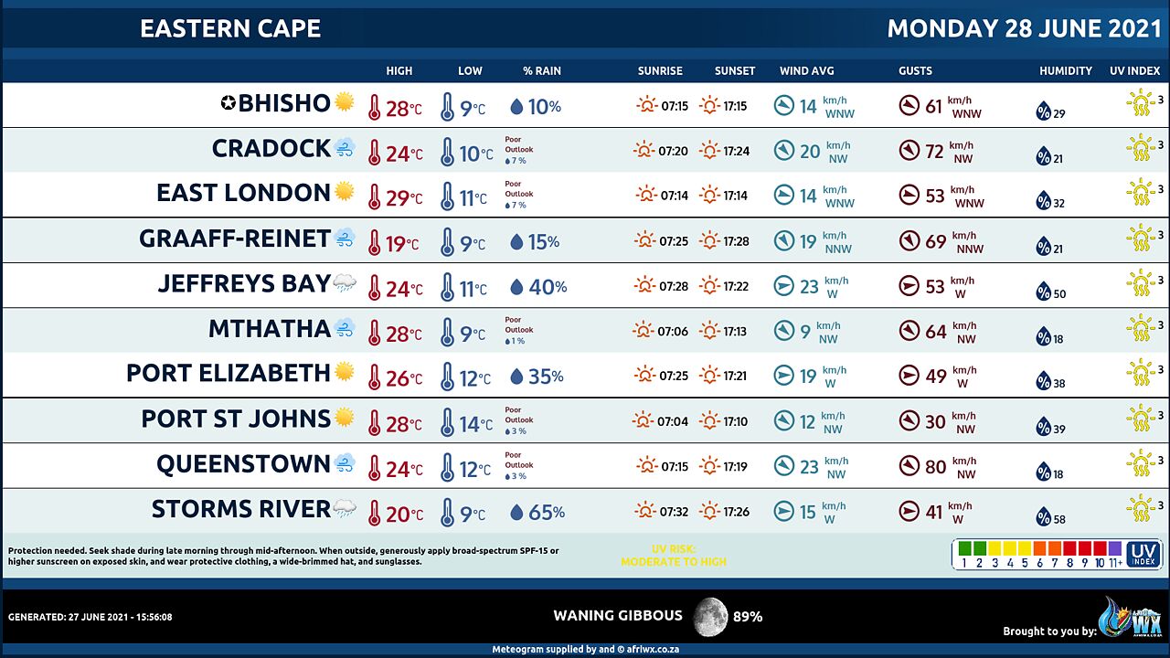
Eastern Cape Province Weather Meteogram Monday 28 June 2021
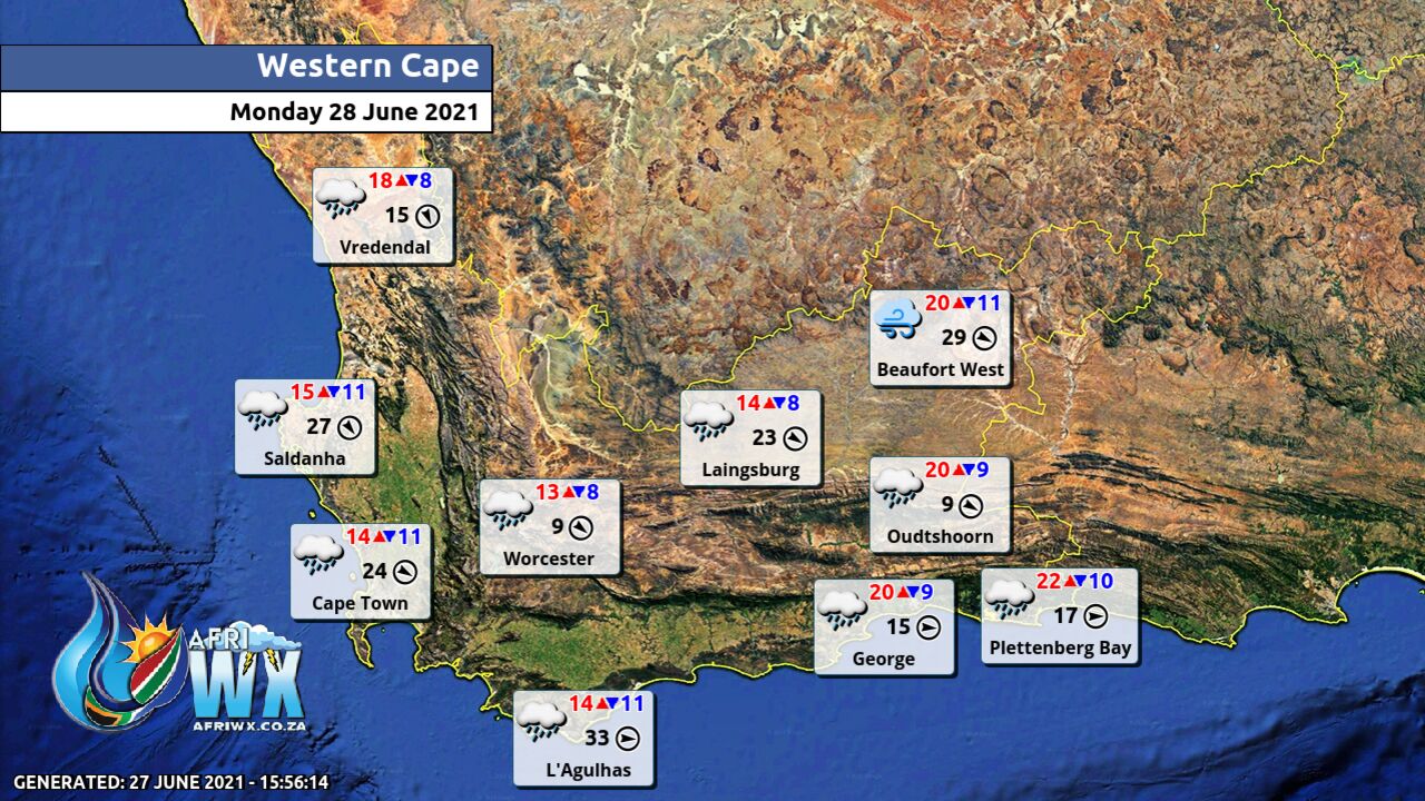
Western Cape Province Weather Map Monday 28 June 2021
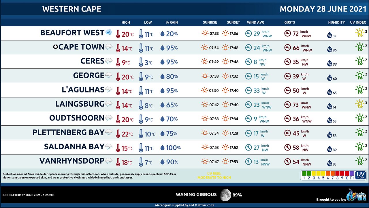
Western Cape Province Weather Meteogram Monday 28 June 2021
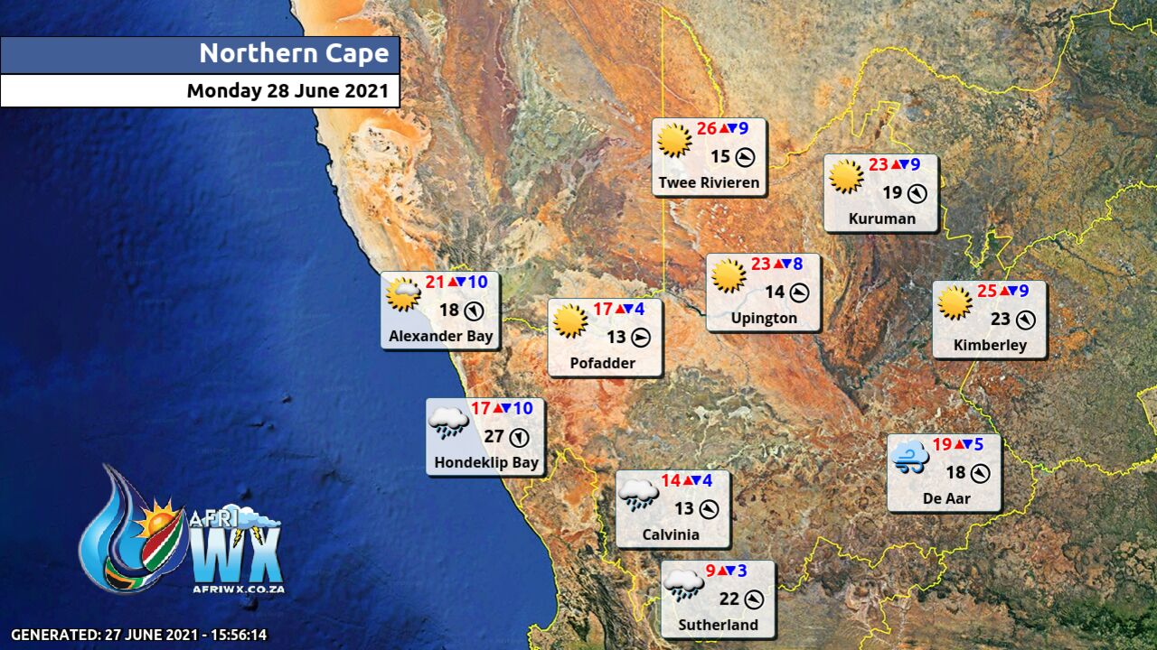
Northern Cape Province Weather Map Monday 28 June 2021
Northern Cape Province Weather Meteogram Monday 28 June 2021
North-West Province Weather Map Monday 28 June 2021
North-West Province Weather Meteogram Monday 28 June 2021
Limpopo Province Weather Map Monday 28 June 2021
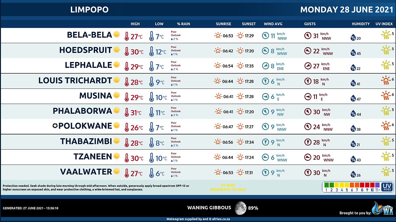
Limpopo Province Weather Meteogram Monday 28 June 2021
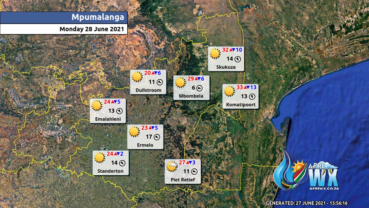
Mpumalanga Province Weather Map Monday 28 June 2021
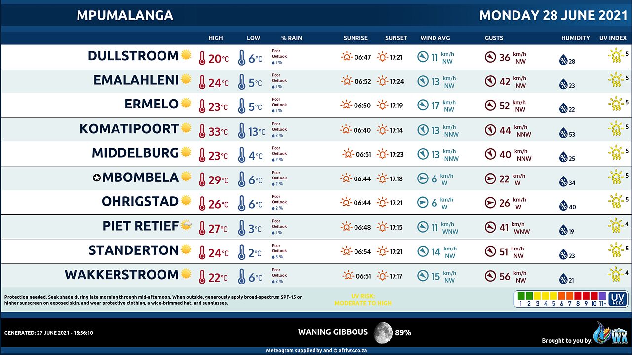
Mpumalanga Province Weather Meteogram Monday 28 June 2021
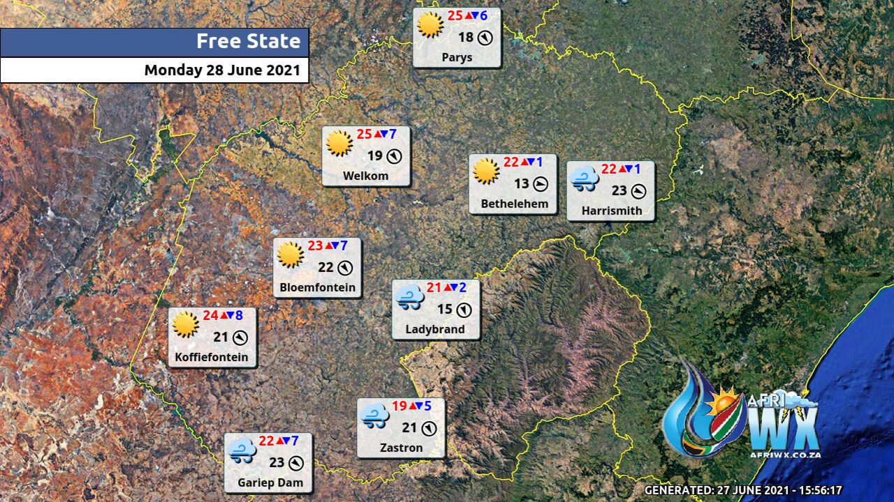
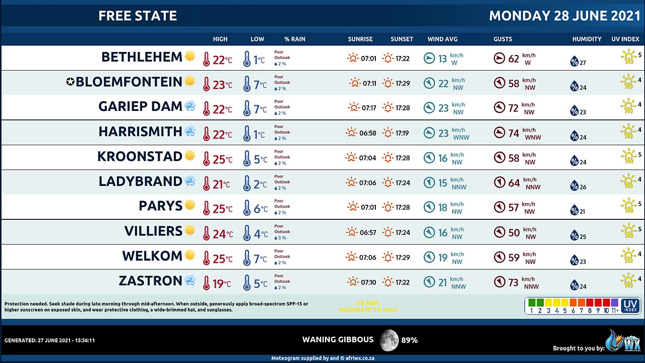
Free State Province Weather Map Monday 28 June 2021
Free State Province Weather Meteogram Monday 28 June 2021
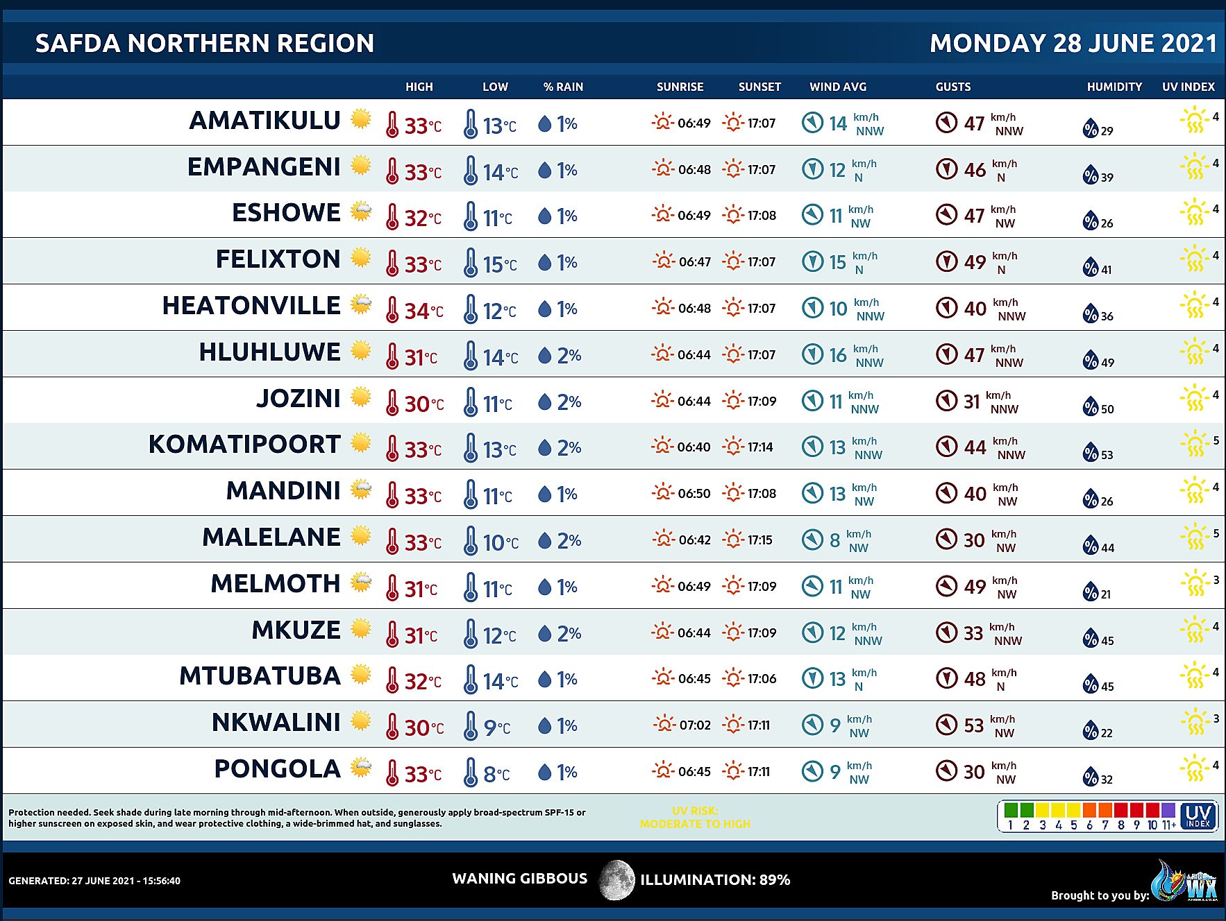
SAFDA Sugar Cane Farming (Northern Kwazulu-Natal) Weather Forecast Monday 28 June 2021
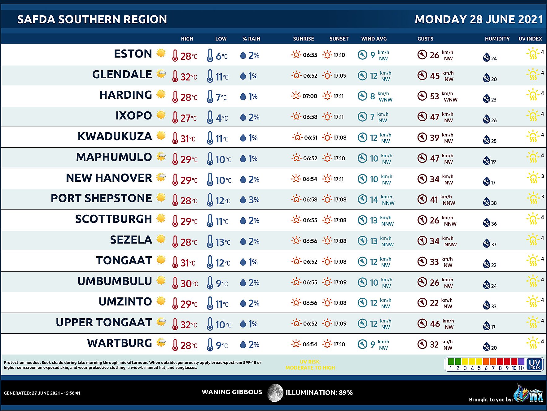
SAFDA Sugar Cane Farming (Southern Kwazulu-Natal) Weather Forecast Monday 28 June 2021
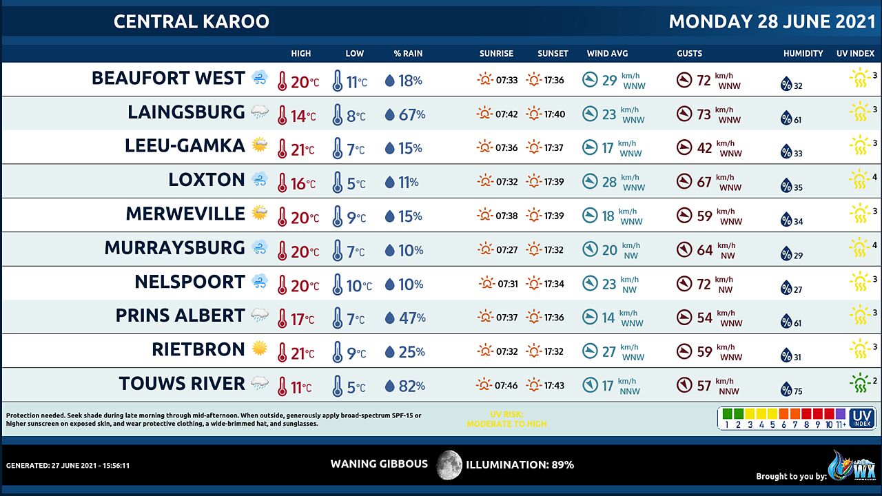
Central Karoo (Northern Cape) Farming Weather Forecast Monday 28 June 2021
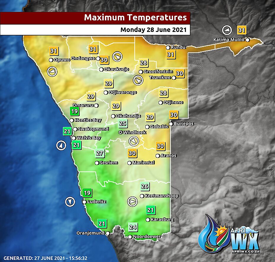
Namibia Maximum Temperatures Monday 28 June 2021
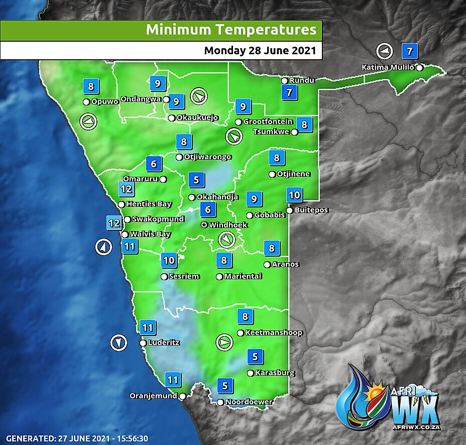
Namibia Minimum Temperatures Monday 28 June 2021
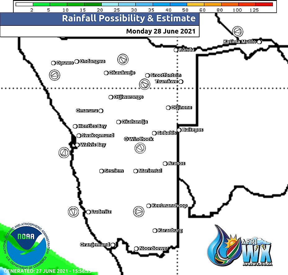
Namibia Rainfall Probability Map Monday 28 June 2021
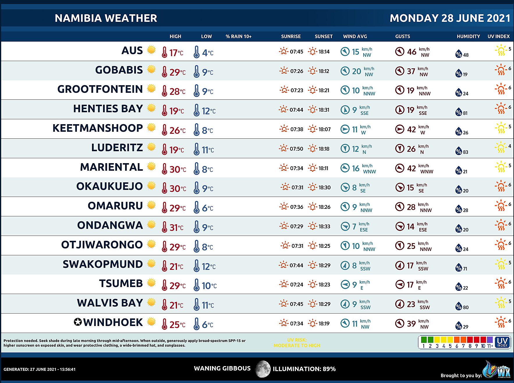
Namibia Weather Meteogram Monday 28 June 2021
Namibia Meteorological Services METEONA Weather Forecast Monday 28 June 2021
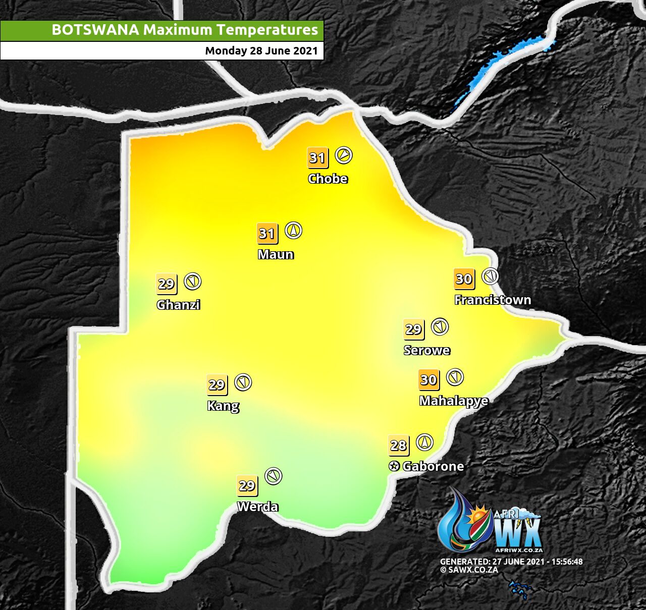
Botswana Maximum Temperatures Monday 28 June 2021
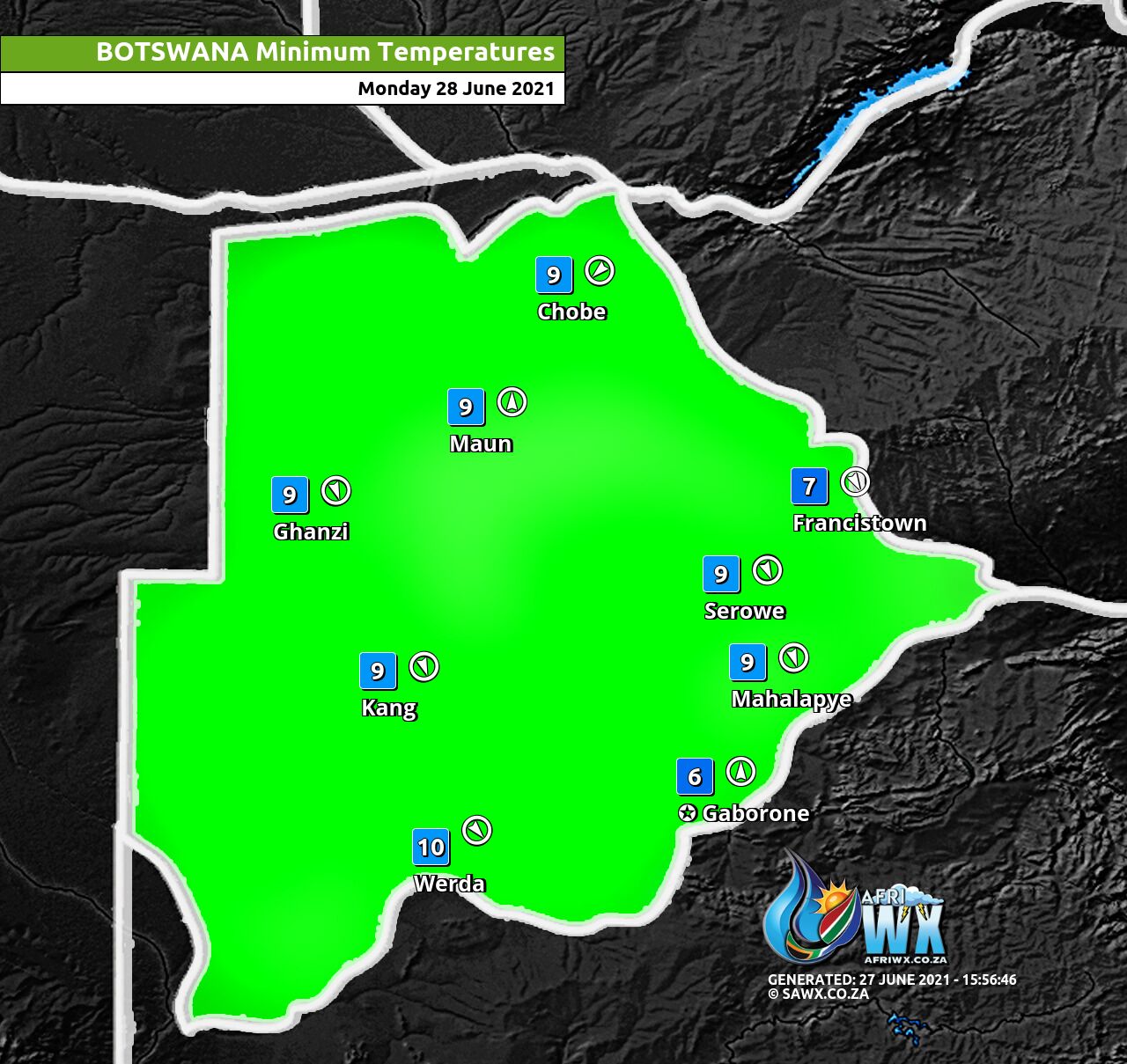
Botswana Minimum Temperatures Monday 28 June 2021
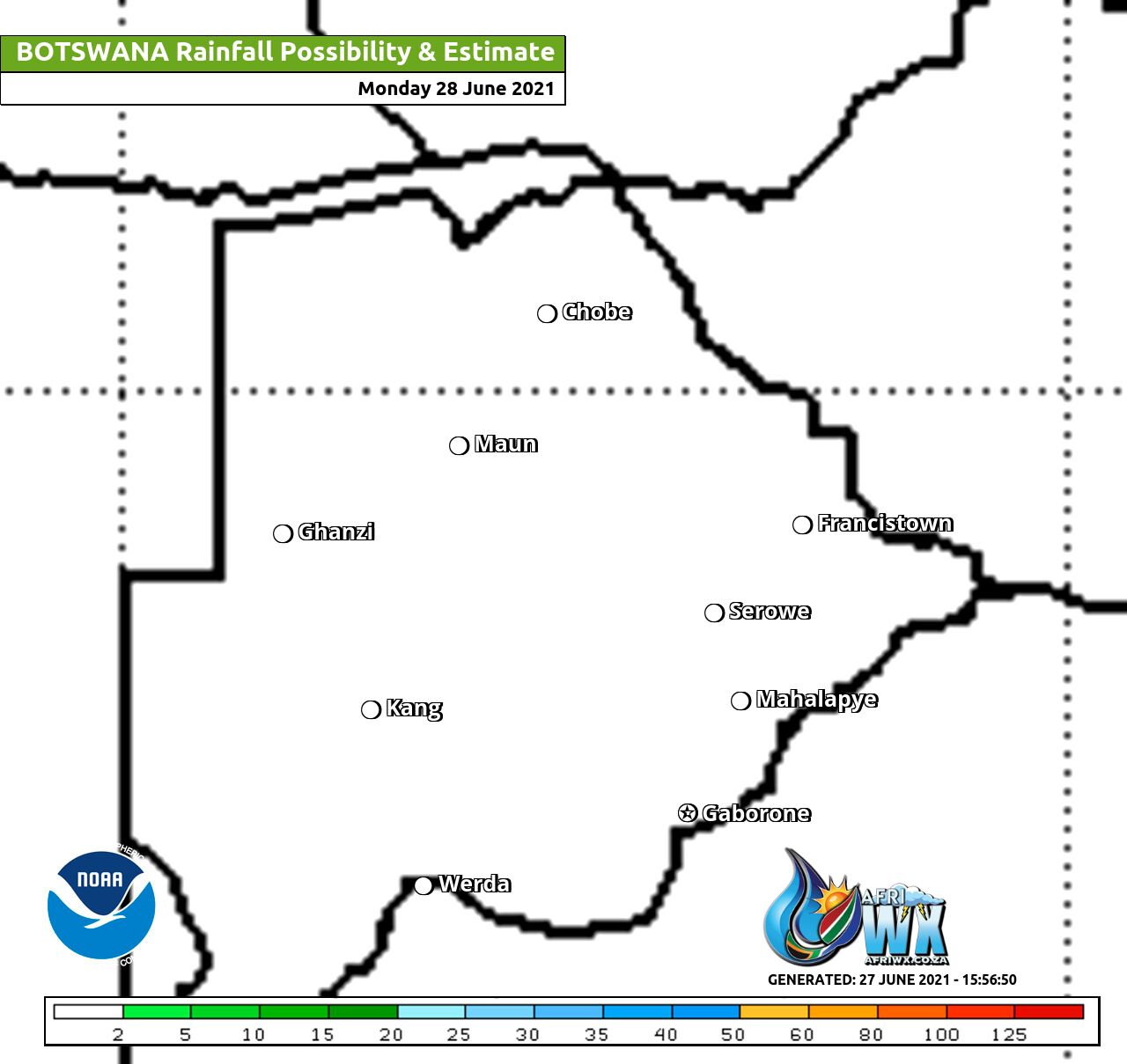
Botswana Rainfall Possibility Map Monday 28 June 2021
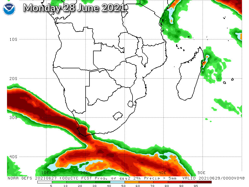
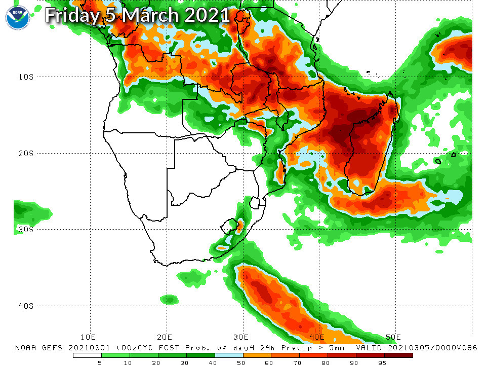
NOAA GEFS Global Ensemble Rainfall Outlook Southern Africa
JOIN OUR FREE AFRIWX WEATHER GROUP on Telegram Messenger
Please download Telegram for Android or iPhone if you want to always be up to date with the latest weather maps.
CLICK HERE TO JOIN our Telegram Group Now


