Last Updated on 9th July 2020 7:07 AM by AfriWX
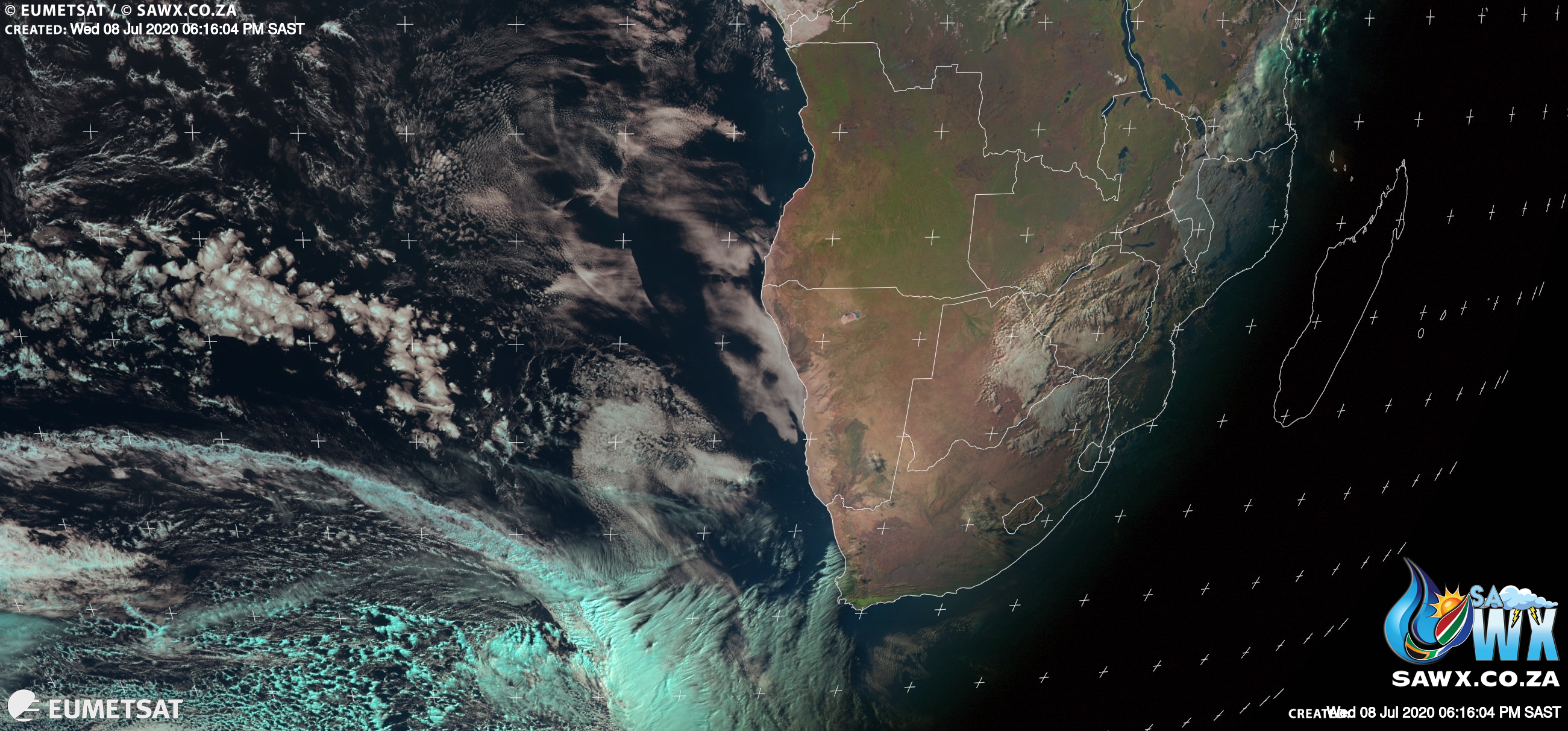
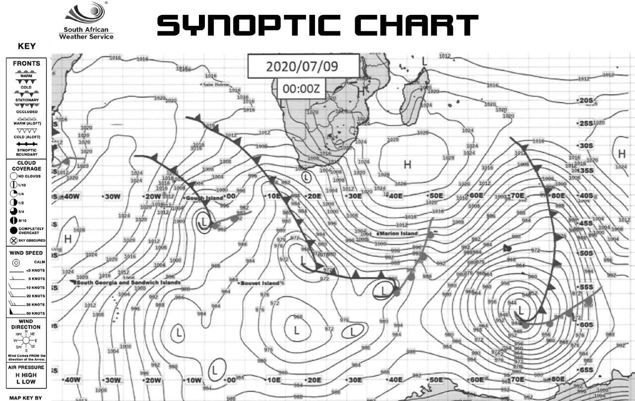
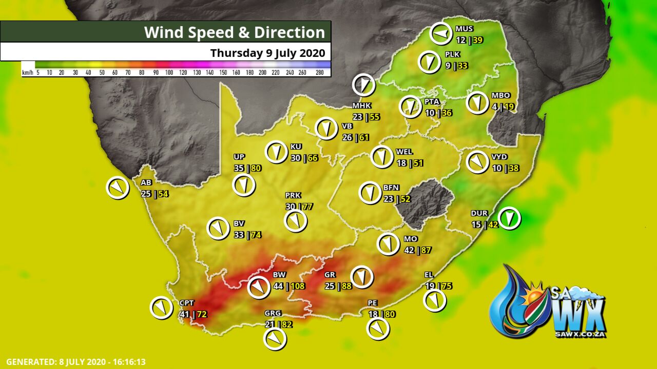
We have not 1, not 2 but 3 cold fronts in a row moving into South Africa. The first expected to make landfall tomorrow Thursday 9 July 2020 is being followed closely by another much stronger and bigger front expected Friday.
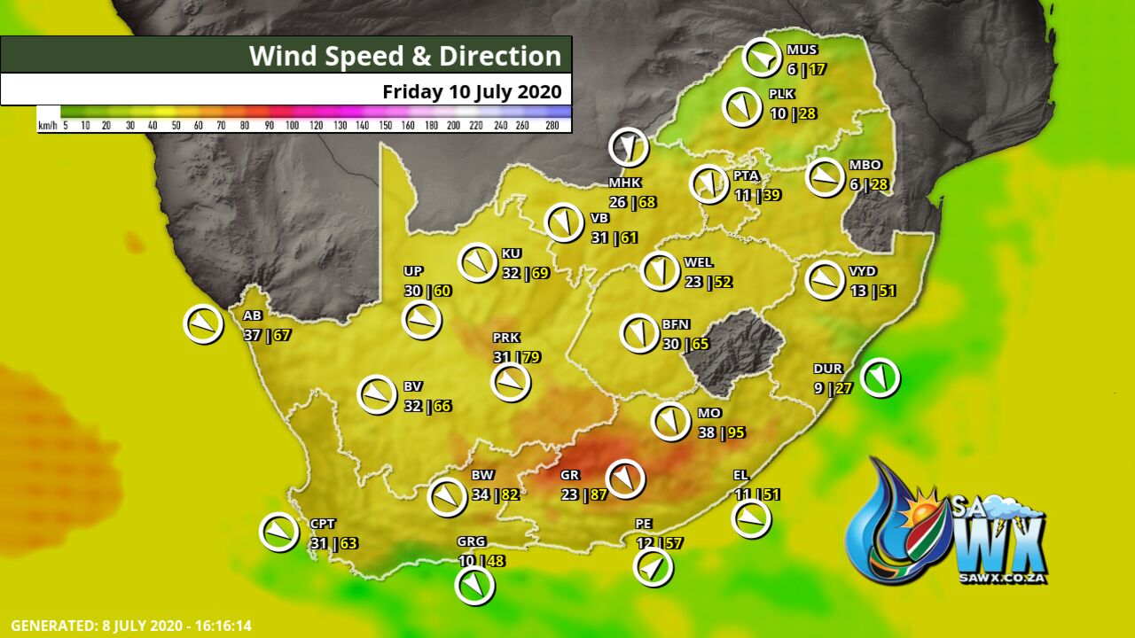
The front arriving Friday arrives with a mighty punch bringing heavy rainfall, widespread snowfalls and Gale force winds.
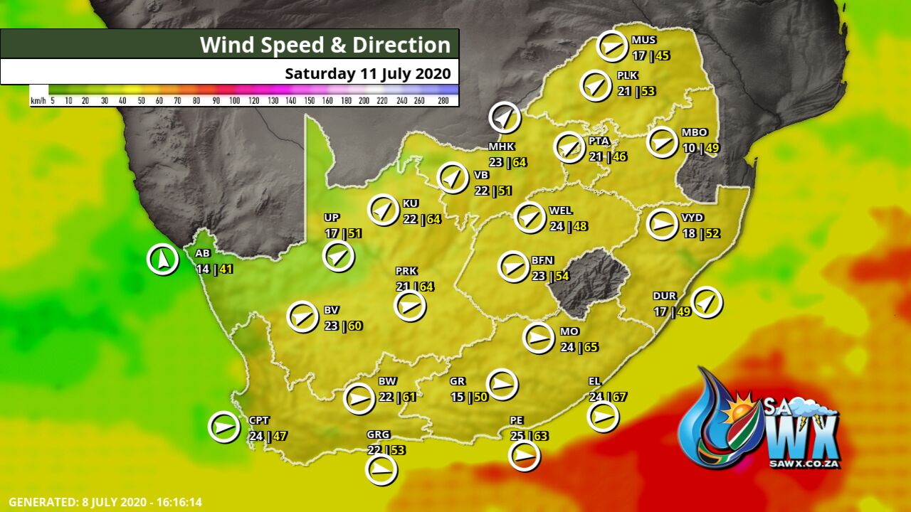
As if that weren’t enough of an icy winter punch, a third cold front arrives Monday bringing even more rain and snowfall with it.
While may parts of the Western Cape, Eastern Cape, Northern Cape and some parts of the Free State and KwaZulu Natal are set to see snow, Lesotho above all places promises to see some of the heaviest snowfall it has seen in some time.
As always we at SAWX are monitoring this closely and will keep you updated.
Stay safe and stay warm, winter is only getting started.
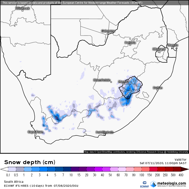
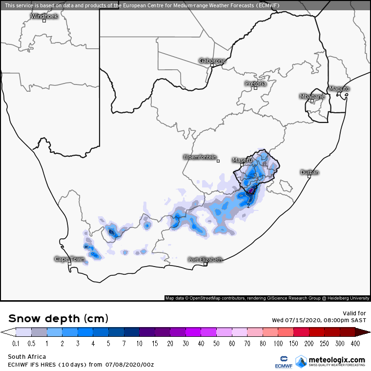
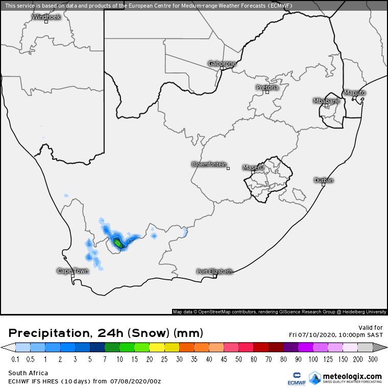
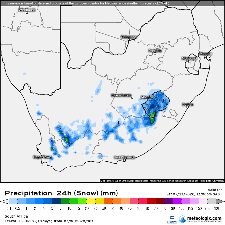
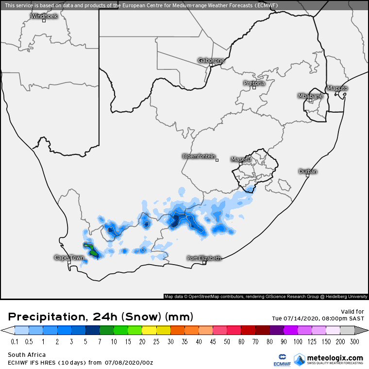
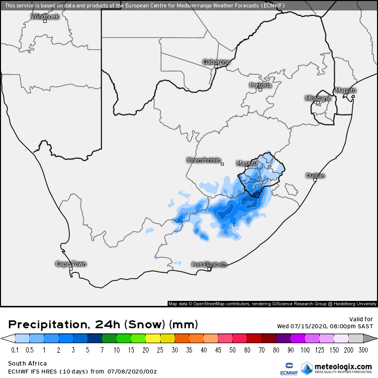
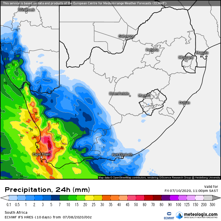
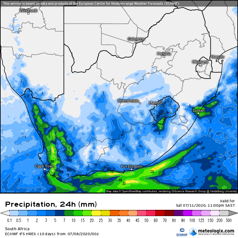
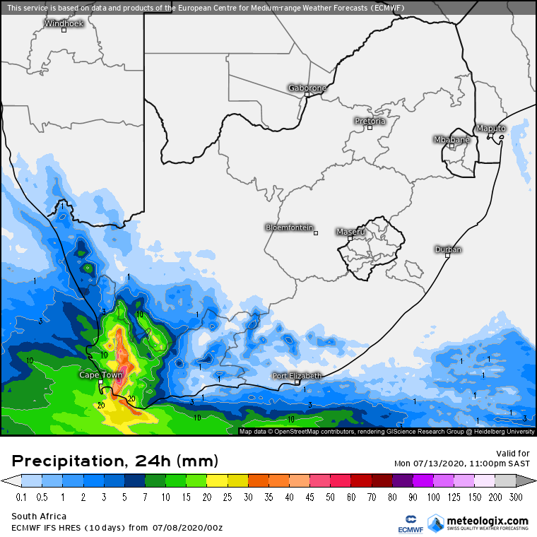
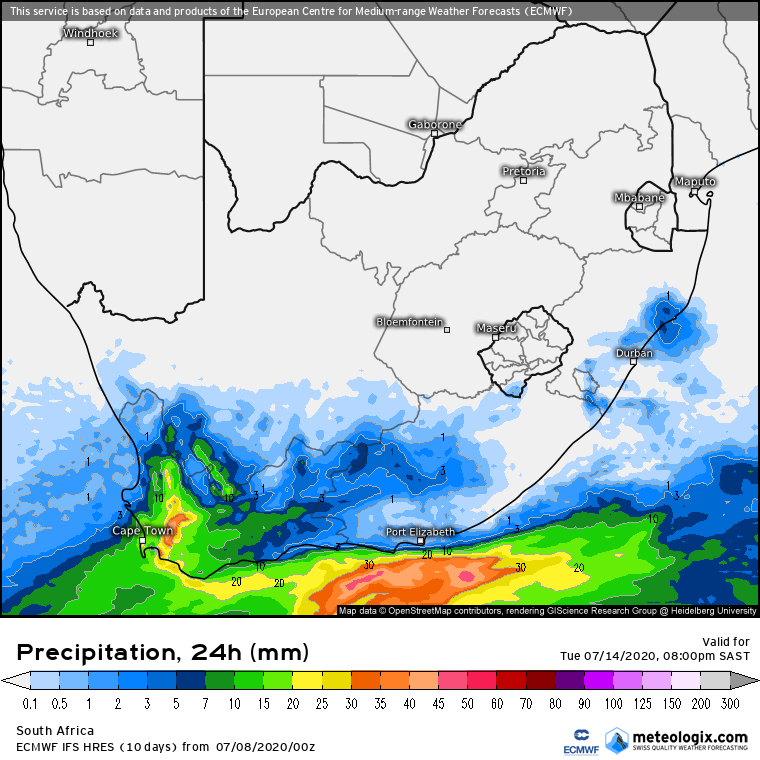
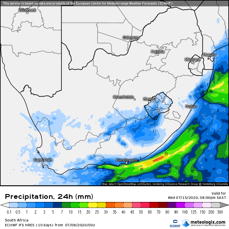
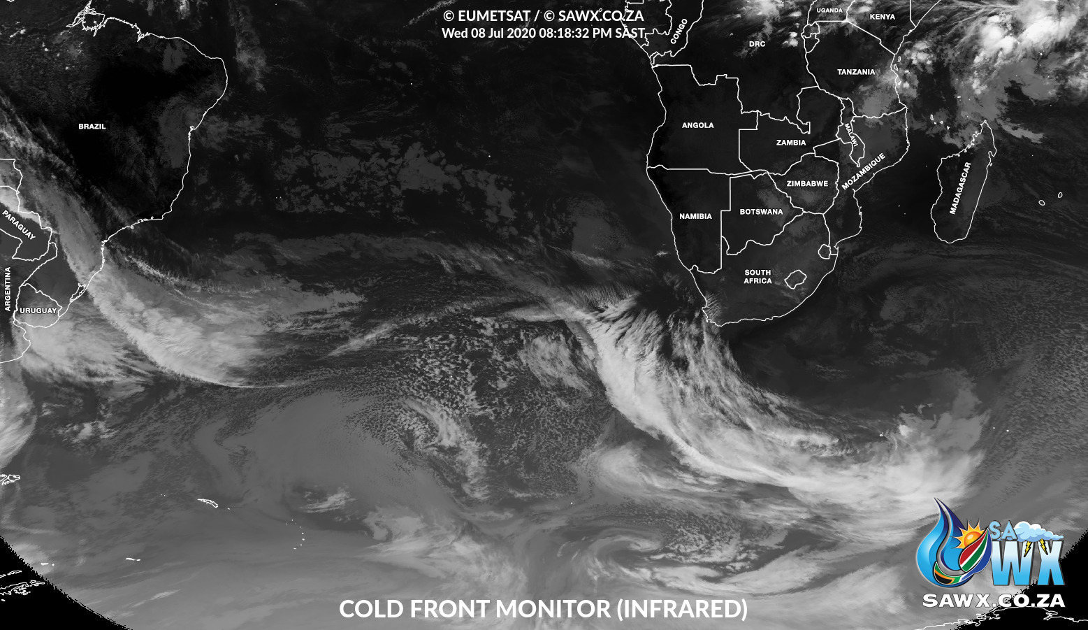
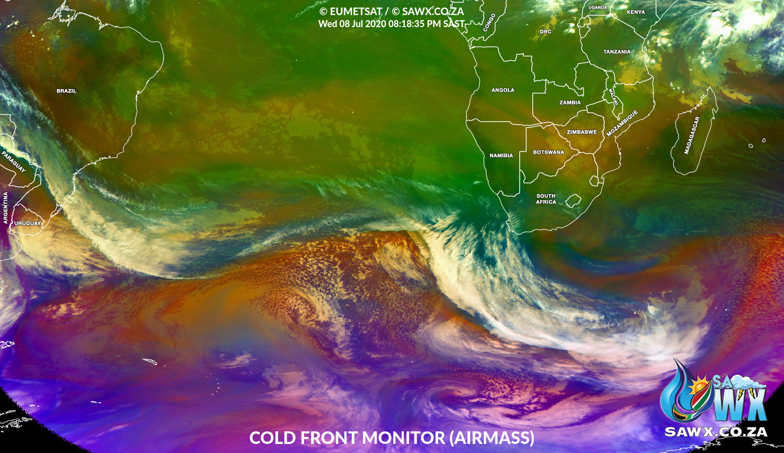
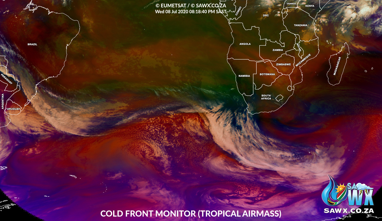
Here is also the latest synopsis from Mike Berridge of Weather Today Southern Africa
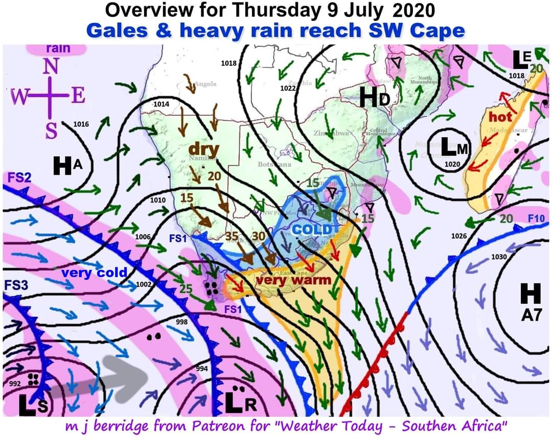
Here are the big ones that many people have been dreaming about for ages. Far out in the Atlantic Ocean, a series of mid-latitude cyclones wondered rather further north than in recent years. Hence the approach of the systems shown here, which I will describe “step-by-step”:-
Extending from the mid-latitude cyclone “LR” at the bottom of the diagram we see a broad low pressure trough extending way up the west coast as far as Angola in the north. The wind circulation around low pressure systems is CLOCKWISE, so we see the strengthening of the overland north-west winds. In the central Cape highlands these winds will attain gale force as shown at the tails of the wind arrows. Gusts could reach 100km/hr (>50 knots).
When these winds start moving downwards towards the altitude of the sea, the southern and south-eastern regions will become very warm due to adiabatic heating as the winds blow downwards. This process is shaded orange with red wind arrows.
The diagram represents 2 p.m. when the front marked “FS1” has already moved into west Cape. This will accompany the onset of moderate to heavy rain over the far south-west Cape. The seaward end of this front is detached by the effect of the adiabatic berg winds. The front is marked “FS1” which stands for “frontal stage 1”
“FS2” will reach the Cape after sunset. It will join up with “FS1” to produce a large rain area over the south-west and west Cape overnight and tomorrow (Friday) – also penetrating south-west Namibia.
Late tomorrow (Friday) “FS3” will arrive as additional back-up to the cold and heavy rain and will be discussed in tomorrow’s bulletin. The directional movement of the mid-latitude cyclone “LS” associated with this third front is shown with a broad grey arrow.
And as if this is not enough, “frontal stage 4” (not yet in view) is on it’s way and will strike on Sunday night with gales exceeding 35 knots.

