Last Updated on 13th August 2020 12:20 PM by AfriWX
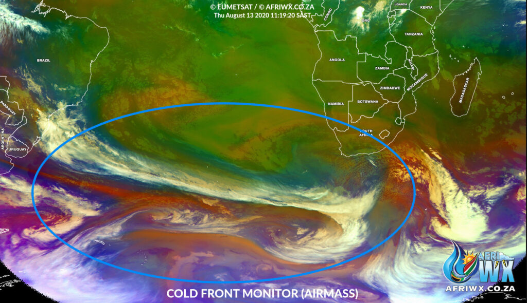
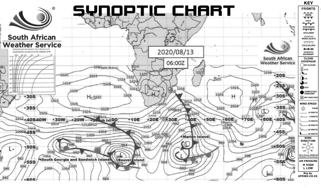
This updated forecast shows the developing cold front still on track to make landfall this weekend.
Satellite Airmass Aimation
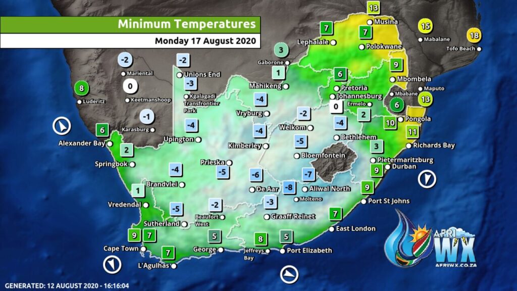
As you can see in the latest satellite image and animation above, this looks to be quite an extensive low-pressure (cold front) system which, coupled with our own rainfall and temperatures charts (below), appears to be bringing some good rainfall, snow and also an icy cold snap for the country.
Join our AfriWX Telegram Weather Group
Don’t forget to join the free AfriWX group on Telegram Messenger, please download Telegram for Android or iPhone if you want to always be up to date with the latest weather maps.
Click to join our Telegram Group
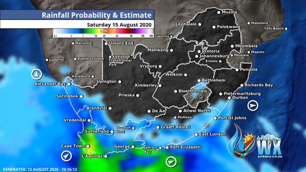
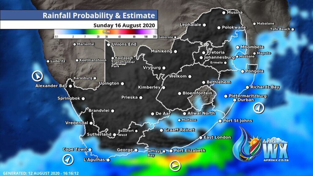
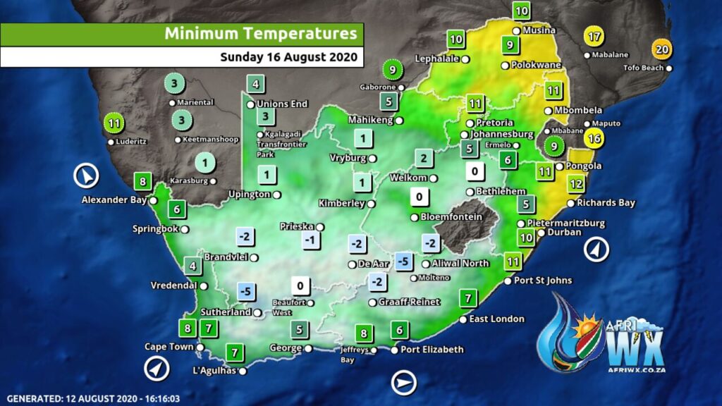
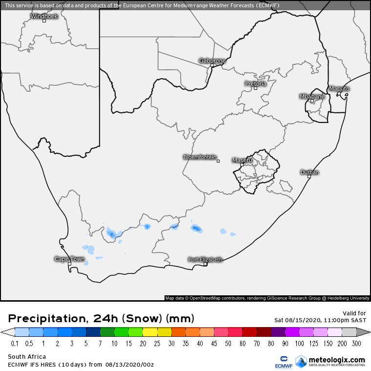
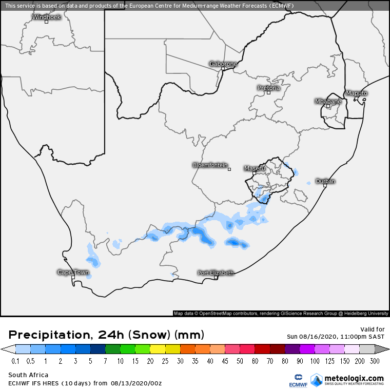
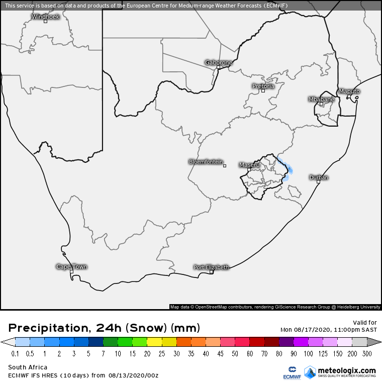
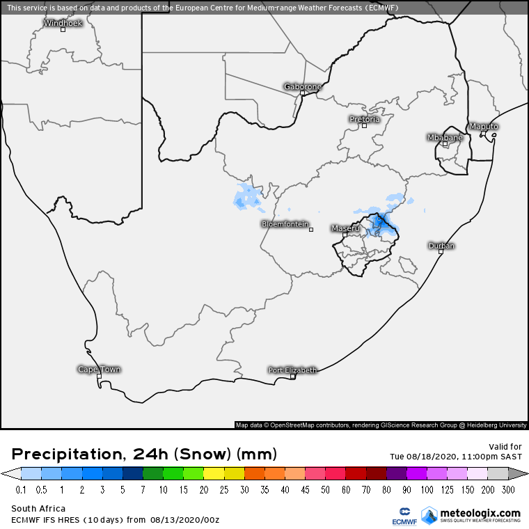
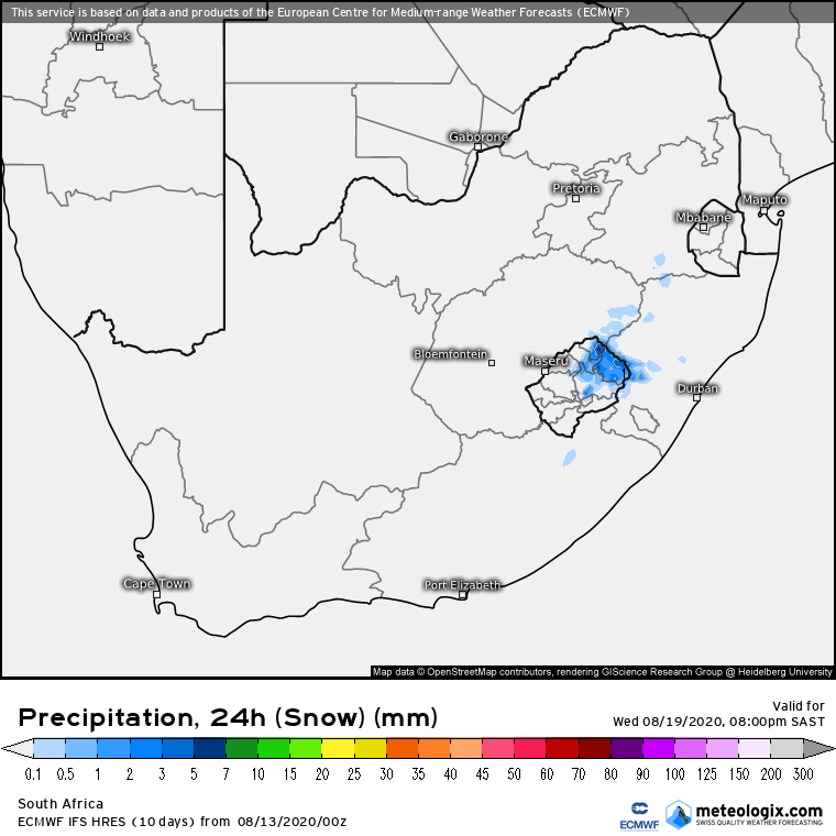
The latest snowfall weather maps from Meteologix (below) also confirm the forecasts of light snow across numerous parts of the country.
Extending into next week (early forecast) we could possibly even see some snowfall in the interior of the country.
Join our AfriWX Telegram Weather Group
Don’t forget to join the free AfriWX group on Telegram Messenger, please download Telegram for Android or iPhone if you want to always be up to date with the latest weather maps.
Click to join our Telegram Group

