Last Updated on 19th January 2020 5:21 PM by AfriWX
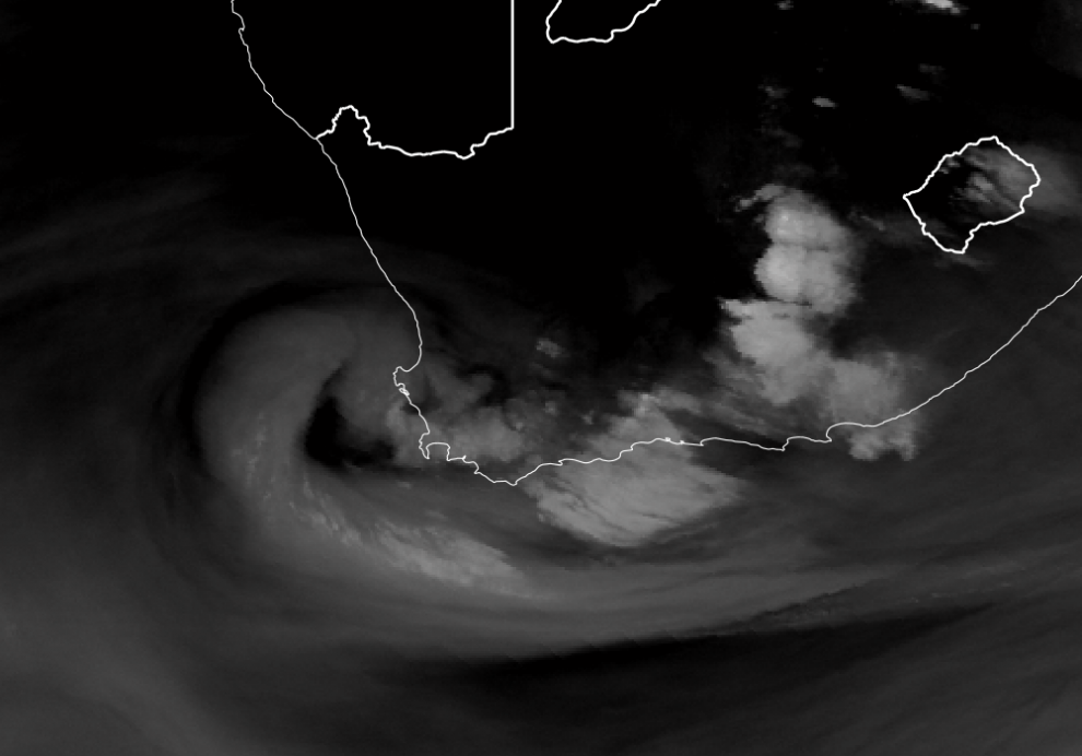
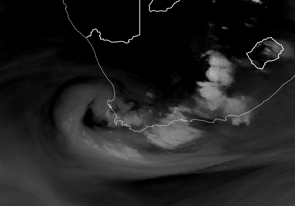
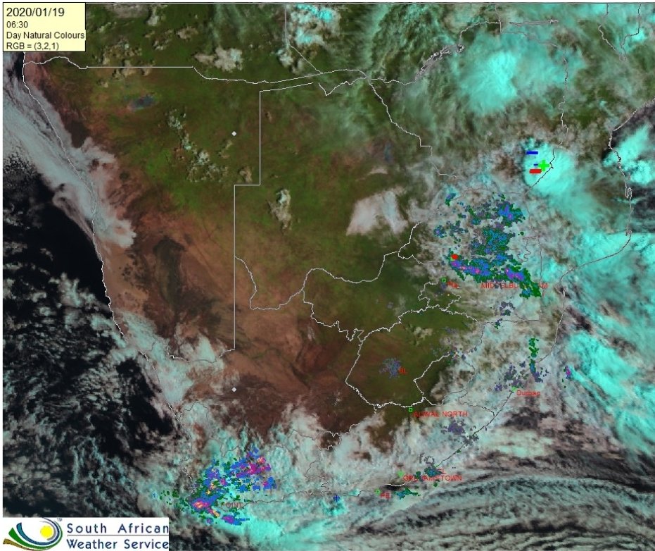
Our first well developed Cut-Off Low Pressure System (COL) for 2020 has formed over the Western Cape and this will result in sporadic heavy showers and thundershowers.

What is a Cut-Off Low Pressure System?
A Cut-off low is a low pressure system that becomes ‘cut-off’, detached or severed, from the the main planetary circulation and spins off independently.
Because it is no longer attached to the westerly pressure wave to the south, it loses all momentum and can just sit for days, or move very slowly before dissipating.
Cut-off lows are associated with very strong atmospheric instability and powerful convection up drafts.
Cut-off lows also bring a range of severe types of weather, including torrential rainfall, snow on the mountainous areas and violent winds.
Cut-off lows are one of the main drivers of damaging floods in South Africa and can also trigger thunderstorms.
A good example of the damage that a cut-off low can cause is the Laingsburg flood on 25 January 1981.
A Cut-Off Low (COL) is a low pressure system that develops south of South Africa, stemming from the main westerly trough systems of cold air.
As the COL develops, it deepens into a defined closed system that extends to the surface and which also becomes displaced equator-ward of the main westerly flow .

A COL system usually prevails over an area for more than a day , and can last up to 6 days.
The COL moves slowly over a confined region leading to heavy rainfall. COL’s are unstable, baroclinic systems that slope to the west with height and are associated with strong convergence and upward motion, particularly while they are deepening.
A Broader Overview of Cut-Off Low Pressure Systems
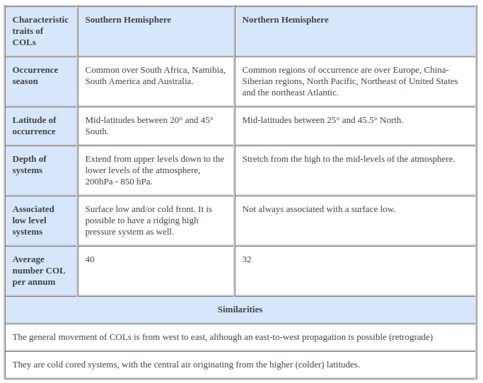
The Conceptual model above has been developed by Eumetsat in order to create a visual model that depicts the theory of COLs as we know it.
The Conceptual model is built around the use of MSG satellite imagery and NWP fields to clearly depict the characteristics, movement and intensity of the systems.
The occurrence of COL pressure systems is not limited to the southern hemisphere and much research has been conducted for northern hemispheric COLs, with the addition of a Conceptual model already available.

What role does South Africa’s Topography play?

The topographical map of South Africa above, shows just how close the mountain ranges are to the South African coastline, a feature which has a large effect on the amount and location of rainfall over the southern, south-western and south-eastern parts of the country, when dealing with COL systems.
The locations of the COL systems themselves, vary from season to season, however, the distribution of the systems zonally in both hemispheres is mostly between latitudes 20 and 45 ° north and south of the equator, extending to 45.5 ° in the northern hemisphere. Along the longitudes the distribution is variable, with the maximum density around 38 ° East.
How long do Cut-Off Lows Last?
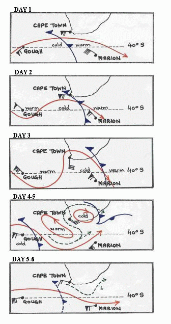
The life cycle of the COL in the Southern Hemisphere has been divided into four stages, namely: Upper Trough Stage, Tear-off stage, Cut-off stage and the final stage. These four stages can occur over a period of up to 6 days. An idealized schematic representation for the life cycle of the COL over a six day period is shown in the imagery below.
Morning Satellite images of South Africa showing the Cut-Off Low Pressure System


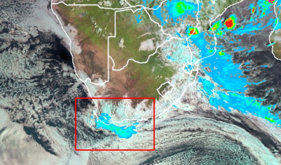
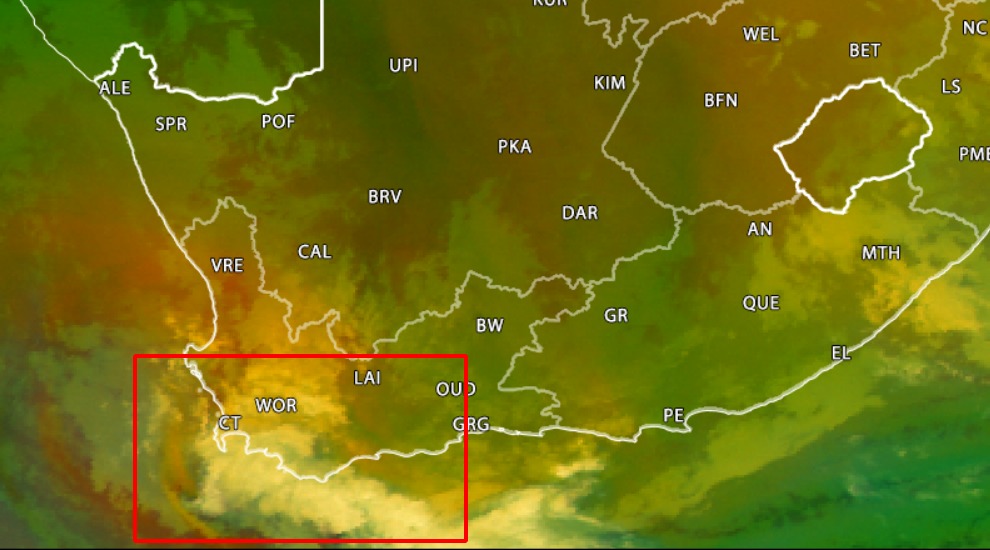


The composite SpectraView / SpectraChrome / SpectraColor Day/Night Satellite images on this page are created exclusively by and Copyright to SAWX using specialized and copyrighted imaging technologies.
Satellite weather photos on this page provided by EUMETSAT and copyright to EUMETSAT.
Click here for even more detailed technical meteorological information.
Sources:

