Last Updated on 16th August 2020 5:39 PM by AfriWX
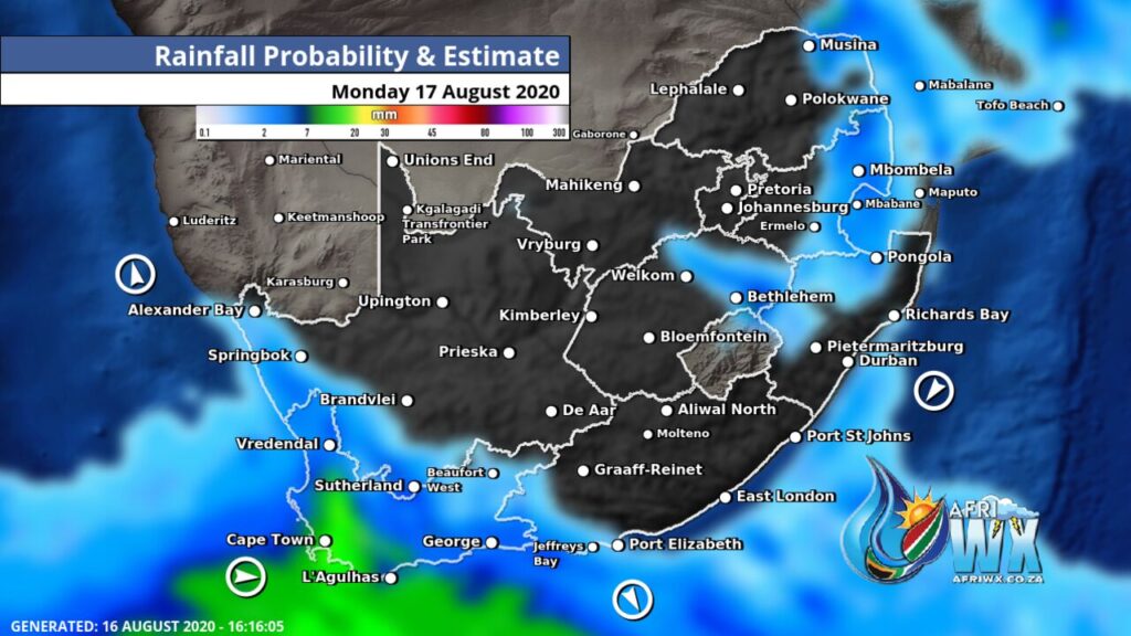
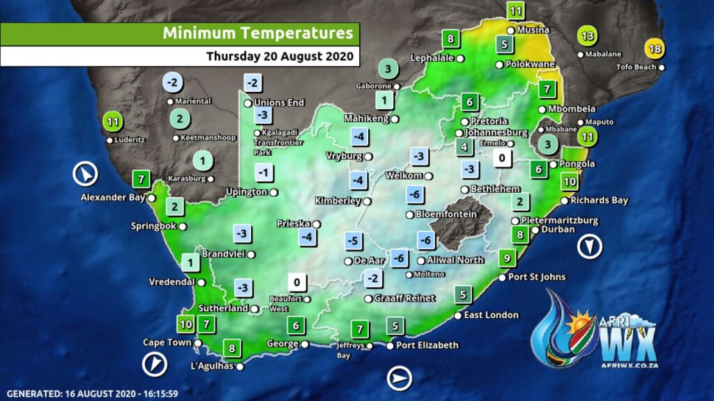
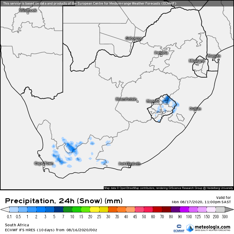
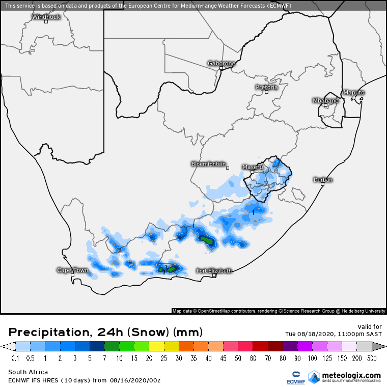
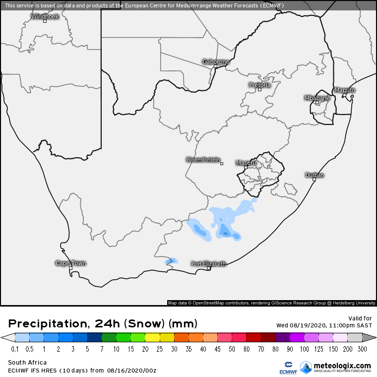
Winter and her icy grip is not done with us yet. Another cold front is moving in which will more widespread rain and snowfall across the Western and Eastern Cape, Lesotho and Drakensberg.
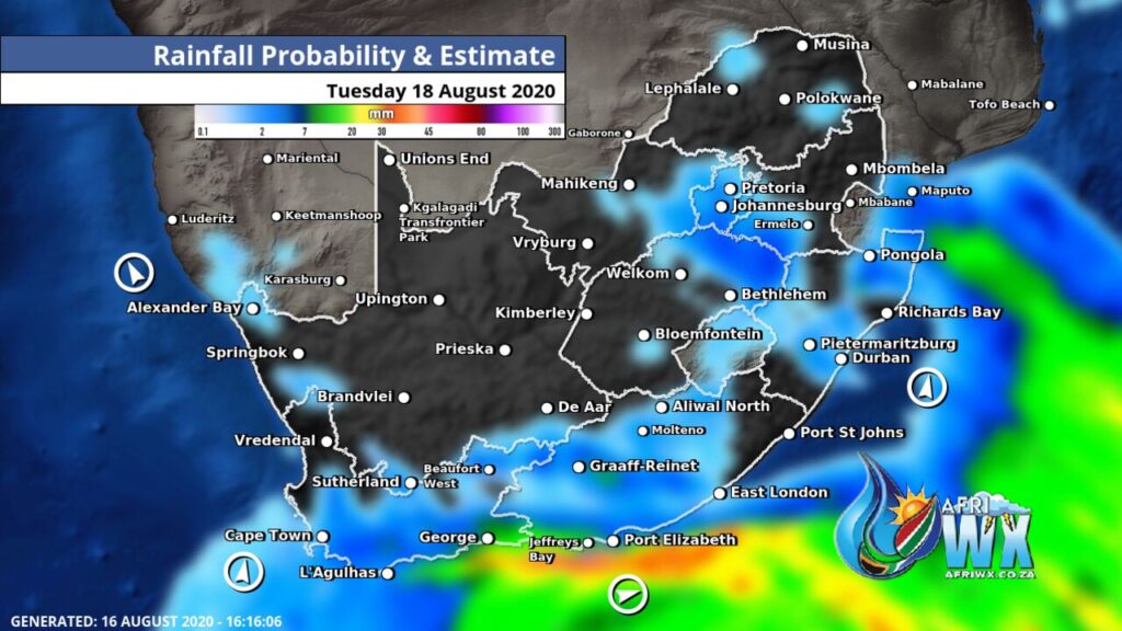
The Cold Front will move inland reaching Gauteng and Mpumalanga by Tuesday with some light rain and another icy cold snap comes along with it.
Join our AfriWX Telegram Weather Group
Don’t forget to join the free AfriWX group on Telegram Messenger, please download Telegram for Android or iPhone if you want to always be up to date with the latest weather maps.
Click to join our Telegram Group
Icy Cold Snap
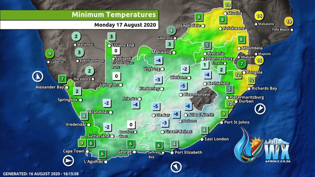
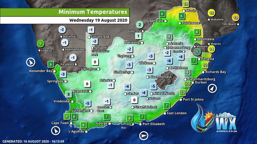
Widespread Snowfall Expected
Weather Watches and Advisories issued
The South African Weather Service has issued the following Warnings, Watches and Advisories
🟥 SEVERE WEATHER ALERTS:
⚠️ WARNINGS:
(1) Extremely high fire danger conditions expected over the North-West province except the north-east, the northern parts of Free State.
(2) A gale force NW`ly winds of 62-80km/h expected between Table Bay and Cape Agulhas in the morning, becoming SW`ly and spreading to Plettenberg Bay in the evening subsiding on Tuesday morning.
(3) High seas with wave heights between 6-(9)0m expected between Cape Point and Cape Agulhas.
⚠️ WATCHES:
(4) Localised flooding expected over the Cape Metropole and Overberg areas in the Western Cape towards evening.
(5) Heavy rain expected over the Garden Route coastal areas early Tuesday morning.
(6) Disruptive snowfalls expected over the high lying grounds of Cape Winelands, central Karoo and Garden Route Districts as well as Karoo Hoogland in the Northern Cape.
(7) High seas with wave heights between 6.0 to 9.0m expected between Cape Columbine and Plettenberg Bay on Tuesday morning, subsiding west of Cape Agulhas from Tuesday afternoon.
👁️ SPECIAL WEATHER ADVISORIES:
====(1) Very cold conditions expected over the Hantam and Karoo Hoogland in the Northern Cape, including the interior of the Western Cape.
(2) Strong winds(50-62km/h) expected over the Cape Metropole and Overberg areas in the afternoon into Tuesday morning.
Join our AfriWX Telegram Weather Group
Don’t forget to join the free AfriWX group on Telegram Messenger, please download Telegram for Android or iPhone if you want to always be up to date with the latest weather maps.
Click to join our Telegram Group

